Download
1 / 46
460 likes | 643 Vues
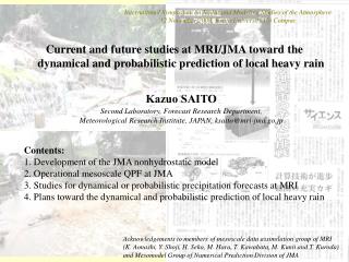
International Symposium on Radar and Modeling Studies of the Atmosphere 12 November 2009, Kyoto University Uji Campus. Current and future studies at MRI/JMA toward the dynamical and probabilistic prediction of local heavy rain. Kazuo SAITO Second Laboratory, Forecast Research Department,

E N D
International Symposium on Radar and Modeling Studies of the Atmosphere 12 November 2009, Kyoto University Uji Campus Current and future studies at MRI/JMA toward the dynamical and probabilistic prediction of local heavy rain Kazuo SAITO Second Laboratory, Forecast Research Department, Meteorological Research Institute, JAPAN,ksaito@mri-jma.go.jp Contents: 1. Development of the JMA nonhydrostatic model 2. Operational mesoscale QPF at JMA 3. Studies for dynamical or probabilistic precipitation forecasts at MRI 4. Plans toward the dynamical and probabilistic prediction of local heavy rain Acknowledgements to members of mesoscale data assimilation group of MRI (K. Aonashi, Y. Shoji, H. Seko, M. Hara, T. Kawabata, M. Kunii and T. Kuroda) and Mesomodel Group of Numerical Prediction Division of JMA
1. Development of the JMA nonhydrostatic model Ikawa (1988; JMSJ, 66, 753-776) Ikawa and Saito (1991; Tech. Rep. MRI, 28, 238pp) First description of MRI-NHM ○ Numerics on the dynamical cores ○ Bulk cloud microphysics ○ Turbulent closure model and surface boundary layer physics Airflow over a 3-dimensional bell-shaped mountain with hm=100 m, U=8m/s, N=0.01s-1 Left:a=6km, Right: a=1.2 km Top: hydrostatic analytic solution Middle: non-hydrostatic analytic solution Bottom: Numerical solution by the model http://www.mri-jma.go.jp/Publish/Technical/DATA/VOL_28/28.html
Development of a nested model (Saito, 1994; JMSJ) Numerical simulation of a local downslope wind in Japan Wind and potential temperature with a 2.5 km nonhydrostatic model http://www.journalarchive.jst.go.jp/jnlpdf.php?cdjournal=jmsj1965&cdvol=72&noissue=2&startpage=301&lang=ja&from=jnltoc
Fully compressible version with a map factor Saito (1997; Geophys. Mag. Ser. 2, 2, 109-137.) ○Fully compressible, no linearization by the reference atmosphere ○HI-VI (3D implicit) scheme with non-iterative direct elliptic solver ○Direct evaluation of the buoyancy term ○Full evaluation of the diabatic heating term in pressure equation ○Map factor and curvature terms ○Mass-virtual potential temperature ○Fall-out of precipitable water substances in continuity equation
Application to tropical island convection observed in MCTEX Numerical simulation of diurnal evolution of tropical island convection (Saito et al, 2001: Mon. Wea. Rev.) MCTEX: The Maritime Continent Thunderstorm Experiment in 1995 by BMRC, NCAR, CSU, etc., .. (Keenan et al., 2000: Bull. AMS, 81, 2433-2455) http://ams.allenpress.com/archive/1520-0493/129/3/pdf/i1520-0493-129-3-378.pdf
Unified nonhydrostatic model between MRI and NPD Documentation of the Meteorological Research Institute/Numerical prediction Division unified nonhydrostatic model. Technical Reports of the MRI, 42, 133pp. (Saito et al., 2001) Flux correction scheme for advection Parallelization for distributed memory computers Re-implementation of the HE-VI method Numerical simulation of convective clouds around Japan in the winter cold air outbreak. http://www.mri-jma.go.jp/Publish/Technical/DATA/VOL_42/42.html
Activities on the Earth Simulator A super high resolution (1 km) simulation of winter monsoon cloud bands over the Sea of Japan 1km-NHM : Total Water Path Eito et al. (2004) GMS-5 : Visible-Image 15JST 14 JAN. 2001
2. Operational mesoscale NWP and the short range precipitation forecast at JMA Operational run with a horizontal resolution of 10 km was started on 1 September 2004 Saito et al., 2006: Mon. Wea. Rev., 134, 1266-1298. • Kain-Fritsch convective parameterization scheme • Time split of gravity waves and advection • Non-local boundary layer scheme
3600 km 2900 km Computational domain Mesoscale model (MSM) at JMA • Purpose: to provide information to prevent disaster, such as heavy rain, wind. • Output is used for: • Short-term weather forecast • Very short range forecast of precipitation • Forecast for aviation (TAF) • Forecast of a storm surge • Forecast of air pollutant distribution • Initial condition: given by 4DVAR with 3-hour data assimilation window. • Boundary condition: provided from GSM (TL959L60) forecasts.
Upgrade of MSM 2006 MarchHorizontal resolution enhancement to 5 km 2007 May3 hourly 33 hour forecast (Saito et al., 2007; JMSJ) ・hybrid vertical coordinates ・Sedimentation of cloud ice ・MYNN3turbulent closure model ・New trigger function in the Kain-Fritsch scheme UL)Satellite image UR) MSM(10km) LF) MSM(5km) 00UTC 20 January 2006 http://www.jstage.jst.go.jp/article/jmsj/85B/0/271/_pdf/-char/ja/
Implementation of MYNN-3 Satellite IR image • The world first implementation of the level 3 closure model to the operational NWP model Winter monsoon case Boundary layer is well developed with MY3, which is more realistic than that with Deardroff scheme. TKE MY3 Deardroff
Nonhydrostatic 4DVAR (Apr. 2009-) Radar-AMeDAS JNoVA Meso 4DVAR FT=24 from 2006 Aug 17 15UTC Sawada and Honda (2009)
MSM QPF performance at JMA1mm/3hr 20km Threat score (TS) Bias score (BS) Miss rate (MS) False Alarm rate (FAR)
False Alarm rate (FAR) in MSM 10mm/3hr 10km verf. Nonhydrostatic 4DVAR Meso4DVAR Nonhydrostatic model 10km to 5km Upgrade physical process 20km Global model
GPS TPW in MSM (28 Oct. 2009-) Radar-AMeDAS with GPS TPW without GPS TPW FT=3 from 21 UTC 20 July 2009 Ishikawa (2009)
Quality of forecast 0 3 6 9 12 15 18 Forecasttime (hour) Very Short Range Forecast of Precipitation at JMA · Forecast of 1 hour accumulated precipitation up to FT=6. · Covering whole over Japan with 1 km grid· Operated at 30 min. intervals· Calculated by merging extrapolation of calibrated radar echo intensity and prediction from MSM. Merging MSM Extrapolation Persistence
20km verification 10mm/h June 2009 Ebihara (2009)
Development of a cloud resolving operational model (LFM) at JMA (Dx=2km) Operation : Mar. 2012 – Domain ... 1 domain (Mar. 2012-) 3 domains (Mar. 2013-) North region 1100x1300 km2 South region 1300x1100km2 Centre region 1600x1100km2
3DVAR(5km) 18 21 22 23 00 03 06 09 12UTC MSM JNoVA JNoVA JNoVA JNoVA MSM MSM MSM LFM LFM(2km) MSM Test of data assimilation at JMA • AMeDAS: 290wind, temperature • Wind Profiler: 8 • Doppler radar velocity :7 • ACARSwind, temperature Ujiie (2008)
Quantitative Precipitation Forecast 06 UTC on 12th Sep. 2009 Initial time is 00 UTC on 12th 2009 OBS 2km 20km 5km Ishida (2009)
3. Studies for dynamical or probabilistic precipitation forecasts at MRI FY 2005 – 2008: Grant-in-Aid for Scientific Research study “Study on data assimilation and evaluation of forecast reliabilities for dynamical prediction of heavy rainfall” by MRI, Kyoto University (RISH), Tsukuba University and NPD/JMA • Data assimilation studies on heavy rainfall events • WWRP Beijing Olympic 2008 RDP FY 2009-: “Study on advanced data assimilation and cloud resolving ensemble forecast for prediction of local heavy rain”. by MRI, RISH, National Institute of Information and Communications Technology, Tohoku University and NPD/JMA
1.0 10 20 40 60 Development of a cloud resolving 4DVAR Assimilated forecast (16JST) Kawabata et al. (2007; JMSJ)
降水強度 (mm/h) 4DVAR assimilation of the Suginami Heavy rain on 4 Sep 2005 4DVAR解析 観測 Kawabata et al. (2009; MWR, submitted) Assimilation of radar reflectivity 2030-2100JST
Development of Cloud resolving 4DVAR 1st guess 2130 JST Obs 4DVAR with assimilation of radar refectivity 4DVAR without radar reflectivity Kawabata et al. (2009; MWR, submitted)
GPS TPW impact using Meso 4DVAR CNTL GEONET+IGS Shoji et al. (2009; SOLA)
WWRP Beijing Olympic 2008 RDP Project Beijing Olympic 2008 (B08) FDP/RDP is a WWRP’s research project conducted withthe Beijing Olympic Games of August 2008. The project is divided into 2 components: FDP: Forecast demonstration up to FT=6 based on nowcasting. RDP: Research and development up to FT=36 based on the mesoscale (15 km) ensemble prediction. NCEP, MSC, ZAMG&Meteo Fr., MRI/JMA, NMC/CMA, CAMS/CMA participated in RDP.
WWRP Beijing Olympic 2008 RDP Common verification area Forecast domain (2006) Forecast domain (2007 and 2008) MA RF/mfboundary Model domain: 232 x 200 grids with 15 km L40 NHM
Initial perturbation method Following 5 methods were compared; 1) Downscale of one-week EPS of JMA (WEP) 2) Global targeted SV (GSV) 3) Mesoscale model SV (MSV) 4) Mesoscale model BGM (MBD) 5) Mesoscale model LETKF (LET) Horizontal resolution of inner models of MSV, MBD and LET to compute perturbation was unified to 40kmL40.
2008 Final experiment 24 July -24 August 2008 B08RDP website by CMA http://www.b08rdp.org Probability of precipitation (1 mm / 3 hours) 12UTC 10 August 2008(FT=18). Observation is 6 hour rain from 00 UTC to 06 UTC
Threat Scores for 6 hour precipitation of Control run (7/25 – 8/23)
Bias Scores for 6 hour precipitation of Control run (7/25 – 8/23)
Surface (2m) temperature of Control run (7/25 – 8/23) FT=18 (14LT) FT=18 (14LT)
Ensemble spreads of surface variables (7/25 – 8/23) MSC NCEP JMA/MRI ZAMG CAMS NMC
Brier scores and ROC curve for 6 hour precipitation of ensemble mean (7/25 – 8/23) Brier scores Brier scores for 1mm/6hrs
CNTL RAM SPREAD p01 p02 p03 p04 p05 m01 m02 m03 m04 m05 Ensemble forecast using Mesoscale SV for heavy rain event in Japan Dx=15km FT=6 from 12UTC28Aug 2008 Kunii et al. (2009)
CNTL SPREAD RAM Pr02 : >=5.0mm/3hour Prob. Pr04 : >=20.0mm/3hour Prob. Pr05 : >=50.0mm/3hour Prob. Probability of rainfall Pr02 Pr04 Pr05
analysis Pf Ensemble mean NHM-LETKF observation R Pa T=t2 Pa analysis T=t0 T=t1 Miyoshi and Aranami (2006; SOLA) #MLEF has also been developed at MRI (Aonashi, 2009)
Data assimilation of GPS PWV with NHM-LETKF for the 2008 Kobe flashflood Seko et al (2009) 12JST:観測 14JST:観測 Forecast of 1.6km-NHM 1100JST 1200JST 1230JST 1130JST
International Research for Prevention and Mitigation of Meteorological Disasters in Southeast Asia
Ensemble Forecast for Myanmar Cyclone Nargis Storm Surge at Irrawaddy river point (16.10N, 95.07E) Kuroda et al (2009; JMSJ, submitted) Saito et al (2009; JMSJ, submitted) Kunii et al (2009; JMSJ, submitted) Shoji et al (2009; JMSJ, submitted) LETKF application is underway ≈4m 47
4. Plans toward the dynamical and probabilistic prediction of local heavy rain GPSsatellite occultation Slant delay(、) rainwater Cb Doppler winds Reflectivity Mosit air GPSreceiver Doppler radar, lidar Microwave radiometer Cloud resolving data assimilation for deep convection
High density observation campaign around Tokyo metropolitan areas by MRI and JMA 2010-2014 氷晶 降水コア ひょう あられ 雷 Polarmetric C band Doppler radar (MRI) Doppler Lidar 2D scan X band radar Surface rain gauge GPS receiver Lightning Detection 3D scan X band radar sondes Collaboration with MILT, NIED, NICT, OU, .. MW radiometer Moist air 約10km
初期状態 x(t0) 微小時間 x(ts) 予報時刻 P(t=tl) ばらつき(スプレッド) 解析誤差程度の広がり 解析値 非線型的な 時間発展 線型的な 時間発展 アンサン ブル平均 単独予 報 Cloud resolving ensemble NWP SV LETKF MLEF Goal: Dynamical and probabilistic prediction of local heavy rain with a lead time in the scale of local municipalities by near real time cloud resolving ensemble NWP(hourly, 1-2 km, 40-100 members)
The Next Generation Super Computer The Next-Generation Supercomputer is under construction by RIKEN at Kobe, which becomes available for the study of cloud resolving NWP in 2010. Collaborations with universities (Tokyo, Kyoto, Nagoya, Tohoku, ..)