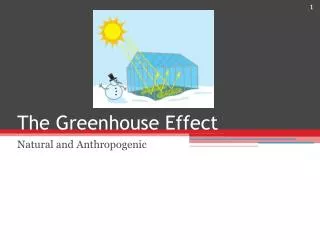
The Greenhouse effect
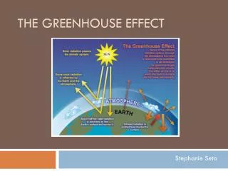
The Greenhouse effect. Greenhouse Gasses (GHG). The Greenhouse Effect. Some light energy from the sun is radiated back to space, some is trapped to surface. Greenhouse Gasses. Most of what we breathe is nitrogen gas (78%) Oxygen is only 21% All other gasses make up the last 1%

The Greenhouse effect
E N D
Presentation Transcript
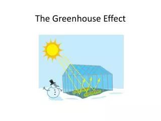
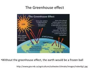
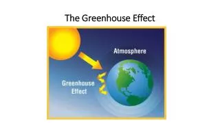
The Greenhouse effect Greenhouse Gasses (GHG)
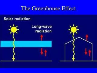
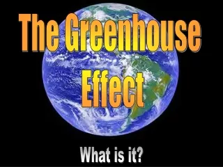
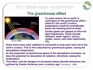
The Greenhouse Effect • Some light energy from the sunis radiated back to space, some is trapped to surface.
Greenhouse Gasses • Most of what we breathe is nitrogen gas (78%) • Oxygen is only 21% • All other gasses make up the last 1% • Only some of these gasses are GHGs
These are the 6 GHGs Web site
Paleoclimatology • Study of ancient climate • HOW?
Borehole Data • Borehole data are direct measurements of temperature from boreholes drilled into the Earth crust. Departures from the expected increase in temperature with depth (the geothermal gradient) can be interpreted in terms of changes in temperature at the surface in the past, which have slowly diffused downward, warming or cooling layers meters below the surface. Most borehole data at the WDC are from the University of Michigan's Global Database of Borehole Temperatures and Climate Reconstructions.
Corals and Schlerosponges • Coral data at the WDC consist of stable isotope and trace metal analyses from corals located around the globe. Corals serve as proxies of upper ocean environment, such as sea surface temperature and salinity, over the past several centuries.
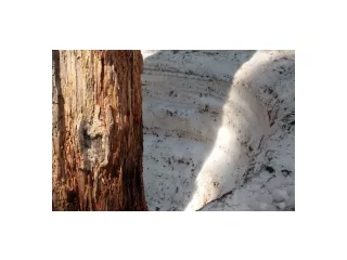
Fire History data • The International Multiproxy Paleofire Database (IMPD) is an archive of fire history data derived from natural proxies. It includes data from tree scars and records of charcoal in sediment to provide a permanent repository for high-quality paleofire records from around the world. Charcoal depostion Fire scars
Historical/Documentary sets • The NOAA Paleoclimatology Program distributes archives of paleoclimatic indicators derived from historical references and documentary evidence, such as church records, harvest dates, harbor ice free dates, etc. Manila Galleons Voyage Records
Ice Cores • Data from polar and low latitude mountain glaciers and ice caps are archived. Proxy climate indicators include oxygen isotopes, methane concentrations, dust content, and other parameters.
Lake Levels • The water level in lakes fluctuates with changes in moisture balance (precipitation minus evaporation) within the lake basin. In closed basin lakes, particularly in arid regions, lake level fluctuations can be dramatic, resulting in fossil shoreline deposits and other features indicative of past lake level. A history of moisture balance and climate in the basin can then be derived.
Paleolimnology • Paleolimnology is the study of past conditions of inland fresh water bodies. A variety of measurements from lake and bog sediments are used to indicate past water temperature, physical properties, biology, and chemistry.
Paleoceanography • Data is derived from many proxies found in deep sea sediments including trace metal and isotopic composition of fossil plankton, species composition, and lithology.
Pollen data • Pollen grains which are washed or blown into lakes can accumulate in sediments and provide a record of past vegetation. Different types of pollen in lake sediments reflect the vegetation that was present around the lake, and therefore the climate conditions favorable for that vegetation.
Speleothem (Cave deposits) Data • Speleothems are mineral deposits formed from groundwater within underground caverns. Stalagmites, stalactites, and other forms may be annually banded or contain compounds which can be radiometrically dated. Thickness of depositional layers or isotopic records can be used as climate proxies.
Tree Rings • The International Tree-Ring Data Bank includes raw ring width or wood density measurements, and site chronologies (growth indices for a site). Over 2000 sites on six continents are included.