Download
1 / 1
10 likes | 140 Vues
Projeto UrbisA mazônia. Indentification. Antônio M. V. Monteiro 1 , Ana Paula Dal’ Asta 1 , Carolina M. D. de Pinho 1 , Fernanda R. Soares 1 , Maria Isabel S. Escada 1 , Newton Brigatti 2 , Silvana Amaral 1

E N D
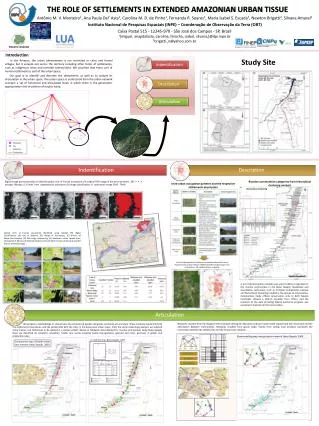
Projeto UrbisAmazônia Indentification Antônio M. V. Monteiro1, Ana Paula Dal’ Asta1, Carolina M. D. de Pinho1, Fernanda R. Soares1, Maria Isabel S. Escada1, Newton Brigatti2, Silvana Amaral1 Instituto Nacional de Pesquisas Espaciais (INPE) – Coordenação de Observação da Terra (OBT) Caixa Postal 515 - 12245-970 - São José dos Campos - SP, Brazil 1{miguel, anapdalasta, carolina, ferocha, isabel, silvana,}@dpi.inpe.br 2brigatti_n@yahoo.com.br The role of settlementsin extended Amazonian urban Tissue Description Articulation PROJETO CENÁRIOS Introduction Study Site In the Amazon, the urban phenomenon is not restricted to cities and formal villages, but it spreads out across the territory including other forms of settlements, such as indigenous areas and riverside communities. We assumed that every unit of human settlements is part of the urban space. Our goal is to identify and describe the settlements, as well as to analyze its articulation in the urban space. The urban space is understood from the urban network concept: a set of functional and articulated locals in which there is the generation, appropriation and circulation of surplus value. Riverine communities categories from hierarchical clustering analysis Digital image processing steps to identify spatial units of human occupation: (A) original TM5 image in the west Santarém ; (B) 3 × 3 average filtering; (C) limits from segmentation procedure; (D) image classification of subtraction image (TM5 - TM4). Intra-urban occupation patterns and the respective settlements description Hierarchical Clustering Spatial units of human occupation identified using Landsat TM digital Classification: (A) city of Belterra, (B) village of Itacimpasa, (C) district of Mojuí dos Campos, (D) São Jorge community, (E) Santarém urban sprawl area, (F) sawmill at Moraes de Almeida District, (G) Curitimbó riverine community and (H) district of Brasília Legal. Limits of the spatial unit of human occupation obtained for Novo Progresso: (A) Landsat TM and CBERS-CCD/HRC merged image color composition; (B) spatial patterns mapping. A set of 30 description variables was used to define a typology for the riverine communities in the Baixo Tapajós. Qualitative and quantitative techniques such as Principal Components Analysis and Hierarchical Clustering resulted in five groups of communities. Communities inside official conservation units at both Tapajós riverbanks showed a distinct situation from others, and the presence of the state providing federal assistance program, was essential to maintain all the communities. Networks resulted from the displacement of people seeking for education and basic level health represented the connection and the articulation between communities. Networks resulted from goods trade, mainly from selling local products expressed the connection between the settlements and the formal cities network. . We propose a methodology to characterize the networks of people and goods circulation at local scale. These networks would link both the settlements themselves, and the settlements with the cities in the Amazonian urban space. From the social networking analysis, we selected some metrics and techniques to be applied in a spatial context. Based on fieldwork data obtained for riverine communities along Baixo Tapajós River, we identified six networks: education, health care center, hospital, public transportation (ground and river), purchase of goods, and production sales. Blockmodelling map transportation network. Baixo Tapajós. 2009 IC synthesis map. Baixo Tapajós. 2009 Componentsmapofhealth center care network. Baixo Tapajós. 2009.