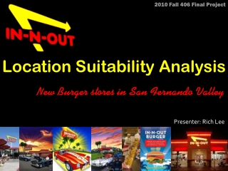
Location Suitability Analysis for New In-N-Out Burger Stores in San Fernando Valley, CA
160 likes | 291 Vues
This project investigates optimal locations for new In-N-Out Burger stores in San Fernando Valley, CA, utilizing Location Suitability Analysis through Geographic Information Systems (GIS). It evaluates critical factors affecting store placement including proximity to highways, existing store locations, land use types, and population demographics. The analysis identifies three potential sites near I-5 and I-210, emphasizing the necessity of further research into real estate prices and additional influencing factors for better decision-making. This methodology can enhance spatial decision support systems for future developments.

Location Suitability Analysis for New In-N-Out Burger Stores in San Fernando Valley, CA
E N D
Presentation Transcript
2010 Fall 406 Final Project Presenter: Rich Lee Location Suitability Analysis New Burger stores in San Fernando Valley
I. Introduction • In-N-Out Burger is famous in South West America. Established in 1948 at Baldwin Park, CA, In-N-Out nowadays has more than 250 stores. • This project assumed that In-N-Out intends to serve more customers in San Fernando Valley, CA, so the company needs to find a new store location. • Since there are too many factors may affect the decision, In-N-Out decided to apply Location Suitability Analysis method in GIS to make sure that their new store could locate in a suitable place.
II.Question • Where is the best new store locations in San Fernando Valley, CA? • Factors: • Closer to highway • Existing locations • Land use type • Population (Age from 18 to 39) • Others
III. Dataand Sources In this project, the following data had been used: • Current In-N-Out locations • Download from The official website: www.in-n-out.com • San Fernando Valley • ESRI US Street Map (copy form Geography Data Drive) • (Including Background data, Census data, Highway data) • Land use Data • Copy from Geography Data Drive
IV. GIS Methodology Pre-Processing • In-N-Out Locations: • Geo-Coding existing In-N-Out locations data by Google Map • Convert (Lat, Lon) into Shapefile (polygon) • Buffer all the locations with 0.5 mi radius from 0.5 to 3.5 miles • Highway data: • Select those highways in the study area • I-5, I-405, I-210, US-101, SR-118, SR-170
IV. GIS Methodology Pre-Processing • Land use type: • Classify different land use type into 1 to 10 scale • agriculture and government places are 0~3 • residential places are 5 • commercial places are 10 • Census data (Age): • Reclassify the population from age 18 to 39 into 10 groups
IV. GIS Methodology Data Analysis • Euclidean Distance • For In-N-Out locations and Highway data • Convert into “Raster” format with the same cell sizes • Reclassify • convert all the raster data into 1 to 10 scale, so the overlap will be done under the same conditions with each data layers. • Weighted Overlay • Majority
IV. GIS Methodology Data Analysis • Weighted Overlay Existing location---40% Highway---30% Age---20% Land use type---10% • Majority • By Eight cell size • make sure the places are large enough • Final Selection • within 0.2 mi to Highway
V. Results • The final output are three different places located in the east of the study area. Those places are around I-5 and I-210 in SF valley.
VI. Discussion • Due to the number of factors, it is hard to have only one optimal site. • However, those three locations are still good suggestions that In-N-Out burger could start to do more research about ( e.g. real estate price). • If there could have more elements added into analysis, the result will be better.
VI. Discussion • The analysis of location suitability is a good method to support the decision maker and it could be applied into a wide range. • Those analysis methods could be combined into a “Spatial Decision Support System”, in which could help the decision maker to find a better solution that is based on the latest updated geographical information data.