Download
1 / 21
450 likes | 910 Vues
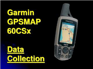
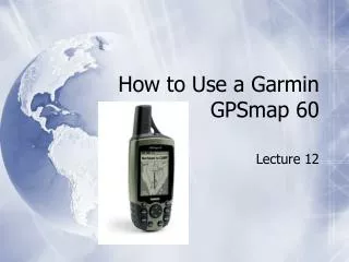
How to Use a Garmin GPSmap 60. Lecture 12. External Features. Satellite Page. The Satellite Page shows a sky view array of the satellites overhead with your position centered in the array. The outer circle represents the horizon and the inner circle a position 45 degress from the horizon.

E N D
How to Use a Garmin GPSmap 60 Lecture 12
Satellite Page • The Satellite Page shows a sky view array of the satellites overhead with your position centered in the array. • The outer circle represents the horizon and the inner circle a position 45 degress from the horizon. • The numbers displayed indicate the number assigned to each satellite.
Satellite Page • A bar graph at the bottom of the page displays the strength of signals from each satellite. • When the receiver has signals from at least three satellites, the display at the top of the page changes to indicate position accuracy and location coordinates.
Map Page • The Map Page is the primary navigation feature of the GPS MAP 60C. • It displays a detailed map of the area surrounding your current location.
Map Page • You can use the Map Page to do the following:・ • Determine your current location and progress while moving. • Select and save a map point as a waypoint. • Locate and navigate to map items by following a route displayed on the map. • Customize the map display to your requirements.
Map Page Options Menu • Through the Map Page Options Menu, you can: • change the display of a variety of information for navigation • stop navigation to a destination • arrange up to four data fields to display the type of navigation information you desire • include a navigation guidance text message on the map page • display the distance from your current location to other locations on the map • reduce the amount of map clutter to increase the visibility of roads and other geographic features.
Compass Page • When navigation is in progress, the Compass Page provides navigation data and directions.
Compass Page • It uses a graphic compass display and bearing pointer along with digital data fields to display information such as: • current speed • distance to the next point on the route • estimated arrival time • You can choose from three or four data fields and select the type of data displayed in each from a list of options
Compass Options Page • The Compass Page Options Menu is where you can: • stop navigation • switch between "course pointer" and "bearing pointer” • customize data fields to display the information that you want
Trip Computer Page • The Trip Computer Page provides you with a wide variety of travel data useful when navigating a long distance.
Trip Computer Page • It indicates your: • current speed • average speed • trip odometer • other helpful statistics useful for navigation • You can customize the Trip Computer display however you want it, with a list of data options to choose from.
Mark Waypoint Page • The Mark Waypoint Page allows you to mark and record your current (or any other) location as a waypoint and displays a name and a symbol for that waypoint.
Mark Waypoint Page • You can mark your current location at any time. • Custom waypoint symbols can be downloaded from Garmin's website. • You can mark a waypoint with the map panning arrow or as a "Man Overboard" (MOB). • MOB is where you want to mark a location while on the water (with no available reference points) and come back to that point later. • You can project a waypoint from any map item and establish a new waypoint that is a certain bearing and distance from that map item.
Find Feature Page • The Find Feature provides you with a method for searching for cities and exits, which are included in the GPSMAP 60C basemaps.
Find Features Page • If you have downloaded MapSource mapping data that contains additional map detail, you can search for points of interest, addresses and intersections. • If you download BlueChart data, you can find detailed marine items such as wrecks and obstructions, NAVAIDS, and anchorages.
Main Menu • The Main Menu is the directory for all unit features not in the Main Page sequence with the exception of Mark Waypoint and the Find Menu, which have their own keys.
Main Menu • The following features are on the Main Menu: • Tracks - allows you to maintain a record of your movements. • Routes - allows you to create a list of points that you wish to navigate to. • Highway - a graphic representation for navigating. • Setup - controls the settings for most of the features. • Proximity - acitvates an alarm for a defined radius. • Sun & Moon - sunrise and sunset times, moon phases, and sun and moon positions. • Hunt & Fish - best times to hunt and fish. • Calendar • Alarm Clock • Calculator • Stopwatch • Games
Setup Page • The Setup Page allows you to customize the GPSMAP 60C to your preferences.
Setup Page • You can customize the following: • System - various settings for GPS operation, battery type, etc. • Display - screen display color, day/night viewing, backlight. • Interface - controls input/output format when connected to a PC. • Tones - customize signal tones for a variety of features. • Page Sequence - customize the order the pages appear. • Map - many map customization options.
Setup Page • Routing - customizes the manner in which routing functions behave. • Geocache - geocaching management. • Marine - allows setting of limits that activate alarms. • Time・Units - allows the selection of units of measurement. • Heading - allows the selection of heading and north reference. • Welcome Page - displays a message or your name and address on the Welcome Page