Download
1 / 27
270 likes | 422 Vues
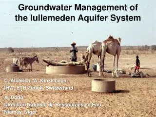
Mexico, Marsh 17 th , 2006. 4 th WORLD WATER FORUM. Risk Management in the Iullemeden Aquifer System. GEOGRAPHIC OVERVIEW. Mali. Niger. R. Niger. Nigeria. IAS OVERVIEW. Countries : Mali, Niger, Nigeria. Area : 525 000 km² Mali : 31000 km² (6%) Niger : 434000 km² (83%)

E N D
Mexico, Marsh 17th, 2006 4th WORLD WATER FORUM Risk Management in the Iullemeden Aquifer System
Mali Niger R. Niger Nigeria IAS OVERVIEW • Countries : Mali, Niger, Nigeria • Area : 525 000 km² • Mali : 31000 km² (6%) • Niger : 434000 km² (83%) • Nigeria : 60000 km² (11%). • Aquifers : • Cretaceous Intercalary Continental • Tertiary Terminal Continental • > 2000 billion m3 • Niger river : • 30 billion m3 per year • Population : • 15 million (2000) • 28 million (2025)
NATURAL RESOURCES Non renewableGroundwater > 2000 billion m3 RenewableGroundwater > 2 billion m3 Surface water (Niger river) : 30 billion m3/y 160 billion m3/y to Atlanticocean « W » National parc (Niger Republic) Fisheries > 200 species Livestock > 4 million cattle Irrigation land > 300 000 ha
SHARED IAS ISSUES • Increased water demand because of growing population : 15 millions in 2000, double in 2025 • Climate change • Decreased groundwater recharge rate • Land degradation 100 000 ha/year • Deforestation > 1 million ton firewood • Silting : river, lake, pools
SHARED IAS ISSUES • Lack of exchange information between countries sharing and exploiting the same resource • Lack of cooperation on aquifers although Basins Authorities exit in the region : NBA, LGA, etc… • Aquifers only studied in the limits of the national borders
GENERAL OBJECTIVE • Within the goal of sustainable : • environmental protection and sub-regional and national development • cooperative framework for joint management of risk and uncertainty To establish the capacity, to identify, reduce and mitigate transboundary risks from changing land and water use and from climate change in the shared Iullemeden Aquifer System
PROJECT OUTCOMES • Joint mechanisms for identification of transboundary risk issues in the IAS; • A joint development and conservation strategy for the IAS; • A joint tripartite legal and institutional cooperative framework for the IAS; • Joint programmes for awareness, participation and inter-governmental communication.
IAS PROJECT COMPONENTS • Transboundary Diagnostic Analysis ; • Strengthening the State of knowledge of IAS; • Consultative Mechanism; • Awareness, Participation, Capacity Building;
PROJECT STRUCTURE STEERING COMMITTEE (Periodic control and Evaluation) Countries : Partners : DNH - Mali - UEP/GEF DRE/MHE/LCD - Niger - IAEA - ESA - IRD DHH/FWRM - Nigeria - FAO - IGRAC - GTZ • UNESCO • Scientific Supervision • OSS • Implementation Agency IAS Project - Coordination and Technical Management - Regional Coordination - Scientific Control • Experts • Transboundary Diagnostic Analysis • Consultative Mechanism • Recharge • Modelling • Remote Sensing • National Teams • National Coordinator • National Focal Point • National Coordination Committee • Scientific Audit • Scientific Evaluation • Validation of final reports
ACHIEVEMENTS SO FAR : • Three national reports for TDA (Mali, Niger and Nigeria) for further IAS wide analysis (under implementation) ; • Common digitalized maps for a further hydrogeological risks analysis; • Analysis of information/data availability in support of cooperation among countries; • Legal and consultative mechanism ; • Management tool development (database)
RISKS IDENTIFIED H = High RiskM = Medium RiskW = Weak Risk
DIRECT NATURAL CAUSE : CLIMATIC CHANGE Sliding of isohyets southwards by 100 km: decrease of 20%- 30% of the rainfall
DIRECT NATURAL CAUSE : CLIMATIC CHANGE Development of sand dunes Erosion and silting in Niger river
CLIMATIC IMPACTS Reduced Niger river runoff at Niamey : 36,2%
CLIMATIC IMPACTS Reduction of groundwater recharge (R. Dessouassi et G. Mahé , 1997)
DIRECT NATURAL CAUSE : FLUORIDE (6mg/l) Bony Fluorosis Apatite : Ca5(PO4)3 (OH, F, Cl) More than 300 victims mainly children incurably deformed
SECRETAIRE Facilitateur) COMITE DE PILOTAGE (Niveau Politique) STEERING COMMITTE (Political level) SECRETARY Facilitator) MALI Comité Technique NIGER Comité Technique NIGERIA Comté Technique MALI Technical Committee NIGER Technical Committee NIGERIA Technical Committee TEMPORAL CONSULTATIVE MECHANISM
STEERING COMMITTEE (Political Level) EXECUTIVE SECRETARY Maintenance of Database; coordination national committee activities ; preparation of decisions to the Steering committee NIGER Technical Committee MALI Technical Committee NIGERIA Technical Committee PERMANENT CONSULTATIVE MECHANISM
COMMON DATABASE Climatology Surface Water Administrative Domains Groundwater Users
CHALLENGES • Definition, Quantification and Analysis of Transboundary risks in IAS • Addressing lack of data/information : A need for country capacity building ; • Rational management of surface water and groundwater ; and • “ Implementable “ consultative mechanism for cooperation and coordination.