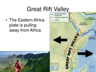
Great Rift Valley
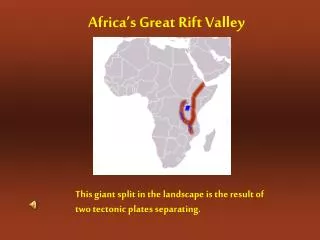
Great Rift Valley. By: Kelly Lane. Facts About the Great Rift Valley. Latitude- 5(5 degrees 0’ 0 N) Longitude- 37(37 degrees 0’0 E) The Great Rift Valley started forming about 35 million years ago It was formed when the African and Arabian plates began pulling away from each other

Great Rift Valley
E N D
Presentation Transcript
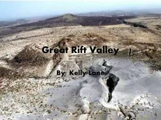
Great Rift Valley By: Kelly Lane
Facts About the Great Rift Valley Latitude- 5(5 degrees 0’ 0 N) Longitude- 37(37 degrees 0’0 E) • The Great Rift Valley started forming about 35 million years ago • It was formed when the African and Arabian plates began pulling away from each other • Plate Boundary- divergent • Fault- transform • Stress- tension
Topographic Map • The darker color in the ocean is the deepest water and the lighter color is the more shallow waters • The green areas are places with low elevation followed by yellow, orange and finally red indicating increasing elevation Highest Elevation- 6,000 ft. (above sea level in Kenya) Lowest Elevation- 1,300 ft. (below sea level near the Dead Sea) Steepest Slopes- Near Kenya where active volcanoes are.
Other Facts and Graphics • Other features near The Great Rift Valley include Mount Kenya, the Congo River Basin, Ethiopian Highlands and the Nile River • The Great Rift Valley is nearly 4,000 miles long and stretches from the Red Sea area to the country of Mozambique