Download
1 / 22
240 likes | 394 Vues
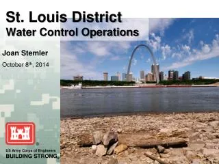
IMPROVING MILLERTON LAKE FLOOD CONTROL OPERATIONS TO INCREASE WATER SUPPLY Mr. Antonio M. Buelna, P.E. Mr. Douglas DeFlitch Ms. Katie Lee October 29, 2009. Reclamation Mission Statement. Is to manage, develop, and protect water and related resources in an environmentally and economically

E N D
IMPROVING MILLERTON LAKE FLOOD CONTROL OPERATIONS TO INCREASE WATER SUPPLY Mr. Antonio M. Buelna, P.E. Mr. Douglas DeFlitch Ms. Katie Lee October 29, 2009
Reclamation Mission Statement Is to manage, develop, and protect water and related resources in an environmentally and economically sound manner in the interest of the American public.
Overview • Reclamation and Friant History • Watershed and Supplies • Millerton Lake Operations • Normal Operations • Flood Operations • 2006 Operations at Millerton Lake • Upper San Joaquin Basin Model • Climate Change in the Upper Basin • Summary
Bureau of Reclamation History • June 17, 1902, President Theodore Roosevelt signed the Reclamation Act: • Settlement in the West by providing water for small-scale family farms. • August 26, 1937, President Franklin Delano Roosevelt signed the River and Harbor Act: • Authorized the Central Valley Project for construction including Friant Dam and other public works facilities.
Friant Dam History • Completed in 1942 • Height: 319 feet • Crest Length: 3,488 feet • Used for Flood Control & Water Conservation to meet demands. • Irrigation • Municipal • Industrial • Downstream release points: • San Joaquin River • Friant-Kern Canal • Madera Canal
Watershed and Supplies Table 1: Average Annual Historical Runoff ------Redding to Bakersfield: 447 miles ----- Sacramento to Fresno: 176 miles • Facts: • The Central Valley: 1/3 is Valley Floor, 2/3 are Mountainous • Cascade Range Elevation (North): 14,000 ft • Sierra Nevada Elevation (East): 14,000 ft • Coast Range Elevation (West): 8,000 ft
Millerton Lake Operations Stakeholders • Downstream Interest: • Lower San Joaquin River Levee District • Land Owners • Private Utilities: • Southern California Edison (SCE) • Pacific Gas and Electric (PG&E) • United States Federal and State Agencies: • Army Corps of Engineers • Department of Water Resources (DWR) • National Weather Service • Water Users: • 28 Districts • Irrigation, Municipal, Industrial
Flood Operations – Millerton Lake • Upper San Joaquin River Floods occurs about 4 out of 10 years. • Rain Floods:results of intense rainfall in the Sierra Mountains. • Period typically: November to March • January 2, 1997: largest rain flood estimated maximum daily flow of 77,500 cfs and a 7-day volume of 416,700 AF. • Snowmelt Floods: results of mountain snowmelt. • Snowmelt floods are sustained, moderate flows for 2 – 3 months, resulting in large volumes of runoff. • Snowmelt produces ~70% of annual water supply. • 1906: largest snowmelt flood with a maximum daily flow of 26,300 cfs and a April – July volume of 3.34 million AF.
Flood Operations – Millerton Lake 520,500 AF 170,000 AF Snowmelt 390,000 AF 130,000 AF Dead Pool Space = 130,000 AF Flood Control Storage ReservationDiagram
2006 Operations at Millerton Lake • March 1, 2006, the San Joaquin River basin hydrologic conditions were at the historic average and the DWR 50 Percent exceedance forecast was 1.27 million AF. • By early April, storage capacity was at 95 percent. • First week of April produced 10 inches of rain. • April’s 100-year average precipitation is 3 inches. • More than 300 percent of normal conditions.
2006 Operations at Millerton Lake 525,747 AF 26,000 CFS 520,823 AF 522,201 AF
Upper San Joaquin Basin Model (USAN) • The USAN model was developed to study re-operation of the upstream reservoirs to enhance the Friant Division water supply. • Improve Friant Division operations and enhance the water supply. • Simulates Flood real-time data from 1896 to present. • Used daily to produce short-term reservoir operations with real-time data (storage, deliveries, releases, etc.) • USAN uses a daily time step of projected operations applied to historic unimpaired flow data.
Upper San Joaquin Basin Model (USAN) • USAN limitations: • Operational decisions based on forecasts. • Millerton Lake February 1st storage plus the February – July unregulated flow forecast to determine the amount of water available for deliveries each year. • Difficult with flexibility to varying conditions or water years in the volume of water available for diversion during snowmelts of equal volume. • (Distribution of snowmelt may cause variations in over 100,000 AF)
Climate Change in the Upper Basin • Important effects to Friant Operations: • Changes in rainfall timing and intensity • Total snow and ice coverage • A rise in ambient temperature • Total snow accumulation in the western U.S. has declined over the period 1925-2000. • Higher temperatures threaten to reduce accumulation up to 40% in the Sierra Nevada. • Climate change effects the watershed and operations at Friant Dam, increasing the probability of a rain flood and decreasing the magnitude of snowmelt flows.
Precipitation Trends 2001-2009 38.68 in
Summary • The San Joaquin River has two major runoff seasons • November through March is predominately rain • April through July is predominately snowmelt • Snowmelt produces ~70% of annual water supply • Managing Friant Division’s Central Valley Project Water Supply considers: • The information needed to make operational decisions • The speculative nature of some information (especially early in the season) • The importance of water supply to the end user • The importance of providing protection from floods • A mission that requires close communication and coordination with many parties and a significant amount of professional judgment.
Questions? Thank You PowerPoint By: Robert Campbell, Rufino Gonzalez