Download
1 / 29
290 likes | 328 Vues
This report evaluates the feasibility of a proposed delta conveyance channel, exploring sediment transport and project alternatives in coastal Louisiana. Phase 1 concludes engineering feasibility, while Phase 2 diversifies analysis to assess environmental and economic impacts. Sediment supply scenarios and land building capacities are detailed, emphasizing the potential benefits of the proposed project.

E N D
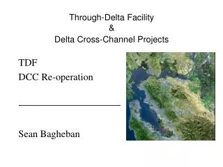
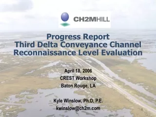
Progress ReportThird Delta Conveyance ChannelReconnaissance Level Evaluation April 18, 2006 CREST Workshop Baton Rouge, LA Kyle Winslow, Ph.D, P.E. kwinslow@ch2m.com
Reconnaissance Level Evaluation of Third Delta • Phase 1: Is the proposed concept viable? • Can the channel be constructed? • Can the channel transport required sediment? • Phase 1 Tasks • Data Collection • Engineering Design and Construction Feasibility • Channel Conveyance Assessment • Delta Building Analysis • Phase 2: • Identify and evaluate project alternatives • Environmental, engineering, and economic impacts • Economic feasibility of implementation • Document scientific and technical uncertainties
Sediment Supply and Delivery • A range of proposed sediment diversion scenarios were investigated to determine the sensitivity of the results to the sediment load • Calculated sand transport rates demonstrate that more sand can be carried to each of the proposed delta building locations than is currently carried to the Wax Lake Delta. • Annual average sand transport to each subdelta: • Diversion Scenario A = 4.18 million tons per year • Diversion Scenario C = 5.68 million tons per year • Wax Lake Delta = to 3.18 million tons per year • Lower Atchafalaya River Delta = 8.60 million tons per year
Phase 1 Conclusions • The Third Delta Conveyance Channel Concept is feasible from an engineering standpoint. • The proposed delta building locations will receive more sand, retain more sand, and build land faster than the Wax Lake Delta has built land in Atchafalaya Bay
Phase 2: Alternatives Analysis • Scope • Task 1. Identification of Project Alternatives (Workshop) • Task 2. Reassess Scope of Work following Workshop • Task 3. General Assessment of Project Alternatives • Environmental , Engineering, and Economic Effects • Scientific and Technical Uncertainties • Task 4. Project Alternatives Report • Land Building Estimates of TDCC • Description of Alternatives, focusing on use of pipelines to transport sediment
Land Building Estimates of the TDCC • Quantify flow in TDCC • Hydrographs defined in Phase 1 • Quantify sediment in TDCC • HEC-6T Mississippi River Model • Corrections to Mississippi River sediment • Assumptions for retention • Based on lower Atchafalaya analysis • Assumptions for average depth of fill • NGDC bathymetric model • Corrections for subsidence
Comparison of Wetland Creation Projects in Coastal Louisiana
Table 4 . Volume Required to fill one acre of open water of a given depth and Land Building Capacity of the Third Delta Conveyance Channel for given depths and Retention Rates Average Fill Sediment Land Building Capacity of TDCC Depth (ft) Volume (square miles per year) (cy/ac) 80% Retention 50% Retention 35 % Retention 2 3227 12.51 7.82 5.47 3 4840 8.43 5.21 3.65 4 6453 6.25 3.91 2.74 5 8067 5.00 3.13 2.19 6 9680 4.17 2.61 1.82 Land Building Capacity of the Third Delta
Land Building Capacity:Summary • Land Building Capacity depends on estimates of: • Flow diversion hydrograph • Assumptions for • Sediment concentration • Retention rates • Depth of fill required (compaction, water level) • Initial estimates on the order of 1 to 2 square miles per year per delta lobe
Alternatives Analysis • Introduction • Preliminary presentation of work in progress • Summary of local and international project experience with use of dredging/pipelines to create wetland / land reclamation • Bayou Labranche • Road/Highway Projects in South LA • Worldwide Land Reclamation Projects • Description of Alternatives and potential restoration areas
Bayou Labranche Wetland Creation Project (1994) • Creation of 300 acres of wetland habitat • Local borrow source in Lake Pontchartrain • 30 inch cutter suction dredge • Approximately 2.7 million CY sediment delivered in 30 days (averaging 90,000 cy/day, peak production 130,000 cy/day) • Project Cost: $3.7 million ($1.40/cy) • Over 8000 cy/acre (loss to pond)
Alternatives Description • Description of three Draft Alternatives • Preliminary definition of Potential Restoration Areas (Alternative 2) • Common Features of three Alternatives
Definition of Restoration Areas • Recent and historic land loss patterns • Specific land loss processes • Habitat types • Local subsidence rates • Average depth of restoration area • Protection of infrastructure • Restoration of local and regional hydrology • Degree of natural confinement
Selection and Ranking of Target Areas • Distance to sediment sources, both riverine and offshore • Availability of freshwater for sustainability • Existing structures to aid in sediment confinement during construction • Average depth of open water areas • Land / water distribution • Need for shoreline protection • Preferred sediment grain size for restoration (sands vs. fines) • Quantification of processes responsible for wetland loss • Measure of local subsidence • Measure of flood and infrastructure protection provided by site • Number of Landowners • Number of oyster leases • Proximity of pipeline right-of-ways • Access for construction • Overlap with CWPPRA projects
Conclusions • Phase 2 underway • Workshop held in May 2005 • Land building baseline developed • Three Alternatives developed • Preliminary restoration areas identified • Work Remaining • Refinement / expansion of areas • Analysis of economic and environmental effects • Description of scientific and technical uncertainties • Comparison to Third Delta • Projected land gain, decrease in land loss • both final and interim • Projected environmental and economic benefits and impacts • Construction duration and Construction cost