Download
1 / 28
280 likes | 476 Vues
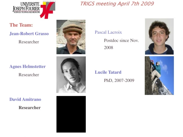
The Team: Jean-Robert Grasso Researcher Agnes Helmstetter Researcher David Amitrano Researcher. Pascal Lacroix Postdoc since Nov. 2008 Lucile Tatard PhD, 2007-2009. TRIGS meeting April 7th 2009. Landslides :

E N D
The Team: Jean-Robert Grasso Researcher Agnes Helmstetter Researcher David Amitrano Researcher Pascal Lacroix Postdoc since Nov. 2008 Lucile Tatard PhD, 2007-2009 TRIGS meeting April 7th 2009
Landslides : seismic monitoring, triggering mechanisms, displacement measurement… (JR Grasso. Tatard, A. Helmstetter, D. Amitrano, P. Lacroix) • Volcanoes : • eruptions, seismicity, and forecasting (JR Grasso, L. Tatard) • Earthquakes : • statistical analysis of catalogs, triggering mechanisms and forecasting (A. Helmstetter, D. Amitrano) • Laboratory expermients : • Fracture and friction experiments • (D Amitrano, JR Grasso) Research Topics
Séchilienne Seveso plant Grenoble 30 km Laffrey, 1999; 2005 Seismic monitoring of Séchilienne landslide WP5.1
Séchilienne landslide and geodetic network The landslide instrumented since 1988 by CETE Lyon, with extensometers, inclinometers, strainmeters, GPS and distancemeters (laser and radar).
Seismic network • vertical • seismometer • ∆ 3 component • Seismometer • Stations THE and RUI installed may 2007 • GAL installed April 2008 • Data, catalogs, … : • Google OMIV • -> Sechilienne • -> seismology
Séchilienne Photo taken from just above the most active zone :
Seismic network : objectives • detection and classification of seismic signals produced by the rockslide: • Micro-seismicity, distant EQs, rockfalls, natural or artificial tremors, … • • event location (work in progress) • • imaging the structure of the movement and its temporal evolution with • Seismic wave tomography with explosions or seismic noise • • site effects : amplification of ground motion due to the damaged zone • (project) • • comparison of micro-seismic activity with meteorological data, • displacement, PS, and external earthquakes
THE RUI GAL (int) (ext) Micro-earthquake? Fracture? Crevasse opening?
Regional earthquakes • Example of earthquake located about 5km from the landslide (p-s ≈ 0.7s) • Higher frequency than local events !? • > Strong attenuation of local events due to damaged rocks?
Rock boulder of ≈20x30x50cm pushed from the top of the ruins Rockfall experiments
Characteristics of events amplitude (t) cdf(amplitude) T>5, rockfalls? T<5 sec Micro EQs? 0.05m3 ≈100m3? cdf(energy) energy (t) cdf(duration) duration (t) micro EQs? rockfalls? 30s duration of rockfall propagation from the top of the ruins
THE RUI (int) GAL (ext) 1-40Hz • find seismic wave velocity V and source location by maximizing the average inter-traces correlation after shifting the traces in time by the travel time t=distance/V Location of seismic signals using antenna methods Map of average correlation
Location of seismic signals using antenna methods • Problems • We assume seismic wave velocity is constant in time and space, but there is a mixture of waves of different type and V • V is highly heterogeneous in the rock mass • The types of seismic waves is unkown : P? S? surface waves? (work in progress of waves polarization with 3C sensor) • Advantages: • Fully automatic • Works well with emergent signals or rockfall, and for looking at the propagation of the source • Time accuracy potentially smaller than sampling rate
Propagation of rockfall avalanches Location using a sliding time window Location in the direction of propagation All 3 stations Azimut relative to station THE, using only THE
events location using a single station : only the azimuth is constrained • histogramm of the direction of natural local events recorded by stations RUI (207 events) and THE (349 events) from 10/4/2008 to 7/2008. • most events located at top of the Ruins (grey area) Location of seismic signals using antenna methods
Influence of climate on displacement and seismicity Natural local events recorded by station THE Displacement rate of target point #631 (CETE Lyon) Chamrousse Weather station (Meteo France)
Influence of climate forcing on seismicity • Precipitation : • Peak correlation for zero time lag (<1hr) • + rain increases on average 2 days before seismic events • Temperature: • seismic events associated with a temperature decrease (freezing?), or just a result of the correlation between rain and temperature?
Correlation between climate and displacement rate • Precipitation : • Peak correlation for a time lag of 4days • + rain increases on average 20 days before landslide acceleration • Temperature: • no significant correlation -> look at data since 1996?
Correlation between displacement and seismicity Peak of correlation for zero time lag (<1 day), But acceleration lasts longer than seismic crisis
Influence of distant EQs on the landslide? • 2 EQs occured about 4km from Séchilienne in 1999 and 2005, with m=3.5 and m=2.8 • Only the 2nd smaller EQ produced an acceleration of the movement !? 11/1/1999 m=3.5 1/10/2005 m=2.8
1m 0 60 m Super Sauze displacement Displacement amplitude measured by correlating pictures taken at one month interval Pictures from EOST Strasbourg (JP Mallet), with 1 month interval Method developped and applied by P. Lacroix • Same results than standard method, but 100 times faster
0 15 m Displacement prior to the 2006 V>20000m3 rockfall Displacement amplitude measured by correlating pictures taken one day and a few hours before the rockfall, from the other side of the valley Pictures from CETE Lyon (Y. Kaspersky) Method developped by P. Lacroix m
Conclusion and perpectives for Séchilienne • A few thousands seismic events recorded of varous types • Intermittent activity, influenced by climate and distance EQs (?) • Better location using a 3D velocity model (work in progress by LGIT and SAGE), and seismometers in boreholes (project 2009 INERIS and CETE)? • Video camera (installed summer 2009 by CETE) : calibration of seismic netwok, estimation of rockfall volume and propagation speed from seismic signals • Quantify rockfall hazard and the influence of rain and distant EQs, using numerous small events to estimate the probability of a 106m3 event?
Project: seismic monitoring of snow avalanches P. Lacroix, A. Helmstetter, JR Grasso, and « Centre D’étude de la Neige » (Grenoble) Col d’Ornon (~20km South of Grenoble), winter 2009-2010 Comparison of seismic signals Location and propagation of avalanches
OMIV: Muldisciplinary Observatory of Slope Instabilities Rockslides (Mica shists and gneiss) Clay or soft rocks http://www-lgit.obs.ujf-grenoble.fr/observations/omiv/