Download
1 / 17
220 likes | 876 Vues
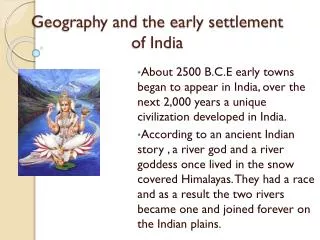
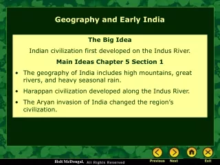
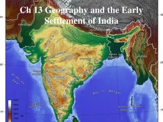
Ch 13 Geography and the Early Settlement of India. Introduction. Subcontinent of Asia Attached to the content of Asia Surrounded on three sides by water Walled Towns Appeared about 2500 BCE Over next 2,000 years a unique civilization developed Legend River god and goddess

E N D
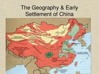
Introduction • Subcontinent of Asia • Attached to the content of Asia • Surrounded on three sides by water • Walled Towns • Appeared about 2500 BCE • Over next 2,000 years a unique civilization developed • Legend • River god and goddess • 8 Key Physical Features
Brahmaputra River • Starts high in the Himalayas • Moves through narrow canyons into valleys • Becomes slower and deeper in the alleys • Monsoon rains add water causing it to overflow • Monsoon - a large wind that often brings lots of rain • Rich minerals left behind • Joins the Ganges • Land is very fertile • Climate • Rainfall • 75 - 150 inches of rain • Heaviest between June and October • Temperature • 45 - 85 degrees F
Deccan Plateau • Triangle shaped area between two mountain ranges in southern India • Flatter area • covered with granite rocks formed by volcanoes • Hillier area • thin forests and low, scrubby bushes • Fairly dry • few rivers • monsoon rains source of most of the water • Soil • Black • rich in iron and good for growing cotton • yellow and red • missing minerals • difficult to grow plants in them • Climate • Rainfall • 30 inches of rain • June through October • Temperature • 65 - 100 degrees F Plateau is an elevated or raised area of land that is flatter than a mountain
Eastern and Western Ghats • Long mountain chains near coast • Form a large V • Deccan Plateau stretches between these mountain ranges • Climate • Rainfall • 100 or more inches • Temperature • 60 - 90 degrees F • Western Ghats • higher than Eastern • Steep slopes, narrow valleys, think hardwood forests, and heavy rains • Tropical plants • Eastern Ghats • Not as wet • several rivers flow through the mountains • Sprinkled with hardwood trees • Rivers • Rarely flood • Not suitable for transportation
Ganges River • Flows across most of northern India • Carries sediment from the Himalayas to the northern plains • Sediment - bits of earth and sand • Some of the most fertile farmland in the world • Good water supply • From melting ice in Himalayas • Can flood and destroy crops • Climate • Rainfall • 25 - 60 inches of rain • Temperature • 55 - 90 degrees F
Himalaya Mountains • Northern border • Highest mountain range in the world • Earthquakes and landslides are common • Mount Everest • rises slightly every year • Earth is always moving • 5 1/2 miles high • Natural border • Water from glaciers feed northern India's major rivers • Climate • Rainfall • 20 inches of snow • June through October • Temperature • at highest peaks never rise above freezing and may go as low as -76 degrees F Himalaya means "home of snows"
Hindu Kush Mountains • Barrier between India and Afghanistan • One of the highest in the worlds • Peaks almost 5 miles high • Many parts unlivable • Permanent snow and ice • Khyber Pass • 28 miles long gap • connects central Asia to the Indian subcontinent • Traders used pass to enter Indus River valley • Invaders also used pass • Climate • Rainfall • 15 inches of rain and snow • Temperature • 25 to 75 degrees F
Indus River • Begins in the Himalaya Mountains • Flows through the current country of Pakistan and empties into the Arabian Sea • Best farmland in the world • Compared to Egypt's Nile River • Climate • Rainfall • 5 - 20 inches of rain • June through October • Temperature • 65 - 90 degrees F
Thar Desert • Northern India • Sand and stone • Very little plant life • grass and low, hardy shrubs • Unbearable heat • 45 to 120 degrees F • Water • rain is rare • Evidence of dried-up riverbeds near the desert's borders • 4 - 20 inches of rain • dust storms common • Animal life • 45 kings of lizards and snakes • Gazaelles • Birds • quail • ducks • geese
Early Settlements in India • First people settled by rivers • Indus River • Ancient Sarasvati River • Use to run through the Thar Desert • Believed to have dried up 1900 BCE • When Sarasvati dried up, ancient Indians moved on to Ganges River • By 2500 BCE walled settlements existed near the Indus and Sarasvati Rivers
Summary • Varied landscape • high mountains • large plateau • desert • many rivers • Early settlers farmed fertile river valleys • Walled settlements were built • Start of civilization