Download
1 / 37
380 likes | 423 Vues
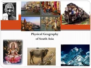
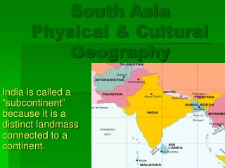
Physical Geography of South Asia. TULOSO-MIDWAY HIGH SCHOOL. Landform Regions of South Asia. Himalayas The Ganges River Basin The Indus River Basin The Deccan Plateau. HIMALAYAS. Separate India from other countries in the region

E N D
Physical Geography of South Asia TULOSO-MIDWAY HIGH SCHOOL
Landform Regions of South Asia Himalayas The Ganges River Basin The Indus River Basin The Deccan Plateau
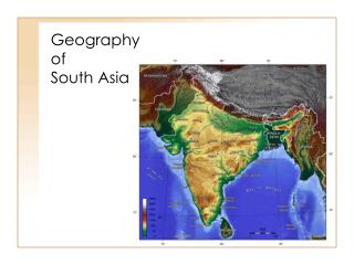
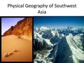
HIMALAYAS • Separate India from other countries in the region • Contains the world’s highest mountain, Mt. Everest (~29,000 ft above sea level)
HIMALAYAS • Formed by tectonic forces - convergence • Earthquakes are common in region • Among the youngest mountain ranges on the planet (70 million years old)
Hindu Kush • Smaller in area than the Himalayas, but almost as high and just as rugged. • Located mostly in Afghanistan. • The word “kush” means “death.”
Khyber Pass • Best known pass through the Hindu Kush. • For centuries, traders and invaders traveled through this pass.
Kashmir • Isolated valley in northern India. • Famous for the production of a fine wool. • Split between India, Pakistan and China.
Indo-Gangetic Plain • Large plain formed by the Indus, Ganges and Brahmaputra Rivers. • Most fertile and densely populated part of South Asia.
Indus River • Largest river of Pakistan. • The word “indus” means “river.” • India’s name comes from this river.
DECCAN PLATEAU • Makes up most of central and southern India • Rugged area • Access difficult • Low population density
Deccan Plateau • Large plateau (an elevated flat or hilly landmass) • Bordered by mountains: • Vindhyas • Western Ghats • Eastern Ghats
RIVER SYSTEMS • Indus River and Ganges River are the two most important in the region • Provide for farming (irrigation) and energy production (hydroelectric power)
GANGES RIVER • Religious rituals of the Hindu include: • Bathing for purification and • Disposal of their deceased • RESULT: • One of the most polluted rivers in the world
Ganges River • Largest river in India. • Most holy river of Hinduism. • Joins with Brahmaputra to create an enormous delta in Bangladesh.
GANGES RIVER • POLLUTED RIVER
GANGES RIVER • National Geographic article on the polluted state of the Ganges River • http://news.nationalgeographic.com/news/2011/11/111123-india-ganges-river-pollution/
Brahmaputra River • Large river that starts in Tibet (China). • Runs through India and Bangladesh. • Name means “Son of Brahma.”
Thar Desert Large desert in India and Pakistan.
Western Ghats Windward Side Leeward Side The Western Ghats create a “rain shadow.”
Review: Physical Features • Deccan Plateau • Himalayas • Hindu Kush • Indo-Gangetic Plain • Thar Desert • Western Ghats Hindu Kush Thar Desert Himalayas Indo-Gangetic Deccan Plateau Western Ghats
Climates • With monsoons to the South and East, there is heavy seasonal rainfall (India). • Dry climates to the west (in Pakistan). • Highland climates in the north (Pakistan, Nepal, Bhutan).
MONSOONS • To the people of India, the monsoons are a source of life. • Seasonal reversal of winds bring heavy rainfall or no rain at all. • General onshore movement in summer, bringing rainfall (lots of it). • General offshore flow in winter, resulting in little rain. • Very distinctive seasonal precipitation
POTENTIALLY NEGATIVE EFFECTS OF MONSOONS • Widespread flooding • Property damage • Destruction to agricultural lands • Damage to transportation infrastructure • Homelessness • Disease • Malnutrition • Serious injury • Death
Natural Hazards in South Asia • Earthquakes • Monsoons and Flooding • Drought and Fires • Tsunamis • Cyclones
TSUNAMIS • A series of ocean waves generated usually by an earthquake in the sea floor. • In the deep ocean, the tsunami wave may only be a few inches high. • The tsunami wave may come gently ashore or may increase in height to become a fast moving wall of turbulent water several meters high.
TSUNAMIS • Video of March 11, 2011 tsunami in Japan • http://video.nationalgeographic.com/video/news/environment-news/japan-tsunami-2011-vin/ • Video of tsunami in Sri Lanka • http://video.nationalgeographic.com/video/environment/environment-natural-disasters/tsunamis/tsunami-sri-lanka/
CYCLONES • A cyclone is a hurricane that occurs in the South Pacific or Indian Oceans
CYCLONES • More on cyclones from the National Oceanic and Atmospheric Administration • http://oceanservice.noaa.gov/facts/cyclone.html