Download
1 / 16
160 likes | 348 Vues
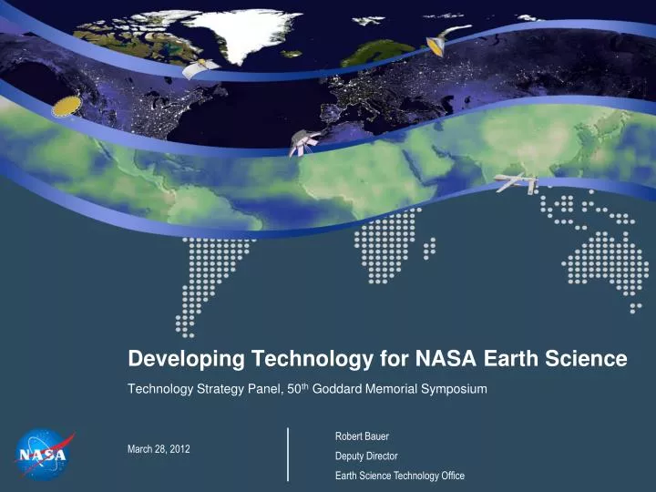
Developing Technology for NASA Earth Science Technology Strategy Panel, 50 th Goddard Memorial Symposium March 28, 2012. Robert Bauer Deputy Director Earth Science Technology Office. Topics. Earth Science at NASA Earth Science Technology Program Incorporating Strategic Direction

E N D
Developing Technology for NASA Earth Science Technology Strategy Panel, 50th Goddard Memorial Symposium March 28, 2012 Robert Bauer Deputy Director Earth Science Technology Office
Topics • Earth Science at NASA • Earth Science Technology Program • Incorporating Strategic Direction • Technology Challenges • Conclusions 2
Earth Science at NASA • Overarching goal: to advance Earth System science, including climate studies, through spaceborne data acquisition, research and analysis, and predictive modeling • Six major activities: • Building and operating Earth observing satellite missions, many with international and interagency partners • Making high-quality data products available to the broad science community • Conducting and sponsoring cutting-edge research • Field campaigns to complement satellite measurements • Analyses of non-NASA mission data • Modeling • Applied Science • Developing technologies to improve Earth observation capabilities • Education and Public Outreach 3
Science Areas and Measurements Water & Energy Cycle Weather Earth Surface & Interior Tropospheric Winds Atmospheric Temperature and Water Vapor Cloud Particle Properties Cloud System Structure Storm Cell Properties Atmospheric Water Vapor River Stage Height Land Surface Topography Surface Deformation Terrestrial Reference Frame Carbon Cycle & Ecosystems Atmospheric Composition Biomass Vegetation Canopy Fuel Quality & Quantity CO2 & Methane Trace Gas Sources Land Cover & Use Terrestrial & Marine Productivity Climate Variability Aerosol Properties Total Aerosol Amount Cloud Particle Properties Cloud System Structure Ozone Vertical Profile & Total Column Ozone Surface Gas Concentrates Ocean Surface Currents Deep Ocean Circulation Sea Ice Thickness Ice Surface Topography 5
Earth Science Technology: Program Elements The Earth Science Technology Office (ESTO) is ascience-driven, competed, actively managed technology program. Competitive, peer-reviewed proposals enable selection of best-of-class technology investments that retire risk before major dollars are invested: a cost-effective approach to technology development and validation. ESTO investment elements include: Observation Technologies: Instrument Incubator Program (IIP)provides robust new instruments and measurement techniques Advanced Component Technologies (ACT)provides development of critical component and subsystem technologies for instruments and platforms Information Technologies: Advanced Information Systems Technology (AIST)provides innovative on-orbit and ground capabilities for communication, processing, and management of remotely sensed data and the efficient generation of data products and knowledge 6
NASA Earth Science Decadal Survey Missions Surface Water and Ocean Topography (SWOT) Geostationary Coastal and Air Pollution Events (GEO-CAPE) LIDAR Surface Topography (LIST) Precipitation and All-Weather Temperature and Humidity (PATH) Soil Moisture Active Passive (SMAP) Deformation, Ecosystem Structure and Dynamics of Ice (Radar)(DESDynI -R) Pre-Aerosol - Cloud - Ecosystems (PACE) Gravity Recovery and Climate Experiment - II (GRACE - II) Active Sensing of CO2 Emissions (ASCENDS) Climate Absolute Radiance and Refractivity Observatory (CLARREO) Snow and Cold Land Processes (SCLP) Ice, Cloud,and land Elevation Satellite II (ICESat-II) Global Atmospheric Composition Mission (GACM) Aerosol - Cloud - Ecosystems (ACE) Hyperspectral Infrared Imager (HYSPIRI) Three-Dimensional Winds from Space Lidar (3D-Winds) Near Term Far Term
NASA Earth Science Decadal Survey Missions LIDAR Surface Topography (LIST) Spatial elevation mapping laser system Single channel lidar with GPS navigation and pointing Laser satellite-to-satellite interferometer Gravity Recovery and Climate Experiment - II (GRACE - II) Active Sensing of CO2 Emissions (ASCENDS) Ice, Cloud,and land Elevation Satellite II (ICESat-II) Multibeam cross-track dual-wavelength lidar Coherent and noncoherent hybrid Doppler wind lidar 1.57 and 2.06 µm bands, 200m swath Aerosol - Cloud - Ecosystems (ACE) Three-Dimensional Winds from Space Lidar (3D-Winds) Lasers
NASA Earth Science Decadal Survey Missions Ku-band near-nadir synthetic aperture radar and Ku-band nadir-looking radar altimeter Surface Water and Ocean Topography (SWOT) Soil Moisture Active Passive (SMAP) Deformation, Ecosystem Structure and Dynamics of Ice (Radar)(DESDynI -R) L-band synthetic Aperture radar L-band Radar Snow and Cold Land Processes (SCLP) Dual-mode X- and Ku-band synthetic aperture radar Aerosol - Cloud - Ecosystems (ACE) Cross-track scanning cloud radar Radars
NASA Earth Science Decadal Survey Missions UV to Vis moderate resolution hyperspectral imager; High resolution coastal event imager; and IR CO radiometer Geostationary Coastal and Air Pollution Events (GEO-CAPE) LIDAR Surface Topography (LIST) Pre-Aerosol - Cloud - Ecosystems (PACE) UV to SWIR hyperspectral radiometric imager; IR to Far IR spectral radiometer Multispectral polarimetric imager (aerosols); UV to NIR spectrometer (ocean color) Climate Absolute Radiance and Refractivity Observatory (CLARREO) UV to IR spectrometers Global Atmospheric Composition Mission (GACM) Vis to SWIR hyperpectral imager; Multispectral thermal imager Aerosol - Cloud - Ecosystems (ACE) Hyperspectral Infrared Imager (HYSPIRI) Passive Optics
NASA Earth Science Decadal Survey Missions 50 to 183 GHz thinned array radiometer (temp. and humidity) L-band radiometer Precipitation and All-Weather Temperature and Humidity (PATH) Soil Moisture Active Passive (SMAP) Snow and Cold Land Processes (SCLP) K and Ka-band radiometers (snow-water equivalent) Global Atmospheric Composition Mission (GACM) Microwave limb sounder (atmospheric chemistry) Passive Microwave
NASA Earth Science Decadal Survey Missions Surface Water and Ocean Topography (SWOT) Geostationary Coastal and Air Pollution Events (GEO-CAPE) LIDAR Surface Topography (LIST) Precipitation and All-Weather Temperature and Humidity (PATH) Soil Moisture Active Passive (SMAP) Deformation, Ecosystem Structure and Dynamics of Ice (Radar)(DESDynI -R) Pre-Aerosol - Cloud - Ecosystems (PACE) Gravity Recovery and Climate Experiment - II (GRACE - II) Active Sensing of CO2 Emissions (ASCENDS) Climate Absolute Radiance and Refractivity Observatory (CLARREO) Snow and Cold Land Processes (SCLP) Ice, Cloud,and land Elevation Satellite II (ICESat-II) Global Atmospheric Composition Mission (GACM) Aerosol - Cloud - Ecosystems (ACE) Hyperspectral Infrared Imager (HYSPIRI) Three-Dimensional Winds from Space Lidar (3D-Winds) Passive Microwave Passive Optics Radars Lasers
Science Driven: Enabling the Earth Science Decadal Survey Upon publication of the Earth Science Decadal Survey in 2007, ESTO investments already supported all 18 of the recommended mission concepts. Since then, ESTO has awarded107 additional technology projects representing an investment of over $211M directly related to the Earth Science priorities outlined by the Decadal Survey (including AIST11 selections not yet identified below). 2010 - 2011 2007 - 2009 Information Systems Investments – Direct Applicability Instrument Technology Investments planned balloon testing planned aircraft testing Information Systems Investments – Secondary Applicability Component Technology Investments Tier I Tier II Tier III (note: component and information systems investments may apply to more than one mission)
CO2 Column Measurement (instrument investments) 2010-11 ASCENDS Science Definition Airborne Experiments ASCENDS Mission 2.0 µm CW CO2 Laser Sounder Menzies IIP-98, Phillips ACT-08 1.6 µm Pulsed CO2 Laser Sounder Abshire ATI-99, IIP-04, IIP-07 Airborne Validations 1.6 µm CW CO2 Laser Sounder Dobbs ACT-08 Broadband Lidar Heaps IIP-07 2.0 µm Pulsed CO2 DIAL Ismail IIP-04, LRRP Ground Demonstration Demonstrations / Campaigns Science Measurements Technology Development
Key Technology Challenges Active Remote Sensing Technologies to enable atmospheric, cryospheric and earth surface measurements • Atmospheric chemistry using lidar vertical profiles • Ice cap, glacier, sea ice, and snow characterization using radar and lidar • Tropospheric vector winds using lidar Large Deployables to enable future weather, climate and natural hazards measurements • Temperature, water vapor, and precipitation from geostationary orbit • Soil moisture and sea surface salinity using L-band • Surface deformation and vegetation using radar Intelligent Distributed Systems using advanced communication, on-board processors, autonomous network control, data compression, and high density storage Information Knowledge Capture through 3-D visualization, holographic memory and seamlessly linked models. • Intelligent data fusion to merge multi-mission data • Discovery tools to extract knowledge from large and complex data sets • Real time science processing, archiving, and distribution of user products • • Long-term weather and climate prediction linking observations to models • • Interconnected sensor webs that share information to enhance observations Information Knowledge Capturethrough 3-D visualization, holographic memory and seamlessly linked models. 15
Conclusions • The technology strategy for Earth science is driven by scientific guidance. • Technology investments are specifically targeted toward Decadal Survey mission and measurement concepts. • A portfolio of competitively selected awards is reducing risk and improving measurement concepts. 16