Download
1 / 28
280 likes | 426 Vues
National Hurricane Center 2010 Forecast Verification. James L. Franklin and John Cangialosi Hurricane Specialist Unit National Hurricane Center 2011 Interdepartmental Hurricane Conference. 2010 Atlantic Verification. VT NT TRACK INT ( h ) ( n mi) (kt)

E N D
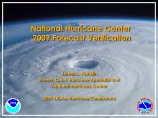
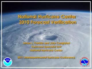
National Hurricane Center 2010 Forecast Verification James L. Franklin and John Cangialosi Hurricane Specialist Unit National Hurricane Center 2011 Interdepartmental Hurricane Conference
2010 Atlantic Verification VT NT TRACK INT (h) (n mi) (kt) ============================ 000 404 11.2 2.4 012 365 34.2 7.6 024 327 54.2 12.0 036 292 71.6 13.9 048 259 89.1 15.5 072 198 129.4 16.7 096 149 166.0 18.4 120 115 186.7 18.6 • Values in green exceed all-time records. • GPRA track goal (48 h error <= 90 n mi) was met. • GPRA intensity goal (48 h error <= 13 kt) was (yet again) not met.
Atlantic Track Errors by Storm Igor, Richard and Tomas notable successes. Danielle (sharper recurvature than forecast) and Lisa (moved unexpectedly eastward for two days) presented challenges.
Atlantic Track Errors vs. 5-Year Mean Official forecast was mostly better than the 5-year mean, even though the season’s storms were “harder” than normal.
Atlantic Track Error Trends Since 1990, track errors have decreased by about 60%. Current five-day error is as large as the 3-day error was just 10 years ago.
Atlantic Track Skill Trends Another leveling off of skill?
Atlantic Model Trends Improvements in skill from 2000-2 due to improvements to the GFS and formalization of consensus aids (GUNS, GUNA)? Skill increases in 2008 can be attributed to enhanced availability and performance of ECMWF. UKMET, NOGAPS consistently trail other models. EMXI best model for the third year in a row.
2011 Atlantic “Cone” 2010 36 62 85 108 161 220 285 Substantial reduction in track cone size for 2011 due to 2005 season dropping out of the sample.
Atlantic Early Track Guidance Official forecast performance was very close to the consensus models. Another good year for FSSE. Best dynamical models were ECMWF and GFS. EGRI had the most skillat 120 h. GF5I performed better than the GHMI through 72 h.
NGPI impact on Consensus (TCON) Removing NGPI from the TCON consensus improves the consensus in the Atlantic basin, even after the mid-season NOGAPS upgrade. NGPI still contributes positively to TCON in the eastern Pacific, however. NHC is strongly considering removing NGPI from TCON and TVCN consensus models for 2011. Probably will want to create an “NCON” and “NVCN” for use in the eastern Pacific.
Atlantic Intensity Errors vs. 5-Year Mean OFCL errors in 2010 were close to the 5-yr means, but the 2010 Decay-SHIFOR errors were above their 5-yr means indicating that the season’s storms were “harder” than average to forecast.
Atlantic Intensity Error Trends No progress with intensity
Atlantic Intensity Skill Trends Little net change in skill over past several years, although skill has been higher recently compared to the 90s.
Atlantic Early Intensity Guidance Statistical and consensus models were competitive. FSSE was the best model through 48 h and LGEM performed best beyond that. Official forecasts paying too much attention to the dynamical guidance, especially late?
Atlantic Genesis Forecasts Forecasts at the high end and low end were very well calibrated (reliable) with minimal bias. However, this year’s forecasts could not distinguish gradations in likelihood between 30% and 70%.
Atlantic Genesis Forecasts Results for the overall sample do show some ability in the mid-range, but it’s clearly an area that could be improved.
2010 Eastern Pacific Verification VT NT TRACK IN (h) (n mi) (kt) ============================ 000 161 9.0 1.5 012 13826.06.1 024 11540.1 9.3 036 9748.6 12.4 048 8354.7 13.5 072 6385.315.6 096 43119.315.9 120 29145.4 17.8 Values in green exceeded all-time lows.
Eastern Pacific Track Errors vs. 5-Year Mean Official forecasts were considerably better than the 5 yr mean, although the season’s storms were “easier” than normal. Substantial ENE bias at days 4-5.
Eastern Pacific Track Error Trends Since 1990, track errors have decreased by 35%-60%
Eastern Pacific Track Skill Trends Skill is at all-time highs from 24-96 h.
2011 Eastern Pacific “Cone” 2010 36 59 82 102 138 174 220 Only modest changes in cone size but portions of the cone will actually get larger.
Eastern Pacific Early Track Guidance • Official forecast performance was very close to the TVCN • consensus model. OFCL • beat TVCN at 12–24 h. • FSSE among the best models through 96 h. • EMXI best individual model from 12–72 h. • GFNI, NGPI are best individual models at 96-120 h.
Eastern Pacific Intensity Errors vs. 5-Year Mean Official forecasts were better than the 5 yr mean, even though the season’s storms were “harder” than average.
Eastern Pacific Intensity Error Trends Intensity errors have decreased slightly at 48 h and 72 h but have remained about the same otherwise.
Eastern Pacific Intensity Skill Trends Skill hit all-time highs at all forecast times in 2010 after many years with little change. Most likely an anomaly due to small sample size.
Eastern Pacific Early Intensity Guidance Official forecasts beat the consensus (ICON, FSSE) at most time periods. Best model was statistical at all time periods. LGEM and DSHP were better than the consensus from 72-120 h, likely due to the less-than-skillful HWRF. FSSE is the best model from 12–48 h. GHMI was competitive with statistical and consensus models.
Eastern Pacific Genesis Forecasts Inability to distinguish the high from the medium likelihood of development (essentially no information conveyed except at 0-20%).
Eastern Pacific Genesis Forecasts Four-year sample is better, but still trouble in the 50-80% range, and under-forecast bias overall persists.