Understanding Geolocation Accuracy using Network Geometry Brian Eriksson Technicolor Palo Alto
260 likes | 404 Vues
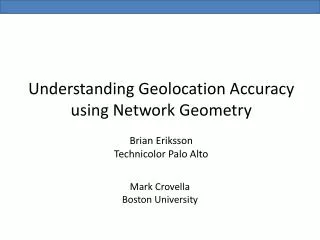
Understanding Geolocation Accuracy using Network Geometry Brian Eriksson Technicolor Palo Alto. Mark Crovella Boston University. ?. ?. ?. ?. ?. Internet. T arget. Geographic location (geolocation) ?. Why? : Targeted advertisement, product delivery, law enforcement, counter-terrorism .

Understanding Geolocation Accuracy using Network Geometry Brian Eriksson Technicolor Palo Alto
E N D
Presentation Transcript
Understanding Geolocation Accuracy using Network GeometryBrian ErikssonTechnicolor Palo Alto Mark Crovella Boston University
? ? ? ? ? Internet Target Geographic location (geolocation)? Why? : Targeted advertisement, product delivery, law enforcement, counter-terrorism Our focus is on IP Geolocation
Measurement-Based Geolocation Landmark d Estimated Distance (known location) Target delay (unknown location) • Landmark Properties: 1 • Known geographic location 2 • Delay Measurements to Targets -Estimated distance (Speed of light in fiber)
Measured Delay vs. Geographic Distance Ideal Geographic Distance (miles) Measured Delay (in ms) Over 80,000 pairwise delay measurements with known geographic line-of-sight distance.
Why does this deviation occur? Delay-to-Geographic Distance Bias Geographic Distance (miles) Line-of-sight The Network Geometry (the geographic node and link placement of the network) makes geolocation difficult Landmark Routing Path Measured Delay (in ms) Target Sprint North America
To defeat the Network Geometry, many measurement-based techniques have been introduced. ? Best Technique Worst Technique ? All of these results are on different data sets!
The number of landmarks is inconsistent. What if this technique used 76,000 landmarks? What if this technique used 11 landmarks?
Our focus is on characterizing geolocation performance. How does accuracy change with the number of landmarks? 1 vs. 3 landmarks 10 landmarks How does accuracy change with the geographic region of the network? 2 vs. “Excellent” Geolocation Performance “Poor” Geolocation Performance
Constraint-Based Target Landmarks
Constraint-Based Maximum Geographic Distance Feasible Region
Estimated Location Constraint-Based Feasible Region Intersection
Estimated Location Estimated Location Smallest Delay Target Landmarks Constraint-Based Shortest Ping Feasible Region Intersection
Maximum Geolocation Error Maximum Geolocation Error Shortest Ping w/ 5 landmarks Shortest Ping w/ 4 landmarks Maximum Geolocation Error α error (-β) Number of Landmarks Background: Fractal dimension, Hausdorff dimension, covering dimension, box counting dimension, etc. Where the Network Geometry defines the scaling dimension, β>0 Shortest Ping w/ 6 landmarks
Estimated scaling dimension, β Network Geometry Given shortest path distances on network geometry, we use ClusterDimension[Eriksson and Crovella, 2012] β = 0.739 β = 0.557 Scaling dimension, β = 1.119 Intuition: Measures closeness of routing paths to line of sight.
Scaling Dimension and Accuracy M α error (-β) For M landmarks and scaling dimension β, we find: error α M(-1/β) Large reduction in error using more landmarks. Small reduction in error using more landmarks. β = 1.119 β = 0.557
Lower dimension networks perform better with many landmarks Power Law Decay = -γgrid Ring Graph (dim. β ≈ 1) Grid Graph (dim. β ≈ 2) Higher dimension networks perform better with few landmarks Power Law Decay = -γring (M) The intuition holds, the accuracy decays like O(M-1/β) 1 Both graphs follow a power law decay (γ) with respect to geolocation error rate. 2
Topology Zoo Experiments From network geometry - Estimated Scaling Dimension, β 1 Geolocation error power law decay, γ (assumption, ≈ 1/β) 2 Internet Topology Zoo Project - http://www.topology-zoo.org/
Constraint-Based and Scaling Dimension Shortest Ping and Scaling Dimension γ β R2 = 0.855 R2 = 0.787 Goodness-of-fit to 1/β curve
We find consistency across geographic regions. “Poor” Geolocation Performance “Excellent” Geolocation Performance
Conclusions • Geolocation accuracy comparison is difficult due to inconsistent experiments.
Conclusions • The scaling dimension of a network is proportional to its geolocation accuracy decay. Ring Graph (dimension ≈ 1) Grid Graph (dimension ≈ 2)
Conclusions • Results on real-world networks fit to this trend and demonstrate consistency across geographic regions. R2 = 0.855