Download
1 / 13
130 likes | 257 Vues
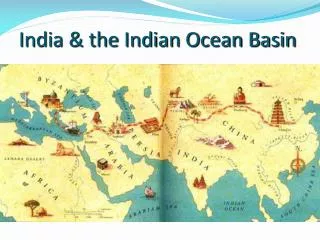
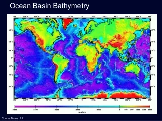
Explore the intricate trade networks and the spread of Islam across the Indian Ocean and Southeast Asia from the 8th to the 17th century. Delve into the Portuguese and Spanish spice routes, the establishment of Muslim settlements in Africa and South Asia, and the cultural exchanges that ensued. This overview highlights significant historical events, including the spread of Islam during trade, the rise and fall of Muslim states, and the impact of European colonial powers on regional dynamics. Discover maps illustrating these transformative centuries.

E N D
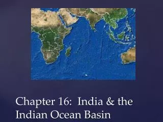
Indian Ocean Basin Map Link: Portuguese/Spanish Spice Routes: <http://upload.wikimedia.org/wikipedia/commons/thumb/9/9c/ 16th_century_Portuguese_Spanish_trade_routes.png/ 1280px-16th_century_Portuguese_Spanish_trade_routes.png>
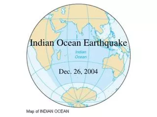
Horn of Africa and east coast Berbera and Land of the Zanj 8th c. Start of Muslim settlement on east coast of Africa Map Link: Africa in 979: <http://www.timemaps.com/store/timemaps/2012/12/ newafrica_ad979.jpg>
8th c. Start of Muslim settlement in S. Asia 10th c. Muslim traders on Malabar coast 11th c. Muslim states in S. Asia Map Link: South Asia in 1215: <http://www.timemaps.com/store/timemaps/2012/4/ newsouthasia_ad1215.jpg>
“The Lands below the winds” Strait of Melaka (Malacca) Sunda Strait Map Link: Southeast Asia: <http://upload.wikimedia.org/wikipedia/commons/ thumb/f/fc/Southeast_asia.svg/506px- Southeast_asia.svg.png>
Themes: Trade Conversion Conflict
Activities of merchants Bantu Swahili (Sahel) Intermarriage Deeper spread in Horn of Africa Map Link: Africa in 1453: <http://www.timemaps.com/store/timemaps/2012/4/ africa_ad1453.jpg>
Activities of merchants End 15th c. Many conversions on Malabar coast Mappilas (Moplahs) Map Link: South Asia in 1453: <http://www.timemaps.com/store/timemaps/2012/4/ newsouthasia_ad1453.jpg>
Activities of merchants in 13th-16th c. Aceh Java “Orthodoxy” vs. custom Tolerance Map Link: Southeast Asia in 1453: <http://www.timemaps.com/store/timemaps/2012/4/ seasia_ad1453.jpg>
1492 Spanish take Granada, end Muslim states in Iberia 1498 Vasco de Gama rounds Cape of Good Hope, reaches Malabar Coast Portuguese/Spanish crusade against Islam 1570 Spanish take Manila. Conquest of Philippines follows (Philip II, r. 1556-98)
Early 17th c. English and Dutch fight for dominance in Southeast Asia (Dutch win) Monopoly, through force if necessary Map Link: Southeast Asia in 1648: <http://www.timemaps.com/store/timemaps/2012/7/ seasia_ad1648.jpg>
Reactions: 16th c. Mappilas respond to Portuguese crusade with modified jihad Islam as symbol of resistance
Decline of Southeast Asian Islam under Dutch: Cutting out the middlemen – decline of Muslim merchant class Controlling prices – impoverishment of cities Breakdown of communications
Sidi (Seydi) Ali Reis (1498-1563) Ottoman admiral commissioned by sultan to fight Portuguese in Indian Ocean Unintended travels in India and elsewhere in 1553-56, incl. meeting Mughal Emperor Humayun (r. 1530-56) Mir’at al-Memalik (The Mirror of the Countries, 1557)