Download
1 / 20
210 likes | 491 Vues
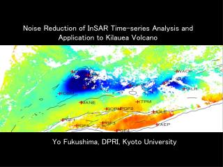
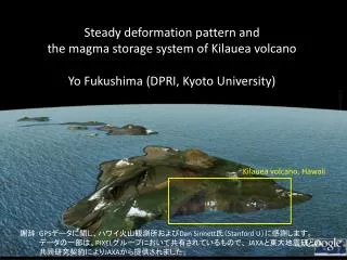
Steady deformation pattern and the magma storage system of Kilauea volcano Yo Fukushima (DPRI, Kyoto University). Kilauea volcano, Hawaii. 謝辞: GPS データに関し、ハワイ火山観測所および Dan Sinnett 氏( Stanford U )に感謝します。 データの一部は、 PIXEL グループにおいて共有されているもので、 JAXA と東大地震研との 共同研究契約により JAXA から提供されました。.

E N D
Steady deformation pattern and the magma storage system of Kilauea volcanoYo Fukushima (DPRI, Kyoto University) Kilauea volcano, Hawaii 謝辞:GPSデータに関し、ハワイ火山観測所およびDan Sinnett氏(Stanford U)に感謝します。 データの一部は、PIXELグループにおいて共有されているもので、 JAXAと東大地震研との 共同研究契約によりJAXAから提供されました。
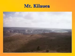
Kilauea Volcano マウナロア プウオオ火口 キラウエア 東リフトゾーン 海側に押し出される 南西リフトゾーン 9 km 火山体 定常すべり・スロースリップ・地震すべり
Deformation of Kilauea in the 1990s 水平 上下 • S. Flank: Seaward 10cm/yr & coastal uplift • Summit and along rift zones: subsidence • Use InSAR to know the details
手法についてInSAR(干渉SAR、干渉合成開口レーダ)手法についてInSAR(干渉SAR、干渉合成開口レーダ) 違う時期に撮像された2枚のSAR画像から、衛星視線方向の地表変位量を測定する
… InSAR time-series analysis Time … Time
Principle of InSAR TS analysis (SBAS) 干渉画像5 干渉画像4 干渉画像3 干渉画像2 d = Gm 干渉画像1 t1 t2 t3 t4 t5 時間 dt1 dt2 dt3 dt4 u1 u2 u3 u4
Data • 21 ALOS/PALSAR images (55 pairs) • Incidence angle ~10 deg (nearly vertical) • May 2006 to Jan. 2011 (nearly 5 yrs)
Baselines Dike intrusion (June 2007) Fissure eruption (Jul. 2997) March 2008 summit eruption SAR画像 干渉ペア Period 1 Period 2 Period 3 Period 4
Result: Period 1May 2006 – June 2007. Uplift SW of the summit
Result: Period 2Dike intrusion in June 2007, start of fissure eruption in July 2007 プウオオ火口
Result: Period 3Oct. 2007 – Aug. 2009. Cont. of fissure eruption
Result: Period 4Aug. 3008 – Jan. 2011. Back to the steady (?) state
Fairly consistent w/GPS (quasi-vertical) (RMS 1.6 cm) Near summit ● GPS + InSAR
Modeling with BEM Vertical rift-zone reservoir (tensile crack) Top=3km depth, height ~6km Sub-horiz. decollement Dipping NW 5 deg • Boundary Conditions • Tensile crack: uniform normal stress, no shear stress • Decollement: no shear stress change, no normal displacement
Can explain the overall deformation pattern of the “steady” state.
Conclusions • Following results were obtained from analysis of ALOS/PALSAR data of May 2006 to Jan. 2011: Uplift SW of the summit -> Dike intrusion and onset of fissure eruption -> During the eruption, significant subsidence around the summit and Pu’u’O’o -> Decrease of the subsidence rate (steady state) • The steady state deformaiton can be explained by the magma supply to the rift-zone reservoir and the slip along the decollement. (no need of the summit reservoir)
垂直な開口クラック(リフト) + 水平面のすべり (Delaney et al., 1993) リフト 水平すべり面 (Owen et al., 1995)
垂直なリフトが開くと、peak-trough-peak型の垂直変動パターンになる。水平面がすべると、片側で沈降するパターンが得られる(Delaney et al., 1993)。 (Figs from Owen et al., 1995) 開口クラック 足し合わせ 水平すべり (Figs from Owen et al., 1995, Science)
InSAR時系列解析(短基線長法)の原理 干渉画像5 干渉画像4 干渉画像3 干渉画像2 d = Gm 干渉画像1 t1 t2 t3 t4 t5 時間 dt1 dt2 dt3 dt4 u1 u2 u3 u4