Download
1 / 11
110 likes | 186 Vues
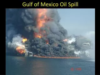
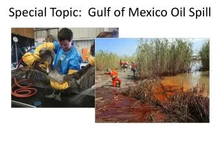
Sea Surface Roughness Milestones 2009-2011 Related to ROSES Gulf of Mexico Oil Spill Project. Bill Pichel. Oil Seep Paper Published in GRL with Front Cover. H.

E N D
Sea Surface Roughness Milestones 2009-2011Related to ROSES Gulf of Mexico Oil Spill Project Bill Pichel
Oil Seep Paper Published in GRL with Front Cover H A joint paper on remote sensing of oil seeps which resulted from a collaboration of faculty members from the University of South Florida/University of Massachusetts and STAR Sea Surface Roughness Science Team members, William Pichel and Xiaofeng Li, was published in Geophysical Research Letters (GRL) in January 2009. A few of the figures from the paper were selected for the front cover of this issue, and the article has been selected by Geophysical Research Letters as an “AGU Journal Highlight.”. The good correspondence between oil slick signatures in synthetic aperture radar (SAR) data and MODIS sun glint imagery increases the sources of satellite data that can be used to map marine oil spills and natural oil seeps. (Courtesy of W. Pichel)
Explore Oil Spill Analysis Systems M Available SAR oil spill analysis systems have been evaluated and a neural network algorithm has been chosen for further development and testing. This Texture Classifying Neural Network Algorithm (TCNNA) will be developed using funding received as the result of a successful NASA ROSES Gulf of Mexico research proposal submitted jointly by NRL Stennis, NASA Langley, STAR, and Florida State Univ. Left – oil signature in ENVISAT Advanced SAR image from a Pipeline spill in the Gulf of Mexico, July 26, 2009. Right - TCNNA analysis of this spill. A SPSRB user request from the NOS Emergency Response Division to support them with rapid satellite-based oil-spill surveys after ship accidents and hurricanes has led to the decision by OSDPD to provide these analyses operationally. These will initially be done manually, but it is planned that the TCNNA analysis will become a tool to make interactive oil spill analysis and output product production more efficient. Sponsor: Ocean Remote Sensing Program (Courtesy of W. Pichel)
STAR and SAB Respond to Deepwater Horizon Accident with Oil Spill Analyses H STAR personnel have assisted the OSDPD Satellite Analysis Branch (SAB) in response to the Deepwater Horizon Oil Platform Accident in the Gulf of Mexico, beginning in April 2010. STAR has scheduled SAR imagery, consulted in analyses, and continued with the development of automated oil spill mapping software in collaboration with Florida State University. Left: Experimental Marine Pollution Surveillance Report issued by OSDPD Satellite Analysis Branch for May 2, 2010. Right: Texture Classifying Neural Network (TCNNA) oil spill map for the same day. This algorithm is being developed by STAR for possible use as an automated oil spill mapping tool. (Courtesy of W. Pichel) Support from Ocean Remote Sensing Program and OSDPD
Development of Oil Spill Mapping Capability H STAR continues to collaborate with the Florida State University in the development of a neural network algorithm for mapping of ocean oil pollution using synthetic aperture radar (SAR) imagery. A prototype capability has been developed with RADARSAT-1 SAR data and is now being trained with ENVISAT SAR data. Time sequence of oil spill maps derived from ENVISAT Advanced SAR (ASAR) imagery (May 31 and June 3) and RADARSAT-1 imagery (June 1). The Texture Classifying Neural Network Algorithm (TCNNA) was utilized to analyze the ASAR data. (Courtesy of W. Pichel) Support from Ocean Remote Sensing Program and OSDPD
M Provide SAR Imagery of Oil Spills – STAR Response to Deepwater Horizon Event STAR personnel have assisted the OSDPD Satellite Analysis Branch (SAB) and the Emergency Response Division of the NOS Office of Response and Restoration in the response to the Deepwater Horizon Oil Platform Accident in the Gulf of Mexico, beginning in April 2010 and continuing into August 2010. STAR has scheduled SAR imagery, procured SAR data purchase, briefed SAB analysts on oceanographic conditions in the Gulf of Mexico, consulted in analyses, and continued automated oil spill mapping and oil spill thickness research. Left: Experimental Marine Pollution Surveillance Report issued by OSDPD Satellite Analysis Branch for July 11, 2010 11:56 UT from COSMO-SkyMed X-band VV SAR Image. Right: Initial research attempt to delineate thicker oil regions by comparing Synthetic Aperture Radar outline of spill (blue) and outline of possibly thicker oil (red) from MODIS visible imagery (July 11, 2010 16:43 UT). (Courtesy of W. Pichel) Support from Ocean Remote Sensing Program and OSDPD
Presentation at NOAA Technology Summit H William Pichel gave a presentation at the NOAA Technology Summit in Silver Spring November 3, 2010. His presentation was entitled: “Synthetic Aperture Radar (SAR) Applications.” Use of SAR imagery during the Deepwater Horizon Event was emphasized. Above: COSMO-SkyMed-2 SAR image July 11, 2010 11:56Z. Below: COSMO-SkyMed-2 SAR image July 11, 2010 11:56Z. Above: MODIS Visible image July 11, 2010 16:43Z. Oil outline from SAR in blue; outline of possibly thicker oil from MODIS in red. Florida State University and NOAA are collaborating on a study of the use of visible Sun glint imagery and SAR data to obtain qualitative information on surface oil thickness. Shipboard oil thickness samples were taken during July for algorithm development and validation. (Courtesy of W. Pichel) Sponsor: ORS
Paper Published in Marine Pollution Bulletin H Xiaofeng Li, STAR contractor, and William Pichel of STAR are co-authors on a paper published in the Marine Pollution Bulletin. The title is: “SAR Observation and Tracking of an Oil Spill Event in Coastal Waters” by Yongcun Cheng, Xiaofeng Li, Qing Xu, Oscar Garcia-Pineda, Ole Baltazar Andersen, and William Pichel. Left: Output of the Texture Classifying Neural Network Algorithm (TCNNA) for three days of a pipeline leak in the Gulf of Mexico. Right: General NOAA Operational Modeling Environment (GNOME) trajectory results (blue dots) after three days (July 29) on top of the SAR image for that day. The GNOME oil spill positions for day 1 were initialized from the TCNNA output of July 26. (Courtesy of W. Pichel) Sponsor: ORS
Train prototype oil spill mapping algorithm to handle ENVISAT, ALOS, and RADARSAT-1/2 data. Improve the handling of shape files . M The SAR oil spill mapping system, being developed by Florida State University has been trained to process ENVISAT, ALOS, and RADARSAT-1/2 SAR data to produce oil spill analyses within an interactive processing environment. An extensive data set of Deepwater Horizon imagery proved invaluable in this effort. Output of the Texture Classifying Neural Network Algorithm (TCNNA) for a June 9, 2010 ENVISAT image over the Gulf of Mexico during the Deepwater Horizon oil spill. Significance: This trained interactive oil spill analysis system will be installed in STAR in June and tested extensively to assess its ability to reliably detect oil spills. The OSPO/Satellite Analysis Branch will also assess its utility to their operational oil spill product generation activities. Sponsor: NASA ROSES and ORS (Courtesy of W. Pichel)
Experimental Oil Spill Analysis System Installed in STAR and Satellite Analysis Branch (SAB) H The synthetic aperture radar (SAR) experimental oil spill mapping system, being developed by Florida State University was installed in STAR and SAB during the week of June 13 for testing. SAB and STAR personnel were trained in its use. Texture Classifying Neural Network Algorithm (TCNNA) Graphical User Interface (GUI) for interactive oil spill Mapping with SAR data. Significance: This trained interactive neural network oil spill analysis system can now be tested in STAR and SAB to assess its ability to reliably detect oil spills. Some modifications will be made before the end of this phase of the project in August 2011. Sponsor: NASA ROSES and ORS (Courtesy of W. Pichel)
Develop and Evaluate Experimentally Operational Oil Mapping Software Using Existing SAR Oil Spill Imagery M The synthetic aperture radar (SAR) experimental oil spill mapping system, developed by Florida State University has been installed in NESDIS and evaluated. Documentation has been received. The NASA ROSES project which provided part of the funding for this project was completed successfully in August 2011. Texture Classifying Neural Network Algorithm (TCNNA) output (right) from ENVISAT VV SAR image of Deepwater Horizon spill (left) as of 05/09/2010. Significance: This trained interactive neural network oil spill analysis system can process ENVISAT, RADARSAT-1, or ALOS SAR imagery into oil spill maps. A new contract with FSU awarded 8/11 will allow enhancements to this system and design of a fully operational system. Sponsor: NASA ROSES and ORS (Courtesy of W. Pichel)