Download
1 / 8
80 likes | 107 Vues
Dive into various types of maps and their applications in Geography education beyond 'Map Skills'. Explore the significance of map interpretation and decision-making in lessons while sharing experiences from teaching placements. Enhance GIS integration for student engagement.

E N D
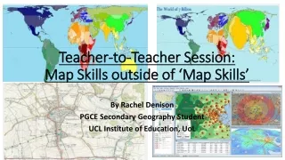
Teacher-to-Teacher Session: Map Skills outside of ‘Map Skills’ By Rachel Denison PGCE Secondary Geography Student UCL Institute of Education, UoL
“You must know where everything is.” “That is the subject that is all about maps and colouring in” YES you are right, Geography does use maps!!!
Types of Map that can be used in a Geography department • Atlases-World Maps, Physical and Political Maps • OS Maps- Extracts, Local Area and Case Study Area e.g. Snowdonia or Lake District • Globes • Choropleth Maps • Population Maps • Proportional Maps e.g. World Mapper • Weather Maps • Sketch Maps/Mental Maps • Geology Maps • GIS
The Importance of Map Skills outside of ‘Map Skills’ Typical Comments from Year 7 Typical Comments from Year 10 after their unit on ‘Map Skills’ having not used their Map Skills since Year 7 I know now how to find the exact location of a point on an OS Map How do I find a six figure grid reference on an OS Map to locate a point? I really enjoy learning how to read a map and understand how its scale works How can I interpret an OS Map to be able to understand how the location of a settlement has affected the management of a coastline? I understand how to measure distance on a map as the crow flies and by road
Maps as a means of interpretation Lesson 9 of a self-planned scheme of work on rivers and flooding for Year 7 taught in my first placement as part of my Masters assignment
Maps as a Means of Decision-Making Will be Lesson 9 of a self-planned scheme of work on natural resources taught in my second placement as part of my professional development on using GIS with Students in Year 8. Used MapZone by Ordnance Survey