Download
1 / 28
280 likes | 372 Vues
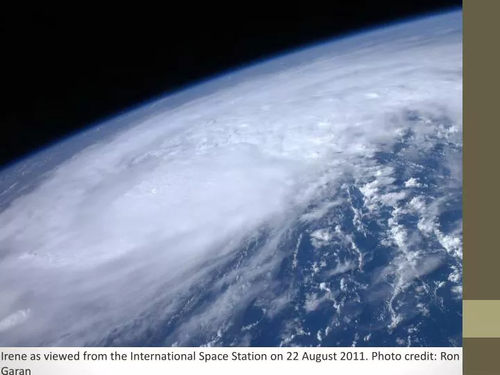
Irene as viewed from the International Space Station on 22 August 2011. Photo credit: Ron Garan. Tropical Storm Irene - A synoptic view of the new flood of record. Dr. Lesley-Ann Dupigny -Giroux Associate Professor of Climatology – University of Vermont VT State Climatologist.

E N D
Irene as viewed from the International Space Station on 22 August 2011. Photo credit: Ron Garan
Tropical Storm Irene- A synoptic view of the new flood of record Dr. Lesley-Ann Dupigny-Giroux Associate Professor of Climatology – University of Vermont VT State Climatologist AASC Annual Meeting - Destin, FL - 11 July 2012
Irene’s winds and rain 27 August 2011 http://www.nnvl.noaa.gov/MediaDetail.php?MediaID=818&MediaTypeID=1
Heavy rainfall from Irene Credit: Northeast Regional Climate Center
Why are hurricanes so dangerous? Associated hazards • winds (beach erosion, property damage, large waves) • intense rainfall - rates of metres/day • storm surge • winds & storm surge most intense to right of hurricane • sum of wind speed and storm speed • tornadoes • inland flooding Photo credit: D. Koopman
General causes of flooding in Vermont • deep snow cover • frozen ground • saturated soil • full reservoirs • existing bankfull conditions • ice-covered rivers • widespread, heavy rain • topography • ground cover
Flooding is enhanced by… • topography • air is funneled • orographic uplift along the Greens RICHFORD JAY PEAK
Tropical storm related flooding • consecutive movement of large storms over the same area • antecedent wet soil conditions (additional precipitation runs off since the soil is saturated) • influence of hurricane/tropical storm remnants • November 1927 • August 1955 (Connie, Danny) • June 1972 (Agnes) • August 1998 (Bonnie) • September 1999 (Dennis, Floyd) • August 2011 (Irene)
North vs. south Vermont southern flash flooding northern riverine flooding
Riverine flooding • long term event over the course of a week or more
Take-home message • Geography matters • topography matters • storm track influences precipitation, winds, storm surge • beware of the inland flooding potential • antecedent conditions are important
IRENE 2011 Flood Aftermath(Paul Sisson – NWS/BTV) BTV Warm Season Workshop 2 May 2012 Photos courtesy of BTV Free Press and Mansfield Heliflight