Analysis of Tide Gauge and AVISO Mean Sea Surface Height Data from East Asia (1980-2009)
270 likes | 392 Vues
This study examines mean sea surface height (SSH) data derived from tide gauges and AVISO across Keelung, Ishigaki, Gangfeng, Suao, Lanyu, and Dawu over significant periods from 1969 to 2009. Black dots indicate tide gauge locations, while blue contours represent isobaths. It includes analysis of wind stress, curl, correlation coefficients, and regression models to compare tide gauge and AVISO data, highlighting the influence of the winter monsoon and variations related to positive and negative PDO phases.

Analysis of Tide Gauge and AVISO Mean Sea Surface Height Data from East Asia (1980-2009)
E N D
Presentation Transcript
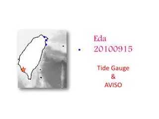
Eda 20100915 Tide Gauge & AVISO
Mean SSH from Rio et al.2009 Black dots are the locations of the tide gauge stations. Blue contours are the isobaths. Time period of data Keelung: 1980-2009 Ishigaki: 1969-2008 Gangfeng: 1997-2007 Suao: 1999-2005 Lanyu:1992-2009 Dawu:2004-2009
outline • EOF (AVISO SSH, ECMWF wind stress, curl) • Mean wind stress and curl • Correlation Coef. , regression and time series of: North Taiwan (tide gauge & AVISO) South Taiwan East Luzon • AVISO SSHA Latitude-Time plot (eddy propagation)
EOF AVISO SSH: 360d running mean mode1: 67% mode2: 7.3% mode3: 3.9 %
Mean wind stress (Pa) and curl (Pa/m) 1980~2008 Wind filed is dominated by winter monsoon
Time series of SSHA Tide gauge (black solid) AVISO (red dash)
Time series of SSHA AVISO: south Taiwan
Time series of SSHA AVISO: east Luzon
Correlation and regression of AVISO SSHA & Tide Gauge North Taiwan
Correlation and regression of AVISO SSHA South Taiwan
Correlation and regression of AVISO SSHA East Luzon
SST (color), SLP (contours) and wind stress (arrows) anomalies during +ve and –ve PDO’s +ve -ve 1990 Comparison: tide gauge and AVISO http://jisao.washington.edu/pdo/