Climate & Urban Planning
Climate & Urban Planning. ENVS – 6123 Feb 6, 2006. Climate – a long tradition in urban design.

Climate & Urban Planning
E N D
Presentation Transcript
Climate & Urban Planning ENVS – 6123 Feb 6, 2006
Climate – a long tradition in urban design “A long tradition of climatic consideration in urban design can be traced back more than 2000 years when…Roman architect and engineer Vitruvius, in…`The Ten Books on Architecture', discussed the layout of towns and individual buildings according to various climatic influences. (Morgan, 1960).”
Eliasson – The Use of Climate Knowledge in Urban Planning • Urban climate information often fails to enter the planning process • The study asks “individuals involved in urban planning, if, why and when climate is considered in the planning process.” • Hypothesis: “low impact is a result of several constraints … explanatory variables, ie, conceptual and knowledge based, technical, policy, organisational and the market.”
Lazar & Podesser - An urban climate analysis of Graz and its significance for urban planning in the tributary valleys east of Graz • Stuttgart 1977, an early application of climatic information to urban planning. • Graz case an example to other Austrian cities • This article: “the most important features of the Graz city climate like the different local wind systems, the heat islands as well as the fog and inversion conditions….described and illustrated… and … description of the spreading conditions of air pollutants”
river • valley • mountains • tributaries • industry • local wind patterns • fog • air pollution • inversions
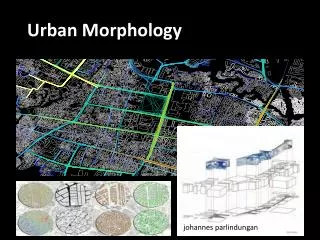
Scherer - Improved concepts and methods in analysis and evaluation of the urban climate for optimizing urban planning processes • Basic idea: introduces “climatope” – a new concept that combines “areal types” and “ventilation classes” via GIS overlay. • Process: Requires normalizing data from different GIS sources to create overlay of “areal type” and “ventilation class”. (See Fig 1 ) • Location: Basel, Switzerland, 1999
Conclusions • Each climatope should be planned for individually • Planners like working with climatopes
Sailor- Simulated Urban Climate Response to Changes in Surface Albedo and Vegetation cover • Computer modeling Los Angeles basin to simulate climate effects of two heat island mitigation techniques: • Raising surface albedo by .14 via cool surfaces • Increasing vegetation cover
Albedo (al-bee-dough) • Albedo, or solar reflectance, is a measure of a material's ability to reflect sunlight on a scale of 0 to 1. Dark objects have low albedos. An object that reflects most of the light that hits it, has a high albedo. • The earth’s albedo is .38
Ramada House / Judith Chaffee As the air in the valley is warmed, it rises up the hillside and under the shade of the Ramada House. The use of a ramada, which allows the passage of air through it is ancient in this region. In this case, however, the scale is relative to huge shade trees that do not exist here. The house is in two parts: the shade structure and the masonry house, scaled to relate to its neighbors, pueblo-style houses of the thirties and forties. The column spacing of the shade structure is absolutely regular, the masonry forms are flexible and earth-hugging. Some of the now unreasonable mannerisms of the pueblo style, such as piling masonry on top of openings, have been eliminated.
The M'zab Valley communities exhibited a consistent overall urban pattern consisting of three elements: fortified winter towns (ksars), summer towns in the valleys (wahat), and cemeteries. The basic arrangement of these communities followed the terrain the white buildings of the ksars were laid out on high ground, the valley contained palm groves that sheltered the summer dwellings, and the desert areas contained the cemeteries. Each ksar (winter town) had its corresponding wahat (summer valley town) where M'zabites spent hot parts of the year. Most of the population moved seasonally between the sunny urban areas on the hill and the lush shady cultivated areas of the valley. diagram of M'Zab summer and winter house usage patterns,
A) Sunlight reflected from adjacent roof and building surfaces is an important component of skylighting in hot dry climates. B) Properly designed skylighting devices can function as windcatchers and/or vents for convective air currents. C) A coffered ceiling is an effective method for distributing light uniformly within a space without creating discomfort from glare.
Trulli Houses Alberobello, Italy Lighting in Trulli house