Download
1 / 18
180 likes | 383 Vues
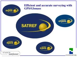
Efficient and accurate surveying with GPS/Glonass. Satref consists of: Permanent GPS/Glonass reference stations situated almost all over Norway Control centre, located at NMA, Hønefoss. What SATREF does:.

E N D
Satref consists of: • Permanent GPS/Glonass reference stations situated almost all over Norway • Control centre, located at NMA, Hønefoss.
What SATREF does: • The SATREF® services continuously model the size of the effects of different error sources in the GPS and Glonass systems • We generate and distribute both real-time reference/correction data (RTCM) and post processing data (RINEX).
The reference stations • PGS-B: 16 stations on the Norwegian mainland + Ny Ålesund, Jan Mayen, Höfn (Iceland) • PGS-C: About 60 stations (continuously increasing) The station coordinates are computed in two independent ways: • Precise point positioning (solution in ITRF2005, transformed to EUREF89) • GNSS baselines from the 4 closest EUREF89 benchmarks (landsnett, stamnett)
Satref services accuracy Your position Your surveyed position GPS only MPOS DPOS CPOS ETPOS 22 metres or better for 95% of the measurements 3-5 metres or better for 95% of the measurements 3 decimetres (30 centimetres) or better for 95% of the measurements 5 centimetres or better for 95% of the measurements Possible to achieve millimetre accuracy
CPOS: Data flow IGS Predicted ephemeris data GNSS raw observation (and ephemeris) data from the reference stations Reference data (RTCM) GNSS position (NMEA) SATREF® control centre GNSS rover
Data processing • Sofware: Trimble GPSNet • Input: • GNSS raw observation data • Predicted (and broadcast) ephemeris data • Known station coordinates • Network processing between the stations error models (“network corrections”) are created
The VRS principle (I) Ref. station 50km Virtual ref. station (VRS)
The VRS principle (II) • Network-RTK in CPOS are operated in the same way as traditional RTK, but a mobile reference receiver is replaced by a virtual reference station (VRS). CPOS uses one of the first NMEA positions it gets from the user as a VRS. • The reference data from the VRS are based on the nearest physical stations. • The CPOS software takes the observation data from the nearest physical station, modifies them by the network corrections and transforms them to the VRS position.
The VRS principle (III) Ref. station Virtual ref. station (VRS) GNSS rover
Mobile phone GSM Internet NTRIP protocol This reduces telecom. costs Most users today connect via GPRS on a mobile phone, but there are alternatives GPS only GPS+Glonass (full coverage autumn 2008) Connecting to CPOS All combinations are possible
Reference data format RTCM v2.3 (CPOS via mobile phone with GPS only) • Contents (in brief): • Pseudorange “measurements” • Carrier phase “measurements” • Position of the VRS + “antenna” description (“null-antenna”) • Position of the nearest physical reference station RTCM v3 (all other CPOS varieties) • Contents (in brief): • Pseudorange “measurements” • Carrier phase “measurements” • Position of the VRS + “antenna” description (“null-antenna”) • Position of the nearest physical reference station • Residual messages from the model interpolation
What are the SATREF services used for? Land surveying Navigation Machineguidance Registration Flight positioning for photogrammetry, laser scanning etc. Retrieving Documentation
Who are the users of CPOS? Municipalities Energy Governmental Private surveying Contractors Quarrying/mining Others
CPOS today • Today there are more than 400 users • CPOS is offered to the entire country, but is only established when there is a sufficient market. • Establishing and management are financed by the users: • 4 users per station established, 2 years commitment and 20000 NOK (approx. 2500 EUR) + VAT each year • Discount for customers with several users: • 3 – 10 users: 15000 NOK • >= 11 users: 13000 NOK • The SATREF services are non-profit services. This means that a possible profit in the short run is used to • reduce the prices • upgrade existing reference stations • establish more reference stations
CPOS coverage areas Areas covered during 2008
CPOS in the future • Goals for 2015: • Coverage area: The 95% most populated areas in Norway + important infrastructure areas (roads, rail) • 1 cm 3D accuracy with a relatively high level of integrity
Additional use of the reference stations • GNSS observation data from the stations are used in • Monitoring and analysing the performance of EGNOS at northern latitudes • Making a Norwegian ionosphere model • Meteorology • Monitoring crust movements • Plate tectonics • Post-glacial rebound (land uplift) • Some stations give observation data to IGS, EUREF and other organisations/institutions All this means that we have to make sure that the quality of the stations is as good as possible