
Navigating Government Maps and Geospatial Information
Discover the wealth of online government maps and geospatial data sources, learn search strategies, and explore mapping tools. Find resources for help with mapping.

Navigating Government Maps and Geospatial Information
E N D
Presentation Transcript
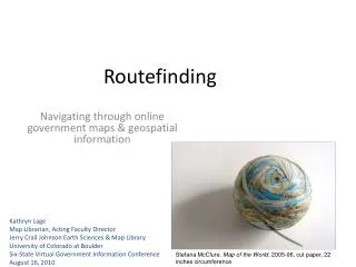
Routefinding Navigating through online government maps & geospatial information Kathryn Lage • Map Librarian, Acting Faculty Director • Jerry Crail Johnson Earth Sciences & Map Library • University of Colorado at Boulder • Six-State Virtual Government Information Conference • August 16, 2010 Stefana McClure. Map of the World, 2005-06, cut paper, 22 inches circumference
Outline • Introduction • Maps • The National Atlas • The National Map • US Topo • Geographic Names Information System (GNIS) • Geospatial Data • Search Strategies • Geospatial One Stop • Mashups • Other Important Map & Geospatial Data Sites • Resources for Help with Maps and Geospatial Data Image from UT Austin Perry-Castañeda Library http://www.lib.utexas.edu/maps/ams/china_city_plans/txu-oclc-6567312-1.jpg
The State of Government Digital Cartographic Products • Online, online, and more online • Often outside of normal government agencies’ publishing mechanisms • - Harder to keep track of • - Harder to understand, sometimes • + More accessible, often • + More easily reused http://nationalmap.gov/125years/index.html
Types of online maps and geospatial information • Static (PDF/JPG) • Dynamic • GeoPDF • Interactive • Web Map Services • Geospatial Data • Downloadable Data • Mashups
I 19.111:998 Six State Virtual Government Information Conference August 11-13 and 16-17, 2010
Nationalatlas.gov: New Topographic Maps Illustrating Physiographic Features Six State Virtual Government Information Conference August 11-13 and 16-17, 2010
Nationalatlas.gov: Wall Maps Six State Virtual Government Information Conference August 11-13 and 16-17, 2010
Nationalatlas.gov: Print Reference Maps Six State Virtual Government Information Conference August 11-13 and 16-17, 2010
Nationalatlas.gov: Map Maker Air Pollution Sites & Population Density Six State Virtual Government Information Conference August 11-13 and 16-17, 2010
Nationalatlas.gov: Map Maker More Map Layers Available in the Map Maker Six State Virtual Government Information Conference August 11-13 and 16-17, 2010
The National Map I 19.79:N 19 Six State Virtual Government Information Conference August 11-13 and 16-17, 2010
National Map Viewer Six State Virtual Government Information Conference August 11-13 and 16-17, 2010
The National Map Viewer: Orthoimagery and Layers Six State Virtual Government Information Conference August 11-13 and 16-17, 2010
The National Map Viewer: Download Data Six State Virtual Government Information Conference August 11-13 and 16-17, 2010
The National Map Viewer: Download Data Process Six State Virtual Government Information Conference August 11-13 and 16-17, 2010
US Topo: Next Generation of Topographic Maps I 19.81:37095-A 5-TF-024/2009 Six State Virtual Government Information Conference August 11-13 and 16-17, 2010
US Topo: Next Generation of Topographic Maps I 19.81:37095-A 5-TF-024/2009 Six State Virtual Government Information Conference August 11-13 and 16-17, 2010
US Topo Release Status Six State Virtual Government Information Conference August 11-13 and 16-17, 2010
US Topo: Download through the USGS Store Six State Virtual Government Information Conference August 11-13 and 16-17, 2010
US Topo: Download through the USGS Store (cont.) Six State Virtual Government Information Conference August 11-13 and 16-17, 2010
I 19.16/2: Six State Virtual Government Information Conference August 11-13 and 16-17, 2010
Six State Virtual Government Information Conference August 11-13 and 16-17, 2010
Government Geospatial Data • Data referenced to a specific location on the earth’s surface • Many sources • Geospatial One Stop (GOS) • USDA Geospatial Data Gateway • Census Bureau Geography webpage • U.S. Geological Survey (too many to list!) • The National Map Viewer • USGS Water Data Discovery • Geographic Data Download (FPT access to some older but still very well-used datasets) • Digital Coast—NOAA Coastal Services Center http://datagateway.nrcs.usda.gov/
Search Strategies • Similar to finding maps or other government documents • What agency might create the data? • What agency might be interested in the data? • Geographical region: study areas/regional or local agencies • Not usually cataloged in Catalog of U.S. Government Publications or in library catalogs unless released in tangible digital format (CD/DVD) Six State Virtual Government Information Conference August 11-13 and 16-17, 2010
Mashups • Government geospatial data “mashed up” with other data to create a new resource • DataMasher • Programmable Web—tagged “government” • Apps for Democracy (Washington D.C.) • Apps for Californians http://billmaps.com http://www.bing.com/maps/?mapurl=http://www2.a2gov.org/feeds/rss.aspx?view=geo
Other Important Map andGeospatial Data Sites • BLM: Geocommunicator • CIA Maps: Library of Congress American Memory, UT Austin Perry-Castañeda Library Map Collection • US Forest Service • FS Geodata Clearinghouse • Census • American FactFinder, Census Bureau Map Products Page • USGS Publications Warehouse Six State Virtual Government Information Conference August 11-13 and 16-17, 2010
Other Important Map andGeospatial Data Sites • Historical Maps: • Library of Congress American Memory • David Rumsey Historical Map Collection • UT Austin Perry-Castañeda Library Map Collection • U.S. Congressional Serial Set databases • CU Boulder Map Library Portion of: Hayden, F.V. ,“Map Of The Yellowstone and Missouri Rivers.” 1869.From the David Rumsey Collection. http://davidrumsey.com
Resources for Help with Maps & Geospatial Data • Western Association of Map Libraries: Information Bulletin, News & Notes, Map Librarian’s Toolbox, new mapping lists, publications: Map Index to Topographic Quadrangles of the United States, 1882-1940. Riley Moore Moffat, 1986 • MAGERT: Baseline,Coordinates, electronic publications: No. 6 A Guide to the Cartographic Products of the Federal Depository Library Program (FDLP). Michele Shular, 2006 • To improve visibility/access of maps: import records for electronic government maps • from GPO catalog or MARCIVE: Documents Without Shelves • Put GeoPDFTerraGo toolbar & DjVuviewer on library computers • Cartographic Users Advisory Council Six State Virtual Government Information Conference August 11-13 and 16-17, 2010
Cartographic Users Advisory Council(CUAC) • “to enhance the distribution and knowledge of the cartographic products of U.S. government agencies” Six State Virtual Government Information Conference August 11-13 and 16-17, 2010
Questions? Six State Virtual Government Information Conference August 11-13 and 16-17, 2010