Download
1 / 11
110 likes | 227 Vues
This semester project report by Yu-Ren Wang explores the application of Geographic Information Systems (GIS) in assessing residential development in the Austin area. The report covers data collection methods, including both vector and raster data, processing techniques with Arc/View, and practical applications for realtors and developers. Key findings highlight the importance of location factors, such as access to water and proximity to schools and downtown. The report also discusses limitations and future directions for enhancing GIS applications in real estate planning and development.

E N D
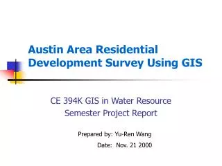
Austin Area Residential Development Survey Using GIS CE 394K GIS in Water Resource Semester Project Report Prepared by: Yu-Ren Wang Date: Nov. 21 2000
CE 394K Semester Project Report – Austin Area Residential Development Survey Using GIS Agenda • Introduction • Data Collection • Data Processing • Application • Path Forward Introduction Data Collection Data Processing Application Path Forward
CE 394K Semester Project Report – Austin Area Residential Development Survey Using GIS Introduction • GIS Applications • GIS in Regional Planning • GIS in Real Estate • Two Folds of this Project • For Realtor • For Developer Introduction Data Collection Data Processing Application Path Forward
CE 394K Semester Project Report – Austin Area Residential Development Survey Using GIS Data Collection • Vector Data • Ex3: jurisdiction, road, lake • TNRIS: school districts • Raster Data • Convert image to grid • Image Data • NLCD: Texas Land Cover Dataset • Real Estate • Websites and references Introduction Data Collection Data Processing Application Path Forward
CE 394K Semester Project Report – Austin Area Residential Development Survey Using GIS Data ProcessingUsing Arc/View • Map Projection • NAD 27 to NAD 83 • Map Projection Wizard • Image File (470 MB) • Header File • Projection Information Special thanks to Sarah Stone Introduction Data Collection Data Processing Application Path Forward
CE 394K Semester Project Report – Austin Area Residential Development Survey Using GIS Data ProcessingUsing Arc/View • Image Convert to Grid • Spatial Analyst • Clip Grid to Polygon • Wrap1117.apr by Brad Hudgens Special thanks to Melissa Introduction Data Collection Data Processing Application Path Forward
CE 394K Semester Project Report – Austin Area Residential Development Survey Using GIS Application: Home Search • Scenario: Buyer:new to Austin • Requirements: • Close to Water • Marvelous View • Major road access • Good School Distr. • Close to Downtown • Low Density Residt. Introduction Data Collection Data Processing Application Path Forward
CE 394K Semester Project Report – Austin Area Residential Development Survey Using GIS Application: Home Search • Available units in selected area • Basic information of the house selected Introduction Data Collection Data Processing Application Path Forward
CE 394K Semester Project Report – Austin Area Residential Development Survey Using GIS Application: Limitation and Recommendation • PC only • Connected to Web • Data is huge and out of date • More data can be established • Be careful with data in “civil3\scratch.tmp” Introduction Data Collection Data Processing Application Path Forward
CE 394K Semester Project Report – Austin Area Residential Development Survey Using GIS Path Forward • For Developer • Weights and Scores • Use Map Calculator • Trend Study • Identify Potential Areas • Decision Support System Introduction Data Collection Data Processing Application Path Forward
CE 394K Semester Project Report – Austin Area Residential Development Survey Using GIS Questions Introduction Data Collection Data Processing Application Path Forward