Download
1 / 18
180 likes | 202 Vues
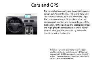
This document provides an overview of the GPS management structure, goals, and modernization plans to strengthen national security and promote the integration of GPS into various applications worldwide.

E N D
DEPARTMENT OF COMMERCE National Oceanic and Atmospheric Administration National Ocean Service National Geodetic Survey Positioning America for the Future GIAC and GPS Policy Rick Yorczyk NOAA - National Geodetic Survey FGDC - Federal Geodetic Control Subcommittee
The Global Positioning System: Management and Operation of a Dual Use System Joint DOD/DOT Task Force December 1993
GIAC GPS Interagency Advisory Council
FGDC/GIAC Relationship GPS Interagency Advisory Council (GIAC) Federal Geodetic Control Subcommittee (FGCS) Federal Geographic Data Committee (FGDC) Fixed Reference Stations Work Group Instrument Work Group Methodology Work Group Spectrum Issues Work Group Vertical Reference Systems Work Group
GPS Interagency Advisory Council (GIAC) DEPUTY CHAIR DEPARTMENT OF DEFENSE US Army Corps of Engineers GENERAL COMMITTEE CHAIR DEPARTMENT OF COMMERCE National Oceanic and Atmospheric Administration National Ocean Service National Geodetic Survey Federal Agencies Including FGCS members DOA DOC DOD DOI DOS DOT EPA FCC NASA. NATIONAL CAPITAL PLANNING COMMISSION TVA EXECUTIVE BOARD POSITIONING & SURVEYING USACE, BLM, NGS, USFS GIS AND MAPPING CENSUS, USGS TIMING SYSTEMS NIST, USNO TRANSPORTATION/NAVIGATION CGSIC SUBCOMMITTEES POSITIONING & SURVEYING APPLICATIONS GIS & MAPPING APPLICATIONS TIMING SYSTEMS APPLICATIONS
GPS Presidential Decision Directive Goals, 1996: • Strengthen and maintain our national security. • Encourage acceptance and integration of GPS into peaceful civil, commercial and scientific applications worldwide. • Encourage private sector investment in and use of U.S. GPS technologies and services. • Promote safety and efficiency in transportation and other fields. • Promote international cooperation in using GPS for peaceful purposes. • Advance U.S. scientific and technical capabilities.
GPS Management Structure Interagency GPS Executive Board (IGEB) Transportation Defense State Commerce Interior Agriculture Justice NASA DOD POS/NAV Executive Committee DOT POS/NAV Executive Committee GPS International Working Group GPS Interagency Advisory Council (GIAC) Defense Radionavigation Policy Civil Radionavigation Policy International Issues State Dept. Lead Civil GPS Service Interface Committee (CGSIC) Primary Information Exchange with Users Federal Non-Transportation Positioning & Timing Interests
CGSIC/GIAC Relationship CGSIC - concerned with influences on private and foreign users; and - serves as forum to exchange information between the Government and all civil users and help identify civil user needs and issues for resolution. GIAC - concerned with the Federal sector; - allows limited non-Federal input, when Federal policy may have a direct impact on civil usage of GPS; and - helps identify non-transportation Federal GPS positioning and timing needs and issues for resolution.
What users want from GPS: Reliability - Every where, all the time Timeliness - Real time or near real time Accuracy -?
Basic Civil Positioning: Before May 2000 100 m GPS I, GPS II A, &GPS II R • C/A Code on L1 • Selective Availability On
Basic Civil Positioning: Now • C/A Code on L1 • Selective Availability Off 6-11 m GPS II R
Basic Civil Positioning: By 2009 • C/A Code on L1 • Civil Code on L2 3-5 m GPS II R(M)
Basic Civil Positioning: By 2014 • C/A Code on L1 • Civil Code on L2 • New Code on L5 Better resistance to interference 1-3 m GPS II F
Basic Civil Positioning: 2018 ? GPS III Full Operational Capability
GPS Interagency Requirements Process Interagency Requirements Oversight Council (IROC) Interagency Requirements Board (IRB) Validated Interagency Requirements Military Requirements Process Civil Agencies Requirements Process DOT Extended Pos/Nav ExCom Approve Civil Requirements DOT Extended Pos/Nav WG Coordinate & Adjudicate Civil Requirements JRP Coordinate and Adjudicate Military Requirements JRB Coordinate and Adjudicate Military Requirements JROC Approve Military Requirements Validated Civil Requirements Validated Military Requirements Interagency Forum for Operational Requirements (IFOR)
Contacts NGS - www.ngs.noaa.gov/ GIAC/FGCS - www.ngs.noaa.gov/FGCS/ IGEB - www.igeb.gov/ CGSIC - www.navcen.uscg.gov/cgsic/default.htm