Download
1 / 22
220 likes | 364 Vues
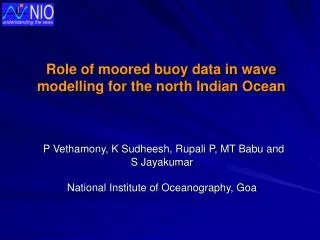
Role of moored buoy data in wave modelling for the north Indian Ocean. P Vethamony, K Sudheesh, Rupali P, MT Babu and S Jayakumar National Institute of Oceanography, Goa. Usefulness of winds and waves: operations of drilling for the exploitation of natural resources in the deep sea

E N D
Role of moored buoy data in wave modelling for the north Indian Ocean P Vethamony, K Sudheesh, Rupali P, MT Babu and S Jayakumar National Institute of Oceanography, Goa
Usefulness of winds and waves: • operations of drilling for the exploitation of natural resources in the • deep sea • ship - routing • design of harbours, breakwaters and jetties • loading and unloading of products from the vessels • preparation of wind and wave atlas • estimation of sediment transport and modelling of circulation, wave, • oil spill and pollution.
In the present study: • NCMRWF analysed winds are used as input to the model • Bathymetry data are provided at grid points • A few case studies have been carried out to test the accuracy of NCMRWF • analysed winds and compared them with wind data from buoys • Model gives wave statistics - height, period and direction of seas and swells, • and, (ii) wave directional spectra. • Grid data very close to the buoy location and ±0.5 h temporal variation • are selected for comparison. • The data of moored buoys are compared with the model output and • altimeters (TOPEX).
Wave data from data buoys • point measurements • wave - height, period and direction are obtained continuously/ at • fixed intervals • accurate data compared to other sources • data can be stored as well as telemetered • expensive and maintenance & logistics problem
MIKE 21 OSW and NSW: • OSW is a deep water wave model • NSW is a nearshore wave model • Output of OSW is used in NSW to get shallow water wave • characteristics • NSW considers refraction, shoaling, wave - current • interaction and bottom dissipation • Fine grid can be provided to NSW • solves the energy balance equation for 2-dimensional wave spectrum
The model domain • Bounded by 5 °S to 25 °N and 45 °E to 100 °E • Objective analysis is used to convert the available NCMRWF winds • (1.5°X1.5° grid size for every 6 h interval in the form of U and V • components) • Wave parameters are generated for 1h interval, but we have • analysed 3h output.
Comparison between model and buoy significant wave heights (deep water): May – August 2000 off Goa off Kochi
Comparison between model and buoy significant wave periods (deep water): May – August 2000 off Goa off Kochi off Chennai
Comparison between model and buoy significant wave direction (deep water): May – August 2000 Off Goa Off Kochi Off Chennai
Correlation coefficients of SWH between model results and moored buoy data (May - Sep 2001)
Validated model results can • be used whenever it is difficult • to make measurements • Good match of model results with • data buoy measurements have • increased the reliability of • model results
Scatter plot of wave heights (m) between MIKE 21(OSW) and buoy May - Sept 2001
Match between the altimeter • and measured data is very good • Altimeter wave heights can • substantiate measurements
Match between the altimeter • and modelled wave heights • is very good • Now, measured, modelled • and altimeter data can • compliment one another, • wherever, data gaps are • identified