Download
1 / 17
170 likes | 392 Vues
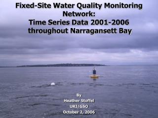
Assessment of Narragansett Bay Waters using data from the Fixed-Site Water Quality Monitoring Network. By Heather Stoffel University of Rhode Island- Graduate School of Oceanography Rhode Island Department of Environmental Management -Office of Water Resources Narragansett, Rhode Island, USA

E N D
Assessment of Narragansett Bay Waters using data from the Fixed-Site Water Quality Monitoring Network By Heather Stoffel University of Rhode Island- Graduate School of Oceanography Rhode Island Department of Environmental Management -Office of Water Resources Narragansett, Rhode Island, USA October 15, 2007
Narragansett Bay Fixed-Site Water Quality Monitoring Network • Agencies:RIDEM-OWR, URI/GSO,NBC, NBNERR, NBNEP, & RWU • 13 Site Locations: • West Passage (NP,MV,QP, GSO) • East Passage (PP,PC,TW) • Providence River (BR, CP) • Seekonk River (PD) • West Greenwich Bay (GB) • Mt. Hope Bay (RWU, MH) • Monitoring Season:buoy stations (May-Oct) & land-based stations (year round) • Funding: NOAA Bay Window Program, EPA Clean Water Act (sections 319 & 106), NBC, & NOAA National Estuary Program
Data Collection Temperature Salinity Dissolved Oxygen pH Chlorophyll Turbidity YSI 6600 EDS
Dissolved Oxygen Criteria for Saltwater of Rhode Island • The criteria was derived from the USEPA criteria for DO • Limits are based a subset of the death rates of 12 fish, 9 crustaceans, & 1 bivalve species during critical development stages
Dissolved Oxygen Criteria For Surface Waters & Waters without a Pycnocline • Waters with a DO concentration above an instantaneous value of 4.8 mg/l shall be considered protective of Aquatic Life Uses. Greenwich Bay Marina Station: Surface DO in 2003
Dissolved Oxygen Criteria For Waters with a Pycnocline (Bottom Waters) • Waters with a DO concentration above an instantaneous value of 4.8 mg/l shall be considered protective of Aquatic Life Uses. When instantaneous DO values fall below 4.8 mg/l, the waters shall not be: • 1. Less than 2.9 mg/l for more than 24 consecutive hours during the recruitment season; nor • 2. Less than 1.4 mg/l for more than 1 hour more than twice during the recruitment season; nor • 3. Shall they exceed the cumulative DO exposure presented in Table 3.A.
Allowable Number of Days without Exceeding a 5% Reduction in Seasonal Larval Recruitment
RIDOCS Software Assessment Tool • Software tool developed by EPA and applied to Rhode Island • Runs the time-series data against the criteria & identifies cumulative exceedence. • DO levels should not exceed a 67% mortality rate for more than one day. • Violations of the criteria are not to occur more than once every 3 years.
Popposquash Pt. Bottom Oxygen Levels: 2004-2006 2004 2005 2006
Insomniac Surveys Support Time Series Data: Mt. View & Popposquash Point Mt. View Buoy July 2006 Popposquash Point July 2006
Translating the RIDOCS Results into Impairment Listings for Oxygen in Narragansett Bay
RIDEM’s Recommendations for Regarding Impairments due to Hypoxia in Narragansett Bay • Previously listed waters remain listed • Providence River, Upper Bay, & Greenwich Bay • Portion of the West & East Passage is identified by RIDOCS as impaired • Mt. View • Popposquash Pt. • West Passage may have more possible impairments • Not enough data at this time to support based on criteria • Area of concern: Mt. View to Quonset Point