Download
1 / 29
310 likes | 542 Vues
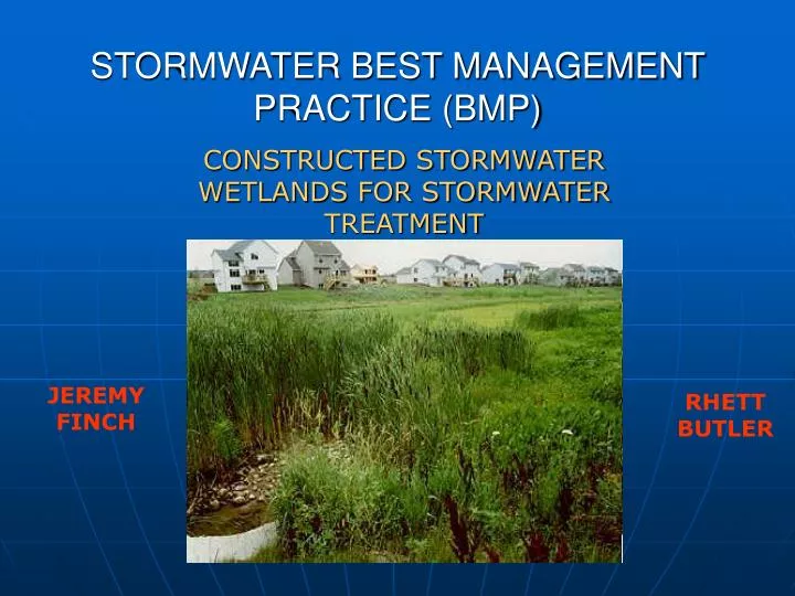
STORMWATER BEST MANAGEMENT PRACTICE (BMP). CONSTRUCTED STORMWATER WETLANDS FOR STORMWATER TREATMENT. JEREMY FINCH. RHETT BUTLER. OVERVIEW OF PRESENTATION. Definition & Functions Characteristics of Stormwater Wetlands Natural Wetlands vs. Stormwater Wetlands Advantages & Disadvantages

E N D
STORMWATER BEST MANAGEMENT PRACTICE (BMP) CONSTRUCTED STORMWATER WETLANDS FOR STORMWATER TREATMENT JEREMY FINCH RHETT BUTLER
OVERVIEW OF PRESENTATION • Definition & Functions • Characteristics of Stormwater Wetlands • Natural Wetlands vs. Stormwater Wetlands • Advantages & Disadvantages • Design of Stormwater Wetlands • Practical Design Example
DEFINITIONS & FUNCTIONS OF STORMWATER WETLANDS Definition - Wetland Systems that are specifically designed to treat/manage the impact of development/urbanization on stormwater quality and quantity Functions - Improve Water Quality (i.e. pollutant removal) - Minimize flooding/flood control - Establish/create wildlife habitat
CHARACTERISTICS OF ALL STORMWATER WETLANDS • Inundated with surface or groundwater for most of the year • Contains vegetation that is adapted to saturated conditions • Primary source of water is runoff from urban areas • Contains forebays, deep pools, shallow pools, outlet control structures • High pollutant removal efficiency
POLLUTANT REMOVAL IN STORMWATER WETLANDS Ref: Bill Hunt
POLLUTANT REMOVAL EFFICIENCY Ref: US EPA
NATURAL VS. STORMWATER WETLANDS • Stormwater wetlands do not perform the same functions as natural wetlands Ref: NCDENR
ADVANTAGES & DISADVANTAGES ADVANTAGES - Removes multiple pollutants from stormwater runoff - Improves overall water quality - If designed & constructed properly, can be aesthetically pleasing - Reduce flooding potential in downstream areas due to development upstream DISADVANTAGES - Can occupy large areas of developable land - Can dry out and become nuisance if drainage area is too small - Mosquito/Snake habitat - May be difficult to establish native wetland plants
DESIGN OF STORMWATER WETLANDS Optimal Location - Where water availability is high - Flat topography - Areas where seasonal high water table is approx. 6” above bottom of wetland - Areas where soil studies show that the underlying soils have an low infiltration rate to maintain a permanent pool of water NOTE: THE FOLLOWING DESIGN PROCEDURE VARIES REGIONALLY. THIS IS ONE DESIGN PROCEDURE SUMMARIZED FROM THE SOURCES SHOWN IN THE REFERENCES AT THE END OF THIS PRESENTATION. IT IS IMPORTANT TO NOTE THAT THIS IS ONE OF MANY POSSIBLE DESIGN PROCEDURES FOR STORMWATER WETLANDS
DESIGN OF STORMWATER WETLANDS(continued) DESIGN REQUIREMENTS - Must have a permanent pool of water (for stormwater wetlands, we use 3 feet) - Must meet required surface area to drainage area ratio Schematic Ref: Bill Hunt Ref: NCDENR
DESIGN OF STORMWATER WETLANDS(CONTINUED) - Must detain volume of runoff resulting from the 1” storm (i.e. first flush runoff) above the permanent pool. This volume is calculated using the SCS Curve Number method shown below: Where: P = Precipitation (in) 1” storm S = Ultimate Storage Capacity (in/in) • Must drawdown the 1” storm over a period of 2 to 5 days • Should contain a sediment forebay for initial settling • To function properly as a wetland, 35% of the total wetland area should have a depth 0-9” • To function properly as a wetland, 35% of the total wetland area should have a depth 9-18” • To function property as a wetland, 30% of the total wetland area should be “shallow land”
FOREBAY • Placed where runoff enters the wetland (i.e. storm drainage) • Serves as a preliminary “screening” device to prevent degradation of primary wetland functions traps sediments, larges pieces of debris, etc. • Deepest part of wetland usually 2-2.5’ deep • Must allow access to forebay for maintenance purposes (sediment cleanout, etc.) • Designed to occupy approximately 10% of total wetland area Forebay Ref: Bill Hunt
SHALLOW POOLS • Typically 0-9” deep • Area where primary wetland functions occur (i.e. denitrification, sedimentation, filtration, adsorption, etc.) • Water velocity decreases dramatically here, thus causing pollutants to settle out of stormwater • Area where majority of wetland vegetation grows • Designed to be a long, winding flowpath occupying approximately 35% of total wetland area • During low flow conditions, this is path the water takes through the wetland Shallow Pool Ref: Bill Hunt
DEEP POOLS • Typically 9-18” deep • Designed to occupy approximately 35% of total wetland area • Contains water in times of drought • Where animal habitats (i.e. fish) are located • Area with least amount of vegetation Deep Pool Ref: Bill Hunt
SHALLOW LAND • Designed to be dry except during storm events • 0-12” above normal pool • Supports a wide variety of vegetation • Designed to occupy approximately 30% of the total wetland area • Supports various types of wildlife Shallow Land Ref: Bill Hunt
STORMWATER WETLAND OUTLET STRUCTURE • Designed to store the 1” storm runoff volume • Contains siphon/drawdown device designed to drawdown the 1” storm volume over 2 to 5 days • Passes higher flows (i.e. 100-year storm) during extreme storm events safely through the wetland • Typically riser-barrels or weir overflow structures
STORMWATER WETLAND VEGETATION GUIDELINES • Avoid non-native species or aggressive plants • Select plants that can adapt in saturated conditions and withstand long term inundation • Include species that are evergreen (meaning not dormant during winter time) • Can use donor soils (if necessary) from natural wetlands to establish vegetation BLACK WILLOW RICE CUT GRASS SMARTWEED Ref: US EPA & Bill Hunt
MAINTENANCE OF STORMWATER WETLANDS • Stormwater wetlands should be inspected after each rainfall event • Check for clogging of the outlet structure, or too rapid of a drawdown • Erosion/scour of wetland embankments • Erosion in areas where the stormwater runoff enters the wetland (i.e. storm drainage pipes, etc.) • Sediment accumulation in the forebay • Condition of outlet structure • Prevention of woody vegetation on the wetland berm • Any additional fertilizing/seeding to maintain healthy vegetation Ref: NCDENR
PRACTICAL STORMWATER WETLANDS DESIGN EXAMPLE Development Requirements • Example Project: Residential development consisting of mult-family townhomes, associated streets, parking, and sidewalks • Detention of 2- & 10-year post-development peak flowrates back to pre-development levels • Reduction of nitrogen loading rate down to at least 6 lbs/ac/yr (must then buydown to 3.6 lbs/ac/yr) • Removal of 85% of the total suspended solids from the stormwater runoff resulting from the development • Safe passage of the 100-year storm event through the wetland
EXAMPLE STORMWATER WETLANDS DESIGN (CONTINUED) • STEP #1 - Determine the stormwater wetlands drainage area
EXAMPLE STORMWATER WETLANDS DESIGN (CONTINUED) Watershed Characteristics PRE-DEVELOPMENT - Total Drainage Area = 12.27 acres - SCS Curve Number = 72 (Hydrologic soil group C) - Pre-development time of concentration = 10.5 minutes - 2-Year pre-development peak flowrate = 20 cfs - 10-Year pre-development peak flowrate = 39 cfs POST-DEVELOPMENT - Total Drainage Area = 11.22 acres - SCS Curve Number = 78 (Hydrologic soil group C) - Post-development time of concentration = 5 minutes
EXAMPLE STORMWATER WETLANDS DESIGN (CONTINUED) CALCULATION OF 1” STORM RUNOFF VOLUME - Precipitation amount = 1” • Directly connected impervious area = 5.67 acres (CN = 98) 0.79 inches = 16,279 cubic feet
EXAMPLE STORMWATER WETLANDS DESIGN (CONTINUED) • Other non-connected area = 5.55 acres (CN=74) 0.023 inches = 467 cubic feet
EXAMPLE STORMWATER WETLANDS DESIGN (CONTINUED) • Total Runoff from 1” storm = 16,279 cubic feet + 467 cubic feet • Total Runoff from 1” storm = 16,746 cubic feet • This volume must be stored on top of the permanent pool, and should be drawn down over a period of 2 to 5 days
EXAMPLE STORMWATER WETLANDS DESIGN (CONTINUED) CALCULATION OF WETLANDS SURFACE AREA • Total Impervious Area = 5.67 acres • Total Drainage Area = 11.22 acres • % Impervious = 51% • Assumed average depth = 3.00 feet • Using table below, required wetlands surface area = 10,157 square feet (interpolation required)
EXAMPLE STORMWATER WETLANDS DESIGN (CONTINUED) • PREPARE STORMWATER WETLANDS GRADING PLAN
EXAMPLE STORMWATER WETLANDS DESIGN (CONTINUED) • Specify stormwater wetlands vegetation planting plan
REFERENCES • Doll, Barbara A; Hunt, William F. Urban Waterways: Designing Stormwater Wetlands for Small Watersheds. North Carolina Cooperative Extension Service. • USEPA. EPA Stormwater Technology Fact Sheet: Stormwater Wetlands. EPA 832-F-99-025, September 1999. • Harris County Texas Stormwater BMP Manual. “Constructed Wetlands for Stormwater Treatment”. 2001 Edition. • NCDENR Division of Water Quality. Stormwater Best Management Practices. April 1999 Edition.