Download

1 / 38
390 likes | 657 Vues
Momentum budget evolution of Typhoon Nari (2001) during the landfall process. Yang, M.-J., T.-C. Chen Wang, Y. Zhang, and C.-Y. Weng , 2011: Momentum budget evolution of Typhoon Nari (2001) during the landfall process. Terr., Atmos., and Oceanic

E N D
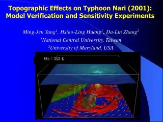
Momentum budget evolution of Typhoon Nari (2001) during the landfall process Yang, M.-J., T.-C. Chen Wang, Y. Zhang, and C.-Y. Weng, 2011: Momentum budget evolution of Typhoon Nari (2001) during the landfall process. Terr., Atmos., and Oceanic Sci., 22, 595–612, doi: 10.3319/TAO.2011.05.31.01(TM)
Outline • Keywords • Introduction • Methodology • Axisymmetric AAM and Radial momentum Budgets over ocean • Asymmetric AAM and Radial momentum Budgets over land • Conclusions
Keywords • Supergradient wind • Momentum budget
Supergradient wind • GWB model(Gradient-wind balance) Vg Coriolis force centrifugal force Pressure gradient force L V>Vg
Momentum budget • Momentum = m * V • angular momentum = r * m * V • Absolute angular momentum (AAM,M) Caused by earth rotation Relate to earth Equations will be discussed later. The law of conservation of angular momentum states that when no external torque acts on an object or a closed system of objects, no change of angular momentum can occur.
Introduction • GWB assumption for the tangential wind has been widely used in theoretical studies for TCs.(Shapiro and Willoughby 1982; Emanuel 1986) • GWB model is a good approximation to the azimuthally-averaged tangential winds in the inner-core region for flows above the MBL and below the upper outflow layer.(La Seur and Hawkins 1963; Willoughby 1990, 1991) • Systematic GW unbalance flows in the eyewall, especially near the radius of maximum wind(RMW).(Gray and Shea 1973) • Utilizing AAM and radial momentum budget, Zhang indicated that both conclusions are correct for the levels of observations they analyzed.(Zhang et al. 2001) • These studies are only for marine TCs , and it remains unknown whether the GWB model is still applicable when a TC makes landfall, such as CMR in Taiwan.
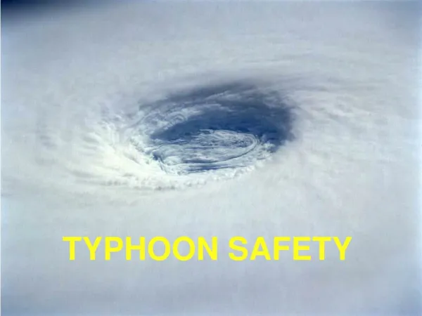
Case : Typhoon Nari(2001) • - Struck Taiwan on UTC16 Sep. • - More than 1400mm/3days • 92 death tolls. • (Sui et al. 2002) Picture originated from CWB
Objectives of the study • Investigate the evolution of tangential and radial flows of Nari during its landfall in Taiwan.(From more axisymmetric structure over ocean to asymmetric features over mountains. ) • Understand the extent that GWB is still valid for a TC made landfall. • Gain insight and examine the physical mechanism responsible of the sloping midlevel radial flow over terrain.
Methodology • PSU-NCAR MM5 model ver.3.5 • PSU-NCAR MM5 model ver.3.5 Horizontal :54 ,18, 6, 2km (quadruply nested-grid ) Vertical:32 σ levels (top= 50 hPa ) Time period : 1200 UTC 16 Sep. ~ 0000 UTC 19 Sep. (84 h) SST is constant I.C. and B.C. : ECMWF/TOGA (1.125°*1.125° horizontal resolution) TC initialization : Davis and Low-Nam (2001) Parameterization : cumulus (Grell 1993)(54, 18 km) microphysics( Reisner et al. 1998) with graupel included PBL (MRF model)(Hong and Pan 1996) atmospheric radiation(Dudhia1989) Output interval : 2-min and 2-km
Methodology • Governing equation for radial and tangential wind Coriolis Force(Uc) Including The Effect of Vertical Motion Centrifugal Force(UE) Radial Pressure Gradient Force(PGFR; Up) PBL Effects And Turbulent Mixing(UTB) (Residues) Horizontal advection Vertical advection Local tendency λ – azimuthal angle. r – radius from TC center, pointing outward. z – vertical height. U – radial wind in cylindrical coordinate. V – tangential wind in cylindrical coordinate. W – vertical wind in cylindrical coordinate. Centrifugal Force(VE) Coriolis Force(Vc) including the effect of vertical motion PBL Effects And Turbulence Mixing(VTB) (Residues) Tangential Pressure Gradient Force(PGFR; Vp) Ω – angular velocity on the earth. Ф – latitude. U’ – storm relative radial wind. V’ – storm relative tangential wind.
Lagrangian derivative of AAM equation Caused by earth rotation β – df/dФ Vm – projections of U and V onto longitudinal axes. Relate to earth’s rotation Pressure Torque Longitudinally-Oriented Coriolis Torque By The Vertical Motion Beta Torque Torque Due To The PBL Effects And Turbulent Mixing
NW NW SW SW SW For the different terrain imposed on the simulated storm due to the landfall position error.
Oceanic Nari:0100-0200 UTC 16 Sep. 2001 (t=13-14h) B1 A1 Less degree of asymmetry. Solid: positive (upward, outflow) Dashed: negative (downward, inflow) NE: stronger and more upright. SW: low level inflow stronger and deeper. A1 B1
Oceanic Nari:0100-0200 UTC 16 Sep. 2001 (t=13-14h) outflow DN wall :12km eye UP inflow wall Radial advection UP RMW MBL friction MBL top: V’ max=57 m/s
Oceanic Nari:0100-0200 UTC 16 Sep. 2001 (t=13-14h) Solid: positive (upward, inflow) Dashed: negative (downward, outflow) Solid: positive (source) Dashed: negative (sink) Outward AAM Upward AAM UP Indicate a slow spindown of tangential wind inside the eye. AAM Slightly conserved Inward AAM AAM Sink
Oceanic Nari:0100-0200 UTC 16 Sep. 2001 (t=13-14h) Outward Up max UP SuperCyclostrophic UE>Up Supergradient-wind UE>Up Same structure as Up , opposite sign. Same as gradient-wind imbalance SubCyclostrophic UE<Up Subgradient-wind UE<Up Inward Cyclostrophic imbalance = Up+UE Gradient –wind imbalance = Up+UE +Uc Solid: positive (outward) Dashed: negative (inward) Solid: positive Dashed: negative
Oceanic Nari:0100-0200 UTC 16 Sep. 2001 (t=13-14h) Solid: positive (outward) Dashed: negative (inward) Upper level: outflow Below the up axis : slightly decrease radial outflow; Above then increase. In the wall : increase radial inflow Out of wall : decrease inflow Strengthen upper level outflow Low level from eye to wall : further reduce the central pressure Solid: positive (outward, upward) Dashed: negative (inward, downward)
Oceanic Nari:0100-0200 UTC 16 Sep. 2001 (t=13-14h) Supercyclostrophic wind = 6 m/s Supergradient wind > 6 m/s Subcyclostrophic wind Subgradient wind Acyclostrophic wind = V-Vc Agradient wind = V -Vg
Landfall Nari:1000-1100 UTC 16 Sep. 2001 (t=22-23h) B 30km A 60km Snow Mountain Range Z=3 km Contour – V’ Shaded – midlevel (σ =0.4~0.8) radar reflectivity (t=22.5 h) Vector – horizontal wind (t=22.5h)
Landfall Nari:1000-1100 UTC 16 Sep. 2001 (t=22-23h) Buckling height
Landfall Nari:1000-1100 UTC 16 Sep. 2001 (t=22-23h) ( ) * M Land: mostly negative. Ocean:very small.
Landfall Nari:1000-1100 UTC 16 Sep. 2001 (t=22-23h) Negative: inward. Peak value decreased: -500 m/s*h (ocean) -450 m/s*h (land) Supergradient wind (UE>UP) (stronger at off shore ) > 500 m/s Solid: positive (outward) Dashed: negative (inward) > 800 m/s
Landfall Nari:1000-1100 UTC 16 Sep. 2001 (t=22-23h) Supergradient wind
Landfall Nari:1000-1100 UTC 16 Sep. 2001 (t=22-23h) Over ocean: R < 40 km in eye dU/dt >0 reduce the inward. Over land: Accompanied by the vertical transport (outward). Contour – dU/dt , V-Vg solid(positive) dashed(negative) Shaded – U’ 10 m/s Over ocean: In the eye Strong supergradient wind Upper outflow level Weak supergradientwind Over land: Sub- and super- oscillation 5 m/s 15 m/s
Landfall Nari:1000-1100 UTC 16 Sep. 2001 (t=22-23h), R=35km (large GW imbalance near eye.) UTB works over the land than over the ocean (north). Supercyclostrphic wind (Since in th eye) Similar to GW imbalance, but with fluctuation (turbulent mixing). Supergradient wind
Landfall Nari:1000-1100 UTC 16 Sep. 2001 (t=22-23h), R=60 km (outer principal rainband.) UTB works beneath PBL and over the terrain retard radial inflow. Similar to GW imbalance, but with fluctuation (turbulent mixing). Only over the terrain and the rainband (NW) : UE overcompensates UP (supergradient wind)
Landfall Nari:1000-1100 UTC 16 Sep. 2001 (t=22-23h) Contour – agradient wind solid(positive), dashed(negative) Shaded – U’ 21 m/s 9 m/s R=35 km N Semicircle/ near the wall and mid-low level: Strong supergradient winds (by terrain). SE quadrant- (lee side of Snow Mountain Range): Subgradient winds at low level and lee Side. -24 m/s R=60 km North Semicircle: Strong supergradient winds near the wall and low level. Southeastern quadrant (lee side of Snow Mountain Range): Strong subgradient winds lee Side. 6 m/s -24 m/s
Leads to more quickly-evolved vortex flows and 2nd circulations above terrain.
Reference • CWB • 氣象名詞查詢表 http://photino.cwb.gov.tw/rdcweb/lib/h/g_000853.htm • http://www.phy.ncu.edu.tw/notes/angular/purpose.htm • wikipedia :http://en.wikipedia.org/wiki/Angular_momentum • http://encyclopedia2.thefreedictionary.com/supergradient+wind • http://www.superglossary.com/Definition/Weather/Gradient_Wind.html • http://en.mimi.hu/aviation/gradient_wind.html
Cyclostrophic Flow Vc centrifugal force Pressure gradient force L