Download
1 / 43
430 likes | 673 Vues
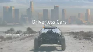
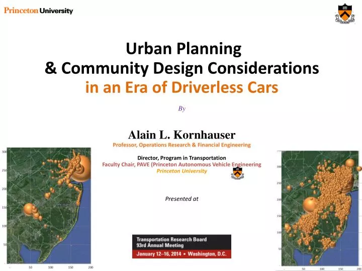
Urban Planning & Community Design Considerations in an Era of Driverless Cars By Alain L. Kornhauser Professor, Operations Research & Financial Engineering Director, Program in Transportation Faculty Chair, PAVE (Princeton Autonomous Vehicle Engineering Princeton University Presented at.

E N D
Urban Planning & Community Design Considerations in an Era of Driverless Cars By Alain L. KornhauserProfessor, Operations Research & Financial Engineering Director, Program in Transportation Faculty Chair, PAVE (Princeton Autonomous Vehicle Engineering Princeton University Presented at
Outline What is a “Driverless Car” (aka SmartDrivingCar) The Mobility Needs of Today’s “Community Design” Suggest some places to try out SmartDrivingCars
What is a “Driverless Car” (aka SmartDrivingCar) Preliminary Statement of Policy Concerning Automated Vehicles • “Drive Less” Car • Well yes, How much less?
What is a SmartDrivingCar? Preliminary Statement of Policy Concerning Automated Vehicles Level 0 (No automation) The human is in complete and sole control of safety-critical functions (brake, throttle, steering) at all times. Level 1 (Function-specific automation) The human has complete authority, but cedes limited control of certain functions to the vehicle in certain normal driving or crash imminent situations. Example: electronic stability control Level 2 (Combined function automation) Automation of at least two control functions designed to work in harmony (e.g., adaptive cruise control and lane centering) in certain driving situations. Enables hands-off-wheel and foot-off-pedal operation. Driver still responsible for monitoring and safe operation and expected to be available at all times to resume control of the vehicle. Example: adaptive cruise control in conjunction with lane centering Level 3 (Limited self-driving) Vehicle controls all safety functions under certain traffic and environmental conditions. Human can cede monitoring authority to vehicle, which must alert driver if conditions require transition to driver control. Driver expected to be available for occasional control. Example: Google car Level 4 (Full self-driving automation) Vehicle controls all safety functions and monitors conditions for the entire trip. The human provides destination or navigation input but is not expected to be available for control during the trip. Vehicle may operate while unoccupied. Responsibility for safe operation rests solely on the automated system & Trucks SmartDrivingCars
What is a SmartDrivingCar? Preliminary Statement of Policy Concerning Automated Vehicles
What is a SmartDrivingCar? Preliminary Statement of Policy Concerning Automated Vehicles
What is a SmartDrivingCar? Preliminary Statement of Policy Concerning Automated Vehicles
What is a SmartDrivingCar? Preliminary Statement of Policy Concerning Automated Vehicles
What is a SmartDrivingCar? Preliminary Statement of Policy Concerning Automated Vehicles
What is a SmartDrivingCar? Preliminary Statement of Policy Concerning Automated Vehicles
What about Level 4 Implications on Energy, Congestion, Environment? • What if a “Community Design” (New Jersey) only had • Walking, • Bicycling, • NJ Transit Rail • aTaxis for mobility. What are the Societal Implications of that Mobility (Energy, Pollution, Congestion) ? (Hint: It’s all about Ride-Sharing!)
Currently • New Jersey’s “Community Designs” (32 million Trips per day) are Served by • The Automobile (~ 28 million) • Walking + bicycling (~3 million) • Bus + rail Transit (~1 million) • That Demand is enormously diffuse in time and space
An aTaxiTrip {oYpixel, oXpixel, oTime (Hr:Min:Sec) , } An aTaxiTrip {oYpixel, oXpixel, oTime (Hr:Min:Sec) ,dYpixel, dXpixel, Exected: dTime} a PersonTrip {oLat, oLon, oTime (Hr:Min:Sec) ,dLat, dLon, Exected: dTime} P1 D O O
http://orfe.princeton.edu/~alaink/NJ_aTaxiOrf467F13/Orf467F13_NJ_TripFiles/MID-1_aTaxiDepAnalysis_300,SP.xlsxhttp://orfe.princeton.edu/~alaink/NJ_aTaxiOrf467F13/Orf467F13_NJ_TripFiles/MID-1_aTaxiDepAnalysis_300,SP.xlsx c
However… • If New Jersians are willing to wait around for a little while (< 5 minutes) for someone else to show up that is going in the same direction at the same time (“casual ride-sharing”): • AVO ~ 2.0 for the whole State for a whole day, and • Substantially higher in peak directions at peak times • Implications: • Congestion is eliminated • Energy, Pollution and Environmental Impacts are cut in half.
Preliminary Statement of Policy Concerning Automated Vehicles What the Levels Deliver: Levels 1 -> 2: Increased Safety, Comfort& Convenience Primarily an Insurance-assisted Consumer Play Levels 3: Increased Personal Satisfaction, Safety,Comfort& Convenience Exclusively a Consumer Play Level 4 (DriverFreeOpportunity) : Mobility, Efficiency, Equity Revolutionizes “Mass Transit” by Greatly Extending the Trips that can be served @ “zero” cost of Labor. (That was always the biggest “value” of PRT; zero labor cost for even zero-occupant trips) Primarily a Private Utility/Fleet Play
Initial Deployment… • Needs to be Driverless (Able to do Empty Vehicle Repositioning) • With Excellent Pedestrian Recognition • Doesn’t Need To Be… • Fast • Everywhere • Let’s start Slow and Narrow (small set of streets): • Like CityMobile2… • Say 10-15 mph • Along a short Corridor, or • Throughout one of Florida’s/Arizona’s Retirement Communities
What About…… Driverlesselectric shuttle to be trialled in Singapore (video of Luxembourg Demonstration)
What About…… Florida Retirement Community
Discussion! Thank You alaink@princeton.edu www.SmartDrivingCar.com
Let me begin by defining driverless cars using the so called NHTSA levels. As a footnote, I see these as an evolution driven first by consumer demand as a continuation of the demand for the automobile to which planning community will be playing catchup but at the final level 4 driverless stage be an institutional thrust of a utility much like the current transit industry. So... Also, we currently have examples of each of these The fundamental movers of levels 0-3 are consumers and the movers of level 4 are utilities/ industries. The fundamental incremental appeal of level 0: this is the base 1: a little safety: no market for this. It needs to be given away as a steppingstone. Little change 2: a lot of safety: insurance industry has to buy this for the consumer else it will need to be given away as a steppingstone. Little change 3: constrained liberation (I get to "text" some of the time on some road. The more "texting" that I can do the more time on the more roads, the greater the liberation. "Texting": texting, listening to loud music, sleeping... These are not distractions. "Texting" is what I want to do. Driving is a distraction ( from "texting"). I like to drive some of the time. When I like to drive it is in the set of "texting" objects. When I don't like to drive, it is in the ( I don't like using the word distraction because it has a negative connotation. I like to "text". Driving is often a distraction from "texting". There is an enormous consume market for this because the consumer is getting something that she wants and values. Higher VMT 4. Opportunity for a utility to make lots of money in delivering more uniform high-quality mobility at an attractive price to all. No consumer push for this. The consumer gets to go to more places. Attractions have expanded market reach. The market force is the profit opportunity for the utility. Very large decrease in ownership of levels 0-3. There is no need to own more than one car and the one car that you own is a "tesla" ( a toy or trophy, not a transportation vehicle). Maybe substantially lower VMT.
So what are the VMT implications of level 4. Level 4 give you uniform mobility for all. The question about how cheaply and how much money one can make off of this is largely driven by how much ride sharing such a transit system go foster without ruining the delivered mobility. This is what is have been struggling with over the past 3 years. I've tried to answer July a simple question: if level 4 (autonomousTaxis, aTaxis) we're the only way to get around New Jersey today, what kind of ride sharing could be expected under various aTaxi operating strategies. Keeping land use ( aka trip demand) constant. What's the ride sharing. We know that today, there is essentially no ride sharing. There are 32 m daily trips in NJ and Nj transit serves only .... 4 % The rest are served by walking, bicycling and the private auto. The only ride sharing that goes on today is what I call tag-along ride sharing. The trip demand originates with a single person wanting to do something and another person(s) decides to tag along, so they go together. "Let's go to dinner"! "That's a great idea". Ride sharing. Or "drive me to school"! "OK". Ride sharing. I call that "tags-along" rider-sharing. I wonder about the "real ride sharing" that occurs in transit: two or more people who are otherwise uncorrelated, just happen to be traveling between locations at times when their travel can be implemented by one rather than two vehicles. To make that happen in transit, one has few bus stops some people have to bring themselves together spatially and busses run "every hour" so they wait around. Eventually a bus comes, they both get in and we have uncorrelated ride sharing. Or in the case of an elevator. People walk into the building and head to a bank of elevators, some elevators are going to certain floor, so the people gather in front of the proper elevator door, a doer opens, they get in, the doors stay open for a while, the close. Some folks get off at the 4 the floor, others at the 6th and finally I get off at the 10th. The elevator has gone 10 floors to serve 28 people floors and the and the AVO is 2.8 I want to know the AVO for a typical day in NJ with aTaxis operating just like that elevator.
Requirement of Viable AVO Analysis • Must have sufficiently precise Spatial representation of Individual trips so that one knows which building to enter to find the bank of “elevators” (the nearest aTaxi Stand) • Must have sufficiently precise individual trip departure time so that you know which elevator (aTaxi) you have entered to see with whom you are sharing a ride and to add up how long each person had to wait before the doors closed. • Must have sufficiently precise destinations to be able to properly measure the trip lengths and the vehicle travel lengths and to perform the empty vehicle repositioning to properly the necessary fleet
Set off to build an Appropriate “activity-based” Trip Synthesizer • Create a representation for • Each Resident of NJ • 2010 Census block data • Centroid of block = {lat, Lon} of Home. • Other sources to assign, gender, age, “income”, … • Scraped “white pages” to get some family manes • Each Out-of-State resident that works in NJ • 2010 Journey2Work (County2County) census • Each School in NJ • Dept. Of Ed. School file • Geocode of address = {lat, Lon} of School • Each Workplace • Begged, borrowed and stole to build this file • # employees and daily patrons • Geocode of address = {lat, Lon} of WorkPlace and OtherDestination
Set off to build an Appropriate “activity-based” Trip Synthesizer • For each Individual • Assigned an “appropriate” • Primary Activity • Work, School, School&Work, Work@Home • Assigned Workplace to Workers, Schools to Schoolers • Daily Trip Diary • Selected appropriate Other Location commensurate with the individual’s Trip Diary • Chose appropriate departure time (seconds from midnight) for each trip specified by the individual’s trip diary. • This built 32+M trips each with • {Pointer (to trip maker & tip),oLlat, oLon, oTime, dLat, dLon, dTime}
Pixelating the State with half-mile Pixels xPixel= floor{108.907 * (longitude + 75.6)} yPixel= floor{138.2 * (latitude – 38.9))
a PersonTrip a PersonTrip {oLat, oLon, oTime (Hr:Min:Sec), a PersonTrip {oLat, oLon, oTime (Hr:Min:Sec) ,dLat, dLon, Exected: dTime} D O
An aTaxiTrip {oYpixel, oXpixel, oTime (Hr:Min:Sec) , } An aTaxiTrip {oYpixel, oXpixel, oTime (Hr:Min:Sec) ,dYpixel, dXpixel, Exected: dTime} a PersonTrip {oLat, oLon, oTime (Hr:Min:Sec) ,dLat, dLon, Exected: dTime} P1 D O O
a PersonTrip from NYC (or PHL or any Pixel containing a Train station) An aTaxiTrip {oYpixel, oXpixel, TrainArrivalTime, dYpixel, dXpixel, Exected: dTime} NJ Transit Rail Line to NYC, next Departure NYC D O aTaxiTrip Princeton Train Station
Pixel -> Pixel (p->p) Ride-sharing P1 O TripMiles = L TripMiles = 2L TripMiles = 3L
P1 O PersonMiles = 3L PersonMiles = 3L aTaxiMiles = L AVO = PersonMiles/aTaxiMiles = 3
P4 SP5 SP1 P5 P1 SP4 O P3 P6 P2 SP6
P4 SP5 SP1 P5 P1 SP4 O P3 P6 P2 SP6
P4 SP5 SP1 P5 P1 SP4 O P3 P6 P2 SP6
P4 SP5 SP1 P5 P1 SP4 O P3 P6 P2 SP6
P4 SP5 SP1 P5 P1 SP4 O P3 P6 P2 SP6
P4 SP5 SP1 P5 P1 SP4 O P3 P6 P2 SP6
P4 SP5 SP1 P5 P1 SP4 O P3 P6 P2 SP6
Elevator Analogy of an aTaxi Stand Kornhauser Obrien Johnson 40 sec Popkin 3:47 Henderson Lin 1:34
Elevator Analogy of an aTaxiStand 60 seconds later Christie Maddow 4:12 Henderson Lin Young 0:34 Samuels 4:50 Popkin 2:17