NSDI Framework Data Content: Elevation Related Topics Training
This course provides an overview of the NSDI Framework Data Content Standard for the Elevation theme. It covers the basics of Elevation data and how to implement the standard. Prerequisites include familiarity with GIS, geospatial data, and metadata.


NSDI Framework Data Content: Elevation Related Topics Training
E N D
Presentation Transcript
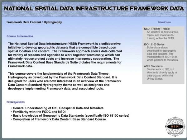
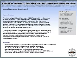
Framework Data Content -Elevation Related Topics NSDI Training Tracks: An initiative to define areas, topics, and materials for training within the NSDI. ISO 19100 Series: Suite of standards developed for geographic data and datasets. The most notable is ISO 19135 which pertains to metadata. ANSI Standards: Similar work to ISO, but standards directly apply to data created within the United States. Course Information The National Spatial Data Infrastructure (NSDI) Framework is a collaborative initiative to develop a set of commonly used geographic datasets that are compatible based upon spatial location and content. The Framework approach allows data collected for variety of reasons and agencies to work together seamlessly; which can ultimately reduce project costs and increase interagency cooperation. The Framework Data Content Base Standards Suite dictates the requirements for Framework data. This course covers the fundamentals of the Framework Data Theme: Elevation as developed by the Framework Data Content Standard. It is designed for users who are both interested in an overview of the Framework Data Content Standard Elevation theme as well as designers and developers implementing Framework data, and associated tools specific to Elevation data. Prerequisites • General Understanding of GIS, Geospatial Data and Metadata • Familiarity with the Federal Geographic Data Committee (FGDC) • Familiarity with the National Spatial Data Infrastructure (NSDI) • Basic knowledge of Geographic Data Standards (specifically ISO 19100 series) • Completion of Framework Data Content Base Standard Course
Learning Objectives Understand Elevation Data Comprehend basics of Elevation framework standard Understand how to implement the standard Course modules • Understanding Elevation Data • Elevation (Part 3) of the Framework Data Content Standard • Implementing the Elevation Standard • Course Review Estimated Time Estimated time for the entire course is 100 minutes.
Module 1: Understanding Elevation Data Time Requirement Topics • What is Elevation Data • Types of Elevation Data • Elevation in Action • Module Exercise and Summary Estimated time for this module is 30 minutes First Topic What is Elevation Data
What Are Elevation Data Hypsography, topography, elevation, TINS, and contours. Digital elevation data are sets of elevation measurements for locations distributed over the land surface. Elevation data have many practical uses ranging from environmental to urban. Slope and aspect can be directly derived from elevation. Stream delineation and subsequently watershed boundaries can also be derived. Elevation datasets are also used for scenario analysis ranging from calculations of cut and fill requirements by engineers for projects relating to road construction to viewshed analysis. Viewshed analysis (or line-of-sight) uses topographical data to determine the visibility of areas from a given point. For example, a project in which a scenic route is to be constructed may utilize elevation to determine the visibility of the landscape from various points to determine the best pathway to construct. Elevation data can be generated from existing contour maps, photogrammetric analysis of stereo aerial photography, satellite imagery, or laser-based (LiDAR). Elevation values are most commonly shown relative to sea level. Thus positive values indicate areas found above sea level and negative values are places on the earth found below sea level. Color Shaded Relief of Continental USA http://ned.usgs.gov/ next Topic Elevation Data in Action
Elevation Data Spatial data are a visual representation or interpretation of a real world feature. For these materials we will focus on the spatial elevation data. There are many types of elevation data representations including: hypsography, topography, Triangular Irregular Networks (TINS), and contours. Additionally, as you can see below, there are many different ways to represent these data. Thus there is a need for some basic standards to allow people to share the s data they created. As we progress through these materials we will see the need and importance of the Framework Data Content Elevation standard. DEM Contour TIN http://hamish.bowman.googlepages.com/elevation.dem.png/elevation.dem-full.jpg https://engineering.purdue.edu/~abe325/contour.gif http://www.clintoncountyohgis.org/buttons/ LiDARHome/Clarksville%20TIN.jpg next Topic Elevation in action
Elevation in action As we have already seen, elevation data comes in a variety of formats. Additionally there are different resolutions or scales that elevation data can be derived from and viewed at. These different scales have pros and cons. The higher the resolution the more detailed the picture one can see; However there are drawbacks to higher resolution including smaller study areas and larger file sizes. Thus there is a need for both common sense and planning in projects utilizing elevation data, and standards that can supports the different types and resolutions of elevation data. Below is an two examples of elevation data showing the difference between a 90M DEM and a 10M DEM for parts of Colorado. 90m DEM 10m DEM http://www.innovativegis.com/basis/Su pplements/BM_Dec_02/Ironing_Colorado_files/image001.png http://blog.simgis.com/wp-content/uploads/2009/02 /shade_dem_less_one_mile.jpg next Topic Elevation Exercise
Elevation s Module 1 exercise Elevation data is being applied and used in real world projects by many different agencies. These agencies use elevation data for a variety of reasons. Now that you have some basic elevation knowledge let’s see some elevation data sets in action. Step 1) Open an Internet Browser and proceed to: http://seamless.usgs.gov/website/seamless/viewer.htm Step 2) Explore the mapping service Step 3) Turn on different layers and pan around the map Step 4) Pay specific attention to the elevation data and how it is displayed, and how the tools provided can be used to view and acquire the data Step 5) Close all Internet windows and proceed with the course next Topic Module Summary
Module Summary Understanding Elevation • Elevation data comes in multiple formats and can be used to show the topographic variation in a landscape. • Many different elevation features can be collected, mapped, and utilized for a variety of reasons • Different scales, data types, and resolutions serve different purposes. next Topic Module 2: Elevation of the Framework Data Content Standard
Module 2: the Framework Data Content Standard: Elevation Time Requirement Topics Estimated time for this module is 30 minutes • What is the Elevation Standard • Purpose for Standard • Goals of the Standard • Capacities of the Standard • Standard Related Contact Information • Module Exercise and Summary Key Terms Elevation Framework Standard Framework
Next Topic Purpose for the Standard What is the Elevation s standard Quick Facts Each Framework standard part was developed and edited by thematic experts Elevation is one of the seven themes of Framework data. Each has a separate standard, some including subparts. All standards use the Framework Data Content Base Standard as the baseline for this data. • The Elevation Framework Data Content Standard: • One of the seven themes defined by the FGDC as Framework data • Establishes a baseline for Elevation data collection and distribution • Builds on the Framework Data Content Base Standard and Framework Elevation s Standard. • Only when a dataset meets the requirements set forth in its thematic standard part and the Framework Base Standard can it be considered Framework data.
Next Topic Goals of the Standard Purpose for the Standard The primary purpose of this standard is to describe geospatial elevation data models in the support of the exchange of elevation information. This document also seeks to establish a common baseline for the semantic content of elevation databases for public agencies and private enterprises. It seeks to decrease the costs and simplify the exchange of elevation data among local, tribal, state, and federal users and producers. That, in turn, discourages duplicative data collection. Benefits of adopting the standard also include the long-term improvement of the geospatial elevation data through the establishment of Web data services for elevation data and maps within the community.
Next Topic Capacities of the Standard Goals for the Elevation Standard • This part of the Framework Data Content Standard identifies the geospatial data model elements required for digital elevation data to be used for the NSDI framework. The standard was written to include common geospatial elevation data models (point, grid, contour, triangulated irregular network, and profile) and to not restrict anyone wishing to contribute their elevation data to the NSDI. The standard supports both topographic elevation data (above a reference datum) and bathymetric elevation data (below a reference datum). Collecting and sharing NSDI digital elevation data that are consistent with this standard will assure the user community accurate and reliable access to the data. Furthermore, the principles described in this standard may be extended to other geographic entities to facilitate the exchange of other geospatial thematic data. • The goal of the Elevation part of the Framework Data Content Standard is to provide common definitions and syntax to enable collaborative development, use, and exchange of data specific to Elevation data • The audience for this part of the standard includes Elevation data users, maintainers, and distributors. Specific guidance on the implementation of the data that meets framework specifications for Elevation is outlined
Capacities for the Elevation Standard More Information The FGDC is the responsible organization for coordinating work on all parts of the Geographic Information Framework Data Content Standard including the Elevation Theme. • The development of this part of the Framework Data Content Standard will greatly assist in mitigating the following issues: • Duplication of data and application development • Complications exchanging Elevation data and information • Difficulties integrating data • Poor framework/support for analytic activities • Difficulties managing multiple representations of features next Topic Contact Info
Who to Contact for Questions about the Elevation s Standard Part Standard Coordination The FGDC is the responsible organization for coordinating work on all parts of the Geographic Information Framework Data Content Standard. The development and maintenance authority for Part 6: Elevation is held jointly by the U.S. Geological Survey and U.S. Environmental Protection Agency. The FGDC shall be the sole organization responsible for direct coordination with the InterNational Committee for Information Technology Standards (INCITS) concerning any maintenance or any other requirements mandated by INCITS or ANSI. Federal Geographic Data Committee Secretariat c/o U.S. Geological Survey 590 National Center Reston, Virginia 20192 USA Telephone: (703) 648-5514 Facsimile: (703) 648-5755 Internet (electronic mail): gdc@fgdc.gov WWW Home Page: http://www.fgdc.gov next Topic Module 2 Exercise
Elevation Module exercise • Open up an Internet browser • Explore NASA’s Aster Satellite Map website: • http://asterweb.jpl.nasa.gov/gdem.asp • Compare these different maps, how does this elevation data compare to other elevation data. Does the world scale give you more detail or information? • Close web browser and continue on with the next part of the module next Topic Module Summary
Module summary • The goal of the Elevation s part of the Framework Data Content Standard is to provide common definitions and model to enable collaborative development, use, and exchange of Elevation data. • Establish the content requirements for the collection and interchange of Elevation features • The Elevation part is one of the seven themes of Framework Data next Topic Module 3: Elevation Requirements
Module 3:Elevation Requirements Time Requirement Topics Estimated time for this module is 60 minutes • Framework Data Content Elevation Standard Requirements • Encoding and Implementing the Standard • Module Summary Key Terms UML Coding Elements Feature Relationships First Topic Elevation Standard Requirements
Framework Data Standard Elevation Requirements In this module you will learn about the three different requirements for Framework Elevation data, as specified in the standard. Each requirement is addressed as a separate topic, however more attention may be given to certain requirements as they are the most crucial requirements for creating Framework quality Elevation data. Many of the requirements are specific UML features. For these requirements the a brief description of the component will be included. Please see the UML chart and associated tables, included as an appendix in the actual standard for more specifics. next Topic Elevation Requirements Continued
Framework Data Standard Elevation Requirements The diagram to the right is the UML flow chart for the Framework Elevation Standard. This diagram shows the components and relationships that comprise the Framework Elevation Standard. UML is designed to show these relationships in a generic manner without specifying a coding language or specific software needed to complete the task. For more information about UML visit http://www.uml.org next Topic Elevation Requirements Continued
Framework Data Standard Elevation Requirements • The following is a list of the four main components to the Elevation Standard including a brief description of the requirement: • Point: • A simple X, Y point file with an elevation field z • TIN: • A triangulated irregular network (TIN) is a digital data structure used in a geographic information system (GIS) for the representation of a surface. A TIN is a vector based representation of the physical land surface or sea bottom, made up of irregularly distributed nodes and lines with three dimensional coordinates (x,y, and z) that are arranged in a network of non-overlapping triangles • GRID: • A raster based elevation of a collection of cells each containing an elevation value • Contour: • Lines showing breaks in topography with similar elevations • Profile: • Cross sections or transects are lines that connect irregulary spaced points of varying elevations next Topic Elevation Requirements Continued
Framework Data Standard Elevation Requirements • UML model • The UML diagram was introduced earlier, however it is a major component in the Elevation Standard, as such a larger version is provided to the right. • Notice the relationships and instances allowed in the UML diagram next Topic Elevation Requirements Continued
Framework Data Standard Elevation Requirements 3. Data Dictionary The data dictionary provides all entity and attribute definitions, domains, obligations/conditions, maximum occurrences and data types for elements depicted in the UML model. The data dictionary is to large too provide in a user friendly format in these materials, so a list of the elements is listed below. A complete copy of the data dictionary is provided as an appendix to these materials next Topic Encoding and Implementation
Encoding and implementation The Bigger Picture The Framework Standards do not have a specific application schema that can be implemented. Implementation of the Framework Standards in relation to data and tool creation occurs at the thematic level. Each thematic part complies with the Framework Base Standard. As such a layer (for example) created in accordance with the Framework Elevation part meets all Framework requirements. • The process of encoding is simply formatting or structuring data in a regulated manner. The Framework standards are encoded by applying the application schemas through the use of several different modeling and markup languages: • Unified Modeling Language (UML) • Extensible Markup Language (XML) • Geographic Markup Language (GML) • Specific knowledge of each language is important for data and tool designers; for more information see the Framework Base Standard Training Materials. next Topic Module Review
Module 3: Elevation Requirements Summary • Elevation Data is available in many different formats: Contours, TINs, GRIDs, Profiles, Points and all can be created at different scales and resolutions • Can be used for many different types of analysis • This module covers the specifications for Elevation framework data implementation • Provides rigid requirements to ensure proper structure and documentation for Elevation data • UML diagrams and data dictionaries provide specifics for programmers and data creators to develop Elevation data that meets Framework specifications next Topic Module 4: Standard Implementation
Module 4: Examples, Exercise, and Certificate Topics • Implementation Example • Review Exercise • Certificate of Completion next Topic Review Exercise
Implementation Example http://www.lib.uwaterloo.ca/locations/umd/digital/images/Collingwood3_D_000.jpg next Topic The example above, illustrates how elevation data can be implemented and how that data can be used to make a product for analysis and visualization, in this case, a perspective view of a color hillshade. Exercise
Elevation Exercise • Click on the following hyperlink:http://www.ambercore.com/files/TerrapointWhitePaper.pdf • Review the paper and learn more about LiDAR and how it is changing elevation data collection today and in the future • See if you can answer the following questions as you review the document: • What does LiDAR stand for? • How is LiDAR data collected? • What are the benefits? • What are the challenges? next Topic Course completion
Course Certificate Congratulations, you have successfully completed the Framework Elevation Standard Training! In order to print the certificate below you will need a copy of Adobe Acrobat Reader, http://www.adobe.com/products/acrobat/readstep2.html. After you open the certificate file, type your name and today’s date on the name/date line and print. Click here to receive course certificate