Download
1 / 23
230 likes | 388 Vues
Geography Matters. July 12, 2014. Geography and Technology. Geography affects us in many ways Our natural environment Our human environment Geography is a Hi-Tech discipline Earth Observation Global Positioning Systems (GPS) Geographic Information Systems (GIS). SPOT. ERS. Landsat (TM).

E N D
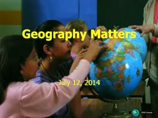
Geography Matters July 12, 2014
Geography and Technology • Geography affects us in many ways • Our natural environment • Our human environment • Geography is a Hi-Tech discipline • Earth Observation • Global Positioning Systems (GPS) • Geographic Information Systems (GIS)
SPOT ERS • Landsat (TM) SPOT • RadarSAT RADARSAT • NOAA • ERS LANDSAT NOAA Earth Observation
Global Positioning Systems • GPS is a revolutionary navigation System • 24 satellites orbiting the earth • Provide location within metres anywhere on the globe. • Now available in many cars as an option
Attribute Information: What is it? Location Information: Where is it? Species: Oak Height: 15m Age: 75 Yrs 51°N, 112°W Geographic Information Systems Describing Our World • We can describe any element of our world in two ways:
GIS - Links Data Sets • GIS software links the location data and the attribute data:
Attribute Questions: What provinces have more than 1.5 million people? Spatial Questions: What provinces border Saskatchewan? GIS - Analysis • GIS software can answer questions about our world:
Base Map Data • Elevation • Surface Geology GIS - Layers • GIS contains many layers of information: These are just a few of the kinds of layers a GIS can contain:
GIS - Analysis • GIS can analyze data in many ways:
GIS Relational Database CAD Graphics • Relational Database Management Systems • Computer Assisted Design and Graphics Software Statistical Analysis • Statistical Analysis and Reporting Packages GIS Technology • GIS borrows from other software technology:
Summary - What is GIS? • GIS is about using data to describe our world in two ways: • Location Data - Where is it? • Attribute Data - What is it? • GIS software maintains a link between layers of location and attribute data • With the Link, we can ask questions about our world…
Real World Applications • Environmental • Park Management • Agriculture • Public Utilities • Health Care • Emergency 911 • Real Estate • Marketing
Environmental • What are the effects of Global Warming? Land cover and temperature relationships are made clear when the data are seen at once using Geotechnology.
Park Management • Will the new building spoil the Park Scenery? Park planners use Geotechnology to determine if a new Visitor Centre can be seen from the peak.
Agriculture • How can I improve food production? Geotechnology is used in making crop management decisions to maximize yields and minimize fertilizer input.
Public Utilities • Is it safe to dig here? A proposed excavation, identified by address, is compared to pipelines in the area using Geotechnology.
Health Care • What Communities are at risk from Disease? Geotechnology identifies communities at risk of River Blindness and helps determine the impact of treatment.
Emergency 911 • What is the fastest route to the Hospital? Geotechnology can choose the fastest route to a hospital. The GIS can take into account traffic and other impediments.
Real Estate • Where is my Dream Home? With Geotechnology, an agent can show a map of a neighborhood and a picture or video of the actual properties.
Marketing • How can I optimize my Marketing Campaign? Geotechnology can query a database and identify only those areas with the highest household income within a specified distance of a store.
http://www.esricanada.com/k-12/ ESRI Schools and Libraries Program • ArcView GIS • Data • Lesson Packs • Training • World Wide Web