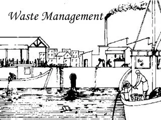
Waste Management Strategy Outline
250 likes | 377 Vues
Waste Management Strategy Outline. - Geography - Future Needs – 5 and 25-Year Time Frames - Capacity - Near-Term Needs - Long Term Needs. Waste Management Areas. Waste Stream Definitions. Three types of waste soil: Institutional Controls Program (ICP)

Waste Management Strategy Outline
E N D
Presentation Transcript
Waste Management Strategy Outline - Geography - Future Needs – 5 and 25-Year Time Frames - Capacity - Near-Term Needs - Long Term Needs
Waste Stream Definitions Three types of waste soil: Institutional Controls Program (ICP) - Homeowner demo and renovation projects - Commercial, infrastructure development Basin Property Remediation Program - Yard cleanup program Ecological Remediation - Upper Basin: mine sites and tailings - Lower Basin: river bed and bank deposits
Remaining Capacity(Page capacity assumes approval of footprint expansion)
Short- and Long-Term Repository Waste Balance
Questions? Comments?
East Mission Flats Update - Archaeological Monitoring Report - Groundwater Monitoring Program - Flood Monitoring - Phase I Operations - 60% Design Report - Visual Simulations
East Mission Flats Update Archaeological Monitoring Report • No recorded sites on State Register at EMF site; • 10 test pits excavated in July 2007, no cultural resources observed in any of the 10 pits; • Cuttings from 12 drill holes were monitored in October 2007; no cultural resources observed in any of the 12 drill holes; and • Recommend to have an archaeologist on-site to observe all excavations scheduled for the site.
East Mission Flats Update Groundwater Monitoring – December 2007 - Four wells sampled - Water levels suggest flat surface; flow from NW to SE - No dissolved metal concentrations reported above drinking water standards (MCLs) - Existing soil contamination has no significant impact to groundwater - Underlying “native” soil sorbs leaching metals - Next sampling event in March 2008
East Mission Flats Update Flood Monitoring - Two level loggers installed this week - Hourly readings through June 2008 - Compare results to Cataldo Gaging Station to establish stage-water level relationship - Use data to compare to HEC RAS flood model - Incorporate results in 90% Design Report
East Mission Flats Update Phase I Operations - Phase I Design Report out for Agency comment - Scheduled limited opening in May 2008 - Limited to 20,000 cubic yards - ICP and Basin Yard Cleanup wastes - Need to construct security fence and gate - Scheduled to acquire additional property between EMF site and Canyon Road in March 2008
East Mission Flats Update 60% Design Report - Draft Design Report completion in April 2008 - Begin 90% Design in Summer 2008 - Begin construction of full project in Summer 2009
East Mission Flats Update Visual Simulations - Simulations prepared for 7 observation points - Two seasons: Fall (October 2007) Winter (December 2007)
Questions? Comments?