National Height Modernization Program (NHMP) Update
180 likes | 204 Vues
Learn about NHMP's role, applications, benefits, and height modernization activities for accurate spatial reference system. Explore NGS mission, history, and programs for enhancing vertical datums. Get insights into regional consortium meetings and future strategic plans.

National Height Modernization Program (NHMP) Update
E N D
Presentation Transcript
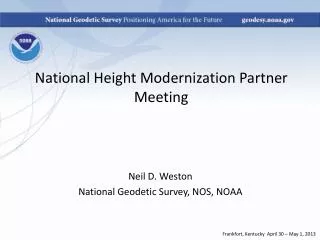
National Height Modernization Program (NHMP) Update Great Lakes Region Height Modernization Consortium Meeting Columbus, OH October 13, 2011
Overview • NGS Mission • NHMP History • NHMP Goals • Applications & Benefits of accurate heights • Height Modernization activities • NHMP role and activities • NHMP future plans
NGS Mission “To define, maintain and provide access to the National Spatial Reference System (NSRS) to meet our nation’s economic, social, and environmental needs.” http://www.geodesy.noaa.gov/INFO/NGS10yearplan.pdf
National Spatial Reference System (NSRS) • The official national coordinate system of the U.S. federal government which includes: • Geodetic latitude, longitude and height • Scale, gravity, and orientation • How these values change with time
NSRS Components • Continuously Operating Reference Stations (CORS) • Network of passive monuments (bench marks) • Official national shoreline • Precise orbits of GNSS satellites • Models and tools
NGS Ten-Year Plan • Plan’s 2022 targets are: • Replace NAD 83 and NAVD 88 • Modernize the Geopotential (Vertical) Datum http://www.ngs.noaa.gov/INFO/NGS10yearplan.pdf
Height Modernization “…the establishment of accurate, reliable heights using GNSS technology in conjunction with traditional leveling, gravity, and modern remote sensing information….” http://www.geodesy.noaa.gov/heightmod/
Height Modernization History • 1994 – Meeting held in Sacramento, CA • 1998 – Height Modernization Study funded • 2000 – Height Modernization planning funded • 2001 – Height Modernization funds directed to CA and NC; efforts began to study need in LA and WI • 2002 to 2011 – Program expands to 18 funded states
Challenges in Consistency • Spatial gaps exist in: • Data & models • Partnerships & funding
NHMP Regional Expansion • Bridges spatial gaps • Promotes partnerships • Still presents challenges
NHMP Activities • Program management - outreach and education • Monthly teleconferences, now with guest speakers • Federal Summit in May 2010 • State conferences • ACSM / Survey Summit / ESRI User Conference in July 2011 • LiDAR workshop and Partner Meeting in August 2011
Transition to the Future – GRAV-D Gravity for the Redefinition of the American Vertical Datum • Airborne Gravity Snapshot of all US and Territories • Tracking of Absolute Gravity Changes at specific locations • Re-define the Vertical Datum of the USA by 2022 • New vertical change (e.g. subsidence/rebound) monitoring paradigm
Questions Christine Gallagher Program Analyst National Geodetic Survey Email: Christine.Gallagher@noaa.gov Phone: (301) 713-3231 x105 http://www.ngs.noaa.gov/heightmod/EventsArchive.shtml