Download
1 / 36
360 likes | 535 Vues
Northern Hemisphere: Weather & Climate over Major Crop Areas. Update prepared by Climate Prediction Center / NCEP 2 May 2011. For Real-time information: http://www.cpc.noaa.gov/products/JAWF_Monitoring/. Outline. Highlights ENSO Current Status MJO Current Status Monsoons Current Status

E N D
Northern Hemisphere: Weather & Climate over Major Crop Areas Update prepared by Climate Prediction Center / NCEP 2 May 2011 For Real-time information: http://www.cpc.noaa.gov/products/JAWF_Monitoring/
Outline • Highlights • ENSO Current Status • MJO Current Status • Monsoons Current Status • Northern Hemisphere Circulation • Rainfall & Temperature Patterns • NCEP/GFS Model Forecast • Forecast Verification
ENSO Current Status • General Summary: • La Niña conditions continued across the equatorial Pacific. • Negative sea surface temperature (SST) anomalies persist across the central equatorial Pacific Ocean, while SSTs are now above-average in the eastern equatorial Pacific Ocean. • Atmospheric circulation anomalies associated with La Niña remain significant. • A transition to ENSO-neutral conditions is expected by June 2011. During the last 4-weeks (3 – 30 Apr 2011), equatorial SSTs were generally 0.5°C or more below average between 170°E and 140°W, while above-average temperatures have emerged in the eastern Pacific. For more information go to: http://www.cpc.noaa.gov/products/precip/CWlink/MJO/enso.shtml
MJO Index -- Recent Evolution Ensemble GFS (GEFS) MJO Forecast • The axes (RMM1 and RMM2) represent daily values of the principal components from the two leading modes • The triangular areas indicate the location of the enhanced phase of the MJO • Counter-clockwise motion is indicative of eastward propagation. Large dot most recent observation. • Distance from the origin is proportional to MJO strength • Line colors distinguish different months RMM1 and RMM2 values for the most recent 40 days and forecasts from the ensemble Global Forecast System (GEFS) for the next 15 days light gray shading: 90% of forecasts dark gray shading: 50% of forecasts Yellow Lines – 20 Individual Members Green Line – Ensemble Mean MJO Current Status The MJO signal remained weak during the previous week. Strengthening of the MJO signal is expected during week 1, with a large forecast spread in week 2. For more information go to: http://www.cpc.noaa.gov/products/precip/CWlink/MJO/mjo.shtml
Northern Hemisphere Monsoons Current Status North America West Africa East Asia Rainfall Anomalies: Last 90 Days Rainfall Anomalies: Last 90 Days Rainfall Anomalies: Last 90 Days Monsoon Season: JUN-SEP Monsoon Season: MAY-OCT Monsoon Season: JUN-SEP The North American Monsoon season has ended. Precipitation during the past 90 days has been near average. During the last 90 days near average rainfall has occurred in west Africa near Senegal and Guinea. Below average rainfall has occurred in central Africa. During the last 90 days above average rainfall has occurred in Indonesia. This is consistent with La Nina conditions. For more information go to: http://www.cpc.noaa.gov/products/Global_Monsoons/
200-hPa, 925-hPa Wind & Temperature Anomalies- Recent 7 days Northern Hemisphere Circulation Low-level (~600 m) wind and temperature anomalies are based on the NCEP Climate Data Assimilation Systems (CDAS) analysis. The patterns of anomalous temperature and wind at 925-hPa are usually similar to surface observations. Note: Areas with surface pressure below 925-hPa are masked out.
Omega Anomalies and Total Precipitation - Recent 7 days Northern Hemisphere Circulation Rising motion (negative omega, yellow/red shading), usually associated with wetter- than-normal conditions. Sinking motion (positive omega, blue shading), usually associated with drier-than-normal conditions. CPC daily gridded precipitation analysis over land only. The daily gauge analysis is created on a 0.5 degree lat/lon over the global land by interpolating gauge observations from ~30,000 stations.
Canada and US • Rainfall Total & Anomaly Patterns • Temperature Patterns • GFS Forecast
Rainfall Total & Anomaly Patterns: Last 7 Days Total Anomaly
Rainfall Total & Anomaly Patterns: Last 15 Days Total Anomaly
Rainfall Total & Anomaly Patterns: Last 30 Days Total Anomaly
Temperature (°C)Based on GTS Stations (no QC) Anomaly Extreme Minimum Anomaly Extreme Minimum
Temperature (°C)Based on GTS Stations (no QC) Anomaly Extreme Minimum Anomaly Extreme Minimum
NCEP/GFS Precipitation Forecasts Forecasts from 2 May 2011 – Days 1-7 Total Anomaly
NCEP/GFS Precipitation Forecasts Forecasts from 2 May 2011 – Week 2 Total Anomaly
Mexico and Central America • Rainfall Total & Anomaly Patterns • Temperature Patterns • GFS Forecast
Rainfall Total & Anomaly Patterns: Last 7 Days Total Anomaly For more information see: http://www.cpc.ncep.noaa.gov/products/fews/central_america/central_america_hazard.pdf
Rainfall Total & Anomaly Patterns: Last 15 Days Total Anomaly
Rainfall Total & Anomaly Patterns: Last 30 Days Total Anomaly
NCEP/GFS Precipitation Forecasts Forecasts from 2 May 2011 – Days 1-7 Total Anomaly
NCEP/GFS Precipitation Forecasts Forecasts from 2 May 2011– Week 2 Total Anomaly
Eurasia • Rainfall Total & Anomaly Patterns • Temperature Patterns • GFS Forecast
Rainfall Total & Anomaly Patterns: Last 7 Days Total Anomaly
Rainfall Total & Anomaly Patterns: Last 15 Days Total Anomaly
Rainfall Total & Anomaly Patterns: Last 30 Days Total Anomaly
Temperature (°C)Based on GTS Stations (no QC) Anomaly Extreme Minimum Anomaly Extreme Minimum
Temperature (C)Based on GTS Stations (no QC) Anomaly Extreme Minimum Anomaly Extreme Minimum
Temperature (C)Based on GTS Stations (no QC) Anomaly Extreme Minimum Anomaly Extreme Minimum
NCEP/GFS Precipitation Forecasts Forecasts from 2 May 2011 – Days 1-7 Total Anomaly For more information on Global Tropical Hazards see: (updated Tuesday at 1pm) http://www.cpc.ncep.noaa.gov/products/precip/CWlink/ghazards/ghaz.shtml
NCEP/GFS Precipitation Forecasts Forecasts from 2 May 2011 – Week 2 Total Anomaly
Famine Early Warning System Network (FEWS) Meteorological Products for the Famine Early Warning System Network (FEWS-NET) Mesoamerica Famine Early Warning System (MFEWS) Asia Flood Network (AFN) Funded by the United States Agency for International Development (USAID) Hazards Impacts Assessments for Central America http://www.cpc.ncep.noaa.gov/products/fews/central_america/central_america_hazard.pdf Africa http://www.cpc.ncep.noaa.gov/products/fews/africa_hazard.pdf Afghanistan http://www.cpc.ncep.noaa.gov/products/fews/AFGHANISTAN/afghanistan_hazard.pdf Additional products at: http://www.cpc.ncep.noaa.gov/products/fews/
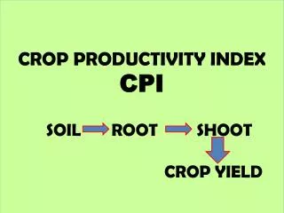
Major World Crop Areas and Climate Profiles Crop Calendars by Month http://www.usda.gov/oce/weather/pubs/Other/MWCACP http://www.usda.gov/oce/weather/CropCalendars USDA Crop Information