Download

1 / 40
400 likes | 529 Vues
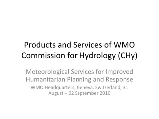
Products and Services of WMO Commission for Hydrology (CHy). Meteorological Services for Improved Humanitarian Planning and Response WMO Headquarters, Geneva, Switzerland, 31 August – 02 September 2010. Improved Humanitarian Planning and Response CHy Products and Services.

E N D
Products and Services of WMO Commission for Hydrology (CHy) Meteorological Services for Improved Humanitarian Planning and Response WMO Headquarters, Geneva, Switzerland, 31 August – 02 September 2010
Improved Humanitarian Planning and ResponseCHy Products and Services WMO COMMISION FOR HYDROLOGY • The Commission for Hydrology (CHy) shapes the water related activities of the WMO and addresses issues related to the basic hydrological observation network, water resources assessment, flood forecasting and management, adaptability to climate variability and change and promotes exchange of technology and capacity building. In particular the outcomes of its deliberations provide guidance to WMO Member countries and WMO Secretariat for the implementation of the Hydrology and Water Resources Programmeof WMO. • Areas of activity include integrated hydrological networks, hydrological forecasting systems, hydrological aspects of natural disastersand environmental issues, assessment of water use, latest advances in hydrological technology and practical implementation of IWRM principles with particular attention to integrated flood management. This information is incorporated into technical standards, reports or guidelines that can be used by NHSsin their work. • NHSs = National Hydrological Services (hydrological agencies)
Improved Humanitarian Planning and ResponseCHy Products and Services WMO/CHy: • Overall technical support to hydrological agencies + value adding • Capacity building • Cooperation between meteorological and hydrological services • Transboundary cooperation • Scientific research • Standardization • Projects and programmes
Improved Humanitarian Planning and ResponseCHy Products and Services WHYCOS: World Hydrological Cycle Observation System
Improved Humanitarian Planning and ResponseCHy Products and Services WMO FLOOD FORECASTING INITIATIVE
Improved Humanitarian Planning and ResponseCHy Products and Services FLASH FLOOD GUIDANCE SYSTEM
Improved Humanitarian Planning and ResponseCHy Products and Services HYDROLOGICAL FORECASTING AND PREDICTION • MANUAL ON FLOOD FORECASTING • (MANUAL ON LOW FLOWS) • ADVICE AND SUPPORT TO FFGS INITIATIVES • ADVISE ON AND MONITOR DEVELOPMENT OF GLOBAL FLOOD ALERT SYSTEM • USE OF NUMERICAL WEATHER PREDICTION (NWP) FOR FLOOD FORECASTING • GUIDANCE MATERIAL ON SEASONAL FLOW FORECASTING • INTERCOMPARISON OF OPEARTIONAL FLOOD FORECASTING SYSTEMS • GUIDANCE AND ADVICE ON HYDROLOGCIAL RISK MANAGEMENT
Improved Humanitarian Planning and ResponseCHy Products and Services Role of hydrological agencies (like National Hydrological Services) in disaster management: • Related to hydrological extremes: • Floods • (Droughts) • Advisory services to (national) disaster management units: • Early warning/Forecasting • Impact monitoring • Long-term planning
Improved Humanitarian Planning and ResponseCHy Products and Services Role of hydrological agencies (like National Hydrological Services) in disaster management: • Related to hydrological extremes: • Floods • (Droughts) • Advisory services to (national) disaster management units: • Early warning/Forecasting • Impact monitoring • Long-term planning
Improved Humanitarian Planning and ResponseCHy Products and Services Flood forecasting model - inputs: at any size of complexity (up to computerized Decision Support Systems) • Most recent upstream riverflow conditions • Most recent catchment rainfall information • Present catchment conditions (soil saturation) • Predicted weather development (rainfall) • Hydrological catchment model (losses, time lag) • River channel routing model (attenuation, time lag) • Floodmapping for risk areas • Historic data records for ‘calibration’
Improved Humanitarian Planning and ResponseCHy Products and Services REPUBLIC OF ZAMBIA MINISTRY OF COMMUNICATION AND TRANSPORT ZAMBIA METEOROLOGICAL DEPARTMENT WEATHER MONITOR 7 DAYS WEATHER FORECAST 19TH TO 25TH FEBRUARY 2010 GENERAL SITUATION: ITCZ is still oscillating about Central and Southern parts of Zambia. FORECAST FROM 19TH TO 25TH FEBRUARY 2010 Most parts of Zambia: Partly Cloudy to cloudy with rain and afternoon thundershowers in places. Heavier falls are expected over Lusaka, Central and North western Provinces.
Improved Humanitarian Planning and ResponseCHy Products and Services MINISTÉRIO DAS TELECOMUNICAÇÕES E TECNOLOGIA DE INFORMAÇÃO Instituto Nacional de Meteorologia-INAMET AVISO DE CHUVAS Elaborado às 10 :00 horas (TL) do dia 11 de Abril de 2010 Um sistema de baixa presao bem acentuado localizado na parte Leste do pais ,vai influenciar o estado do tempo nas provincias do Uige,Malanje, Lunda Norte,Lunda Sul e Moxico nas proximas 48 horas. Assim, o INAMET, prevê a partir de hoje dia 11 de Abril de 2010, ocorrência de chuvas fortes acompanhadas ou não de trovoadas nas provincias do Uige,Malanje, Lunda Norte,Lunda Sul e Moxico A quantidade de precipitação prevista poderá ser superior a 50 milimetros em 24 horas . O Director Geral Adjunto Para Area Tecnica ................................................ Joaquim Adolfo Xavier
Improved Humanitarian Planning and ResponseCHy Products and Services
Improved Humanitarian Planning and ResponseCHy Products and Services
Improved Humanitarian Planning and ResponseCHy Products and Services
Improved Humanitarian Planning and ResponseCHy Products and Services
Improved Humanitarian Planning and ResponseCHy Products and Services
Improved Humanitarian Planning and ResponseCHy Products and Services
Improved Humanitarian Planning and ResponseCHy Products and Services
Improved Humanitarian Planning and ResponseCHy Products and Services
Improved Humanitarian Planning and ResponseCHy Products and Services
Improved Humanitarian Planning and ResponseCHy Products and Services Namibia daily flood bulletin 01 March 2010: The Zambezi River maintains its steady rise in Katima Mulilo. Friday afternoon, ZRA forwarded the upstream readings, confirming the arrival of a high flood in the Zambezi River at Chavuma near the Angola border. Friday’s reading was 8.81 m (on 26 Feb, up from 7.71 m on 23 Feb). See attached graphs. It is possible to make the following comparison: 2007: maximum at Chavuma: 9.04 m maximum at Lukulu: 6.56 m maximum at Katima Mulilo: 7.23 m 2008: maximum at Chavuma: 7.53 m maximum at Lukulu: 5.82 m maximum at Katima Mulilo: 5.88 m 2009: maximum at Chavuma: 9.71 m maximum at Lukulu: 6.89 m maximum at Katima Mulilo: 7.85 m 2010: Friday at Chavuma: 8.81 m Thursday at Lukulu: 6.00 m today at Katima Mulilo: 4.92 m The flow time of floods from Chavuma to Lukulu is a few days and then +/- two more weeks to Katima Mulilo. It depends on rains and flow conditions in the intermediate areas what magnitude of flood will ultimately reach Katima Mulilo, and it is also not known how much further the flood will still rise in Chavuma. For the time being, the heavy rains have moved out of the area and no new heavy rains are predicted by various models, but on Friday ZMD indicated the ITCZ still being over southern Zambia. A prudent forecast is that Zambezi waterlevels may reach and pass the 7 m mark in Katima Mulilo by mid-March. This forecast will be updated and improved in the weeks to come.
Improved Humanitarian Planning and ResponseCHy Products and Services Namibia daily flood bulletin 03 March 2010: There have again been heavy rains in parts of the Zambezi catchment. See attached NASA map. The waterlevels at Chavuma started rising again. See attached graph. Our forecast remains that the Katima Mulilo waterlevels are heading for 7 m by mid-March 2010. For perspective, the flood would be: similar to 2007 higher than 2008 lower than 2009 But much will depend on the rains and the catchment response in the coming weeks.
Improved Humanitarian Planning and ResponseCHy Products and Services Impact monitoring: • Overtopping of banks • Flow channels • Disruption of infrastructure • Access to services • Areas affected • People affected Remote sensing • Initiate space charter activations
Improved Humanitarian Planning and ResponseCHy Products and Services
Improved Humanitarian Planning and ResponseCHy Products and Services
Improved Humanitarian Planning and ResponseCHy Products and Services
Improved Humanitarian Planning and ResponseCHy Products and Services
Improved Humanitarian Planning and ResponseCHy Products and Services
Improved Humanitarian Planning and ResponseCHy Products and Services
Improved Humanitarian Planning and ResponseCHy Products and Services
Improved Humanitarian Planning and ResponseCHy Products and Services
Improved Humanitarian Planning and ResponseCHy Products and Services
Improved Humanitarian Planning and ResponseCHy Products and Services
Improved Humanitarian Planning and ResponseCHy Products and Services
Improved Humanitarian Planning and ResponseCHy Products and Services Long-term planning: • Floodmapping • hazard/risk • Exposure/vulnerability • Seasonal and monthly forecasts • Climate change impacts
Improved Humanitarian Planning and ResponseCHy Products and Services
Improved Humanitarian Planning and ResponseCHy Products and Services
Improved Humanitarian Planning and ResponseCHy Products and Services