Download
1 / 42
420 likes | 562 Vues
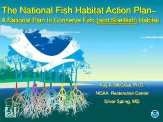
The National Fish Habitat Action Plan – A National Plan to Conserve Fish (and Shellfish) Habitat. Kay A. McGraw, Ph.D. NOAA Restoration Center Silver Spring, MD. Topics. What is NFHAP? Why is it important? How does it work? Science and Data Team – Assessment Tool

E N D
The National Fish Habitat Action Plan– A National Plan to Conserve Fish (and Shellfish) Habitat Kay A. McGraw, Ph.D. NOAA Restoration Center Silver Spring, MD.
Topics • What is NFHAP? • Why is it important? • How does it work? • Science and Data Team – Assessment Tool • How you can be involved
What is NFHAP? • Nationwide strategy • Voluntary • Science-based objectives • Analyze data on fish (and shellfish) habitat (location and condition) • Identify priority areas and actions • Apply to both freshwater and marine fish (and shellfish) habitat
NFHAP MISSION “…to protect, restore, and enhance the nation’s fish (and shellfish) and aquatic communities through partnerships that foster fish habitat conservation and improve the quality of life for the American people.”
The Plan And shellfish Signed on April 24, 2006 by: Carlos Gutierrez Secretary of Commerce Lynn Scarlett Acting Secretary of the Interior John Cooper President of the Association of Fish and Wildlife Agencies John Baughman Executive Vice President of the Association of Fish and Wildlife Agencies http://www.fishhabitat.org
Why NFHAP? The Problem – Fisheries and Their Habitats are at a Crossroads • Oyster reefs are the most impacted of any marine ecosystem in the world (85% loss globally)!! • ~ 90% of native mussel species are endangered, threatened, or of special concern • 51% of crayfish species are at risk • 80% of freshwater gastropods are at risk (many extinct) • 40% of our commercial and recreational fisheries are declining • 37% of our freshwater fish species are in trouble • High rate of aquatic habitat loss in U.S. and globally; • Between 1986 – 1997 a net loss of 644,000 acres of wetlands • ~50 – 60% of the U.S. population lives within 50 mi. of a coastline • ~ 20% of inland species are imperiled; • ~ additional 37% are at risk; • PNW – 80% of known commercial fish stocks in decline
The Concept • Local projects • Regional strategies and priorities • National attention and funding
Five important lessons • Address real problems not symptoms • Process oriented • Provide increased and sustained investment for long term success • Monitor and be accountable for scientifically sound and measurable results • Share information and knowledge
Action Plan Objectives • Conduct condition analysis of all fish (and shellfish ) habitats within the United States by 2010. • Prepare a Status of Fish Habitats in the United States in 2010, and every five years thereafter. • Establish 12 or more Fish Habitat Partnerships throughout United States by 2010. • Protect all healthy and intact habitats by 2015. • Improve the condition of 90 percent of priority habitats and species targeted by Fish Habitat Partnerships by 2020.
Developing and Implementing an Assessment Tool(NFHAP Science and Data Team)
Purpose of the Assessment Tool To characterize aquatic habitat condition… …so the information can be used to make good decisions ….. regarding the protection, restoration, or enhancement of aquatic habitats.
Compile and evaluate existing data Conduct an initial assessment Develop an assessment framework Implementing the NFHAP Assessement Tool
Importance of Assessment to NFHAP • Comprehensive, objective tool for nation-wide comparison • Identification of healthy and degraded aquatic systems • Identification of key disturbance factors • Scientific information at hierarchical levels for different agencies, organizations
Three Geographic Subdivisions Inland Marine Coastal
Overall Habitat Assessment Tool Plan Classify all of the Nation’s Waters Score Their Condition – Using Series of Condition Variables Summed into an Index Grade Them By Best Theoretical Possible and Best Currently Available in Classified Group Apply Appropriate Habitat Measures to Remedy Problems or Apply Protective Measures to Maintain Condition
Why Classify? • Allows for meaningful comparisons and condition assessment • Provides a context for protection and improvement • Allows for experiences and methodologies to be shared between similar systems
Examples—Inland Classification Variables • Regional geology • Landforms • Regional drainage patterns • Biota • Climate
Examples—Coastal/Marine Classification Variables • Depth contours • Tidal height e.g.,intertidal,subtidal) • Bottom type (e.g., mud, sand, cobble) • Salinity regime • Biota (coral reef, oyster reef, salt marsh, sea grass, mangrove, etc.)
Focus on Key Processes(Emergent Properties) • Connectivity • Hydrology • Channel and Bottom Form • Material Recruitment • Water Quality • Energy Flow in Aquatic Communities
Freshwater (upland) Habitat -- (Cowardin??) Process level factors (6) Individual variables Coastal/Marine Habitat (CMECS– Coastal Marine Ecological Classification Standard) Process level factor (?) Individual variables Hierarchies of Classification and Assessment
Inland Assessment Framework:Built from basic, spatial aquatic unit • Mapped for the Nation • Physical, biological characteristics that can be associated with the unit or surrounding landscape (i.e., catchment) • Part of spatial hierarchy, so information can be analyzed and reported at different spatial scales
NFH Assessment Basic Unit National Hydrography Dataset plus (NHD+) • Available nationwide • Confluence to confluence stream segments • Local and network catchment boundaries • Catchment characteristics (i.e., area, slope, precipitation)
NFH AssessmentSpatial Extents WWF Ecoregions (45) Catchments (2,595,196) TNC Ecological Drainage Units (EDUs) (244)
Urban Land Use 0 - 20% 21 - 40% 41 - 60% 61 - 80% 81 - 100% No EDUs Agricultural Land Use 0 - 20% 21 - 40% 41 - 60% 61 - 80% 81 - 100% No EDUs
Anthropogenic Disturbances by EDU • Urban • Cattle • Mines • Agriculture • Population • Road density • Total P yield • Imperviousness Very low Low Medium High Very High No EDUs
Results at Different Spatial Extents Watersheds in Cape Fear River - Piedmont EDU WWF Freshwater Ecoregions EDUs in Appalachian Piedmont
CAF Data Sets • Shellfish Harvest Classification • Physical and Hydrologic (P&H) • Agricultural Census • Agricultural Pesticides Use • Fertilizer Use • Land Use / Land Cover • Socioeconomics • Population and Population Density • Eutrophication • Estuarine Living Marine Resources (ELMR) • Pollution Sources
Examples of coastal indicators • Loss of habitat • Shore line type (e.g., amt. of shore armoring) • Dead zones and low D.O. • Contamination of bottom sediments • Harmful algae blooms (frequency and extent) • Status and trends of commercial fish stocks • Number of species at risk or extinct
CAF Data Examples • Shellfish growing areas – • Closures • pollution sources • Abundance • Harvest data • Eutrophication • Loss of SAV • Effects on fish/shellfish • Impacts on human use (swimming, boating, etc) • Coastal Population and Density
Avg. Annual Nitrogen and Phosphorous loads in Chesapeake Bay Watershed (point source discharges—kg/yr)
Development Pressure Around the Chesapeake Bay(and a 40% increase projected for 2003 -2008
Condition Analysis Best Theoretical Possible 100 0 Best Currently Available Series of sub-scores that can be improved on • Build a Habitat Index based on layered (hierarchal) Individual Habitat Variables that can be improved. • Score each Classified Unit against others in the Classification. Two Scale Scores
Find your niche "Candidate" Fish Habitat Partnerships Find your niche Partner profile Help – find your niche http://fishhabitat.org © fishhabitat.org Joomla Templates by JoomlaShack
Acknowledgments • Susan-Marie Stedman, NOAA OHC • Gary Whelan, Michigan Dept. of Nat. Res. • Dr. Dana Infante, Mich. St. Univ. • Dr. Dayong Wu, Mich. St. Univ.,
Finis Oympia oysters by Cory and Catska Ench, Port Angeles, WA