Download
1 / 33
330 likes | 396 Vues
Explore the development and interpretation of ecological sites at the ESD workshop on June 5, 2012, in Winnemucca, NV. Learn how to systematically divide and study landscapes for effective management and restoration.

E N D
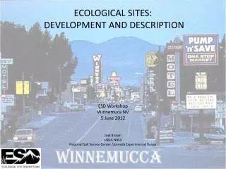
ECOLOGICAL SITES: DEVELOPMENT AND DESCRIPTION ESD Workshop Winnemuca NV 5 June 2012 Joel Brown USDA NRCS National Soil Survey Center /Jornada Experimental Range
A climate, a plant community or a soil, in the sense of an individual, is a ... section of the landscape with a range in characteristics set by our logic, not by nature. (Dyksterhuis 1958)
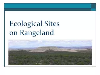
Early forest and range site applications were explicitly designed to divide the landscape as a means of predicting production and restoring production post-disturbance
As site, landscape and regional scale ecosystem services expand, change and become more fluid, ecological site descriptions need to become more robust FAO.org
A climate, a plant community or a soil, in the sense of an individual, is a ... section of the landscape with a range in characteristics set by our logic, not by nature. (Dyksterhuis 1958) A distinctive kind of land with specific physical characteristics that differs from other kinds of land in its ability to produce a distinctive kind and amount of vegetation, and in its ability to respond to management actions and natural disturbances. HOW DO WE SYSTEMATICALLY SUBDIVIDE THE LANDSCAPE AND INTERPRET THOSE DIVISIONS?
Regionswith similar climate, land use Geographicareaswith similar soils Similar landscapepatterns Groups of EcologicalSitesthat share landscapes Intermingledecologicalsitesor single site Oneindividual representativeof thesite Anobservation of plant-soilrelationships
Regionswith similar climate, land use Geographicareaswith similar soils Similar landscapepatterns Groups of EcologicalSitesthat share landscapes IntermingledEcologicalSites Single individual representativeof thesite Point scaleplant-soilrelationships
LAND RESOURCE REGIONS • LRR D – Western Range and Irrigated Region • Semidesert or desert region of plateaus, plains, basins and mountain ranges • 150 – 1065 mm • 105-260 d frost free • Overgrazing is a concern on rangelands
Basics of ecologicalsites: spatialscales Regionswith similar climate, land use Geographicareaswith similar soils Similar landscapepatterns Groups of EcologicalSitesthat share landscapes Intermingledecologicalsitesor single site Oneindividual representativeof thesite Anobservation of plant-soilrelationships
MLRAsdistinguishbroaddifferences in potential and types of ecologicaldynamics Our challenge: to better to understand broad vegetation/disturbance/geo-physical relationships. Non-native grass invasion, increased fire frequency, loss of native woody plants Non-native grass invasion, altered surface hydrology, reduced productivity Drought-triggered forest dieback Nonnative woody plant invasion Perennial grass loss, soil erosion, native woody plant dominance Native woody plant thickening, reduced fire frequency Major Land Resource Areas of the continental USA
MLRA EXPLORER Land Resource Regions and Major Land Resource Areas of the United States, the Caribbean, and the Pacific Basin http://www.cei.psu.edu/mlra/ MLRA 24 Humboldt Area 35, 610 sq miles (92, 275 sq km) low flat coastal plains 44-59 “ (1120-1500) average annual precipitation, 60% June-Sep 70-75o F(21-24o C) Average annual temperature
Basics of ecologicalsites: spatialscales Regionswith similar climate, land use Geographicareaswith similar soils Similar landscapepatterns Groups of EcologicalSitessharinglandscapes Intermingledecologicalsitesor single site Oneindividual representativeof thesite Anobservation of plant-soilrelationships
The MLRA-level “model” isfilteredbysoils/topography and local climate (LRU) Our challenge: to begin to sample/model and understand finer vegetation/ disturbance/geo-physical relationships. Limestone Grass protected by rocks, higher rainfall, good water capture: low risk Gravelly soil (shallow, relict piedmont) Surface soil water limited, high risk for grass loss and erosion: vulnerable/restorable Sandy soil (relict basin floor) Erodible surface soils once grasses removed: vulnerable/hard to restore Soil mapping units of the Jornada Basin (15 km) Loamy soil (active piedmont) Susceptible to water erosion and grass loss: vulnerable/restorable Clayey soil (basin floor) Receives water and sediment: low risk
Basics of ecologicalsites: spatialscales Regionswith similar climate, land use Geographicareaswith similar soils Similar landscapepatterns Groups of EcologicalSitesthat share landscapes Intermingledecologicalsitesor single site Oneindividual representativeof thesite Anobservation of plant-soilrelationships
ECOLOGICAL SITE CHARACTERISTICS Site Type: Rangeland Site Name: LOAMY 5-8 P.Z. / Atriplexconfertifolia - Picrothamnusdesertorum / Achnatherumhymenoides ( / shadscale - bud sagebrush / Indian ricegrass) Site ID: R024XY002NV Major Land Resource Area: 024-Humboldt Area Associated Sites: SODIC TERRACE 6-8 P.Z. R024XY003NV SILTY 4-8 P.Z. R024XY004NV DROUGHTY LOAM 8-10 P.Z. R024XY020NV STREAMBANK 10-14 P.Z. R029XY025NV
Basics of ecologicalsites: spatialscales Regionswith similar climate, land use Geographicareaswith similar soils Similar landscapepatterns Groups of EcologicalSitesthat share landscapes Intermingledecologicalsitesor single site Oneindividual representativeof thesite Anobservation of plant-soilrelationships
Loamy upland Sandy loam upland Sandy loam Loam Clay loam Clay
ECOLOGICAL SITES: DEVELOPMENT AND DESCRIPTION“A Common Way to Describe Ecological Sites”for Rangelands • The Interagency ESD Manual - 2010 • The Interagency ISD Handbook- 2012 (hopefully) • Development of Standards and Process – (2013 Goal)
A Common Way to Describe Ecological SitesESD Project Plans • An ESD Project Plan is the main tool for analyzing workload (planning, scheduling, and coordinating activities) and tracking progress of ES activities. • The scope of ESD project plans will vary. A project plan may simply involve the collection of additional data for inclusion in an existing ESD or may involve going through the entire development process for a new ecological site.
Goals To increase the understanding of ecological dynamics to landscapes To better catalogue expert knowledge and data-driven processes To use common process for defining the ecological site concept To develop ecological site products that meet the needs of multiple users To develop products that are management tools
Establish priorities for development Assemble existing resource material Select locations for reconnaissance Establish local working group Resource allocation Planning Phase
DATA and DOCUMENTATION COLLECTION PHASE Important to have draft STM developed prior to sampling design and data collection Level III sampling should be dependent on Level II results
Basics of ecologicalsites: spatialscales Regionswith similar climate, land use Geographicareaswith similar soils Similar landscapepatterns Groups of EcologicalSitesthat share landscapes Intermingledecologicalsitesor single site Oneindividual representativeof thesite Anobservation of plant-soilrelationships
ECOLOGICAL SITE DESCRIPTION CERTIFICATION PHASE Peer review Correlation of interpretations
SUMMARY • Climate, geology, soils, vegetation occur within spatiotemporal gradients • It is unlikely that you will be able to work with Ecological Sites that are exclusively one unit • Understanding the hierarchical setting of an ecological site can help interpret and apply the information in an ESD to conservation problems
How do ESDs Support Planning? Analyze Resource Data Inventory Resources Identify Problems Determine Objectives Formulate Alternatives Evaluate Alternatives Make Decisions Evaluate the Plan Implement The Plan