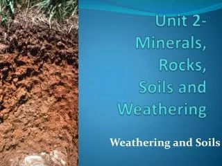
Soil Weathering and Formation Processes Exploration
Learn about the physical and chemical weathering processes that shape soil formation and the importance of soil horizons in different climates. Discover how different types of soil are classified and their agricultural significance. Understand key concepts such as cation adsorption and exchange in soil chemistry.

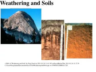
Soil Weathering and Formation Processes Exploration
E N D
Presentation Transcript
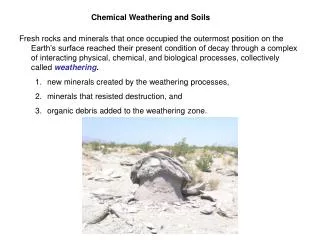
Physical weather reduces the particle size of rocks and in doing so prepare the material for chemical weathering. The rate of all chemical reactions involving solids is determined by the amount of exposed surface area. These four drawing illustrates sequentially dividing particles into smaller particles. Assuming a dimension of 1 cubic centimeter for the cube in drawing A, one can do a little basic arithmetic to calculate the increase in the overall surface area by the time you reached the figure in drawing D.
Regolith is the accumulation of the solid products of weathering above bedrock. By definition, soil is that part of the regolith that supports plant life out of doors. An older, but useful definition as shown in these two drawings is that soil is that part of the regolith down to the deepest penetration of plant roots. If left undisturbed, humid and semi-arid soils develop layers called horizons. The O-horizon and A-horizon consist of the non-decomposed and decomposed plant materials respectively. The E-horizon is a highly leached zone consisting primarily of quartz grains. The B-horizon contains the clay minerals that store the plant nutrients while the C-horizon is regolith presently undergoing conversion to soil.
A map showing the climatic zonation of the southern 48 states into humid (greens and purple), semi-arid (red) and arid (light brown) regions based on the amount of annual precipitation. A temperate humid climate is one that receives in excess of 20 inches of precipitation per year. A semi-arid region is one that receives between 10 inches and 20 inches of precipitation while an arid region receives less that 10 inches of precipitation per year. Note from the map that the southern 48 States are nearly equally divided along the 100th meridian into humid and semi-arid climates.
The chart shows the development of soil horizons under humid, semi-arid, arid, and tropical conditions. The older terms, pedalfer, pedocal, and laterite, although still used world wide, have been replaced in the U.S.by the U.S. Dept. of Agriculture to ultisols, spodosols, mollisols, aridosols, and oxisols. The new classification made two major changes. One was to recognize two types of forest soils, the spodosols of conifer forests and the ultisols of hardwood forests. The other change was to make a separate classification for arid regions by introducing the aridosol. The chart illustrates the distribution of horizons as determined by the relative dominance of the two sources of water that control the formation of the soils as indicated by the lengths of the arrows for acidic rainwater (R) and neutral to alkaline groundwater (G). In both forest soils, the dominance of acid rainwater renders the soils acid. However, with lime treatment, these soils are some of the best agricultural soils. Of all the soils, the mollisols of the grasslands are the best agricultural soils because of the self-neutralization provided by the alkaline groundwater which over-dominates the acid rain water. Before humans became involved, the mollisols were the soils of the worlds great grasslands. Every continent has a great grassland. When humans came onto the scene, they plowed the natural grasses under and planted other grasses such as wheat, oats, and barley, giving rise to the term “The Breadbasket Soils.“ The aridosol is different in that there are no horizons ,the materials is essentially nothing but unaltered regolith. The aridosol is super-dominated by alkaline saltsthat are deposited by the evaporation of rising groundwater. Because of the intense chemical weathering, the oxisols consist of a mixture of iron oxide from the oxidation of the ferro-magnesian minerals, aluminum and silicon from the decomposition of the clay minerals and silica in the form of quartz. The oxisols are our major source of bauxite, the ore of aluminum.
A chemical summary of the three most important chemical weathering processes, oxidation, dissolution by carbonation, and carbonation/hydrolysis.
A summary of the processes of cation adsorption and cation exchange and how they are involved in the neutralization of acid soils and in the providing of essential nutrients to plants are illustrated in these drawings. Because of the lack of cations within their crystal lattices, nearly all clay mineral particles are negatively charged. Cation adsorption refers to the ability for the clay minerals to remove cations from soil water and adsorb them to the surfaces of their particles in order to neutralize the negative charge. Cation exchange refers to the ability of clay minerals to exchange one type of cation for another. It is by cation exchange that the clay minerals in acid soils are able to exchange the acid hydrogen ions for calcium ions applied to the soil by the use of agricultural lime (powdered limestone), thereby neutralizing the acidity of the soil. Cation exchange is also the process used by plants to exchange hydrogen ions created by the dissociation of carbonic acid secreted on their roots for cation nutrients held on the surfaces of neutralized clay minerals.
General summary of United States climatic regions, soil types, older soil names, and the newer USDA soil nomenclature.