Town Planning and Design
Town Planning and Design. Emil R. Moncivais, FAICP, AIA, CNU P. O. Box 769351 San Antonio, Texas 78245 210-416-0885 emoncivais1@satx.rr.com. Presentation Content. San Antonio’s Community Building and Neighborhood Planning Program (Oct. 13, 1998, amended Feb. 8, 2001) (CBNP)

Town Planning and Design
E N D
Presentation Transcript
Town Planning and Design • Emil R. Moncivais, FAICP, AIA, CNU • P. O. Box 769351 • San Antonio, Texas 78245 • 210-416-0885 • emoncivais1@satx.rr.com
Presentation Content • San Antonio’s Community Building and Neighborhood Planning Program (Oct. 13, 1998, amended Feb. 8, 2001) (CBNP) • Downtown Neighborhood Plan (May 13, 1999) • Zoning and its relationship to neighborhood, community and perimeter plans
CBNP Program • Program Summary • A New Era of Neighborhood Emphasis - community revitalization action group (CRAG) identified revitalization strategies, San Antonio Master Plan Policies adopted in May 1997, city council encouraged neighborhood planning and revitalization • CBNP program developed based on - CRAG final report, Master Plan Policy, meeting with neighborhood
Program Summary • neighborhoodgroups and community stakeholders, national research of neighborhood planning programs, city departments input • Goals of the program - based on Master Plan Policies Goal1: Preserve, protect and enhance the integrity, economic viability, and livability of San Antonio’s neighborhoods; Goal 2:Strengthen the use of the neighborhood planning process and plans
Program Summary • Objective of program - Simplify and provide more neighborhood planning; foster partnerships with stakeholders; strengthen significance of neighborhood plans through incentives, zoning and implementation; provide a variety of service components to meet needs of diverse neighborhoods; develop citywide Comprehensive Master Plan
Neighborhood Plan Application • Community and Neighborhood Plans Application • WhatistheProgram? Planning Dept. provides services in the development of a plan - planning process - community stakeholders develop goals, create strategies, plan have three basic elements - land use, transportation network, and community facilities
Neighborhood Plan Application • What is a Plan? Neighborhood plans are for small geographic areas, 4,000 to 10,000 residents, 1500 dwellings, support an elementary school; Community plans includes large areas, 20,000 to 60,0000 people and several neighborhoods; support a middle and high school; perimeter plans - not an application process (I-10 north, I-10 east)
Neighborhood Plan Application • Benefits of a Community Plan? - Formal adopt by City Council; becomes component of the City’s Comprehensive Master Plan; plan used by city departments, boards, and commissions as a guide for decision making; Used as a bases for Plan Annual Report; Developers, investors and others can understand the vision for the future of the community
Neighborhood Plan Application • Who can apply? - neighborhood associations, community organizations, and other community-related groups are eligible to apply
Neighborhood Planning ApplicationRequirements • Planning Team - include all stakeholders - neighborhood associations, community organizations, institutions, businesses, and property owners • Proposed Boundary - show the proposed boundary of neighborhood or community plan (Planning Director has final say) • Neighborhood description - brief description of neighborhood - land use, housing ownership, institutions
Neighborhood Planning ApplicationRequirements • Organizational Capacity - indentify facilitators, leaders for committee work, improve participation at plan meetings, develop a committee structure to implement plan • Neighborhood projects - describe any significant public projects, private investment, and planning efforts • Current or Past Collaboration - history of collaboration with other stakeholders
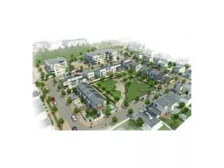
Downtown Neighborhood Plan • Purpose • Downtown Neighborhood Plan • Purpose is to identify proposed land uses, potential housing development, transportation systems, economic development initiatives, urban design guidelines, pedestrian and open space connections • Boundaries - I-35 to the north, Monumental on the east, S. Alamo/Lone Star to the south, and Colorado to the east • Original five neighborhood areas were suggested by the Downtown Strategic Plan
Downtown Neighborhood Plan • The planning process - Joint effort by City of San Antonio, Downtown Advisory Board and the Downtown Alliance, 800 citizens participated in 13 public meeting; 30 community facilitators volunteered,inclusive of all stakeholders, goals and issues from the Downtown Strategic Plan was the basis of the ideas
Downtown Neighborhood Plan • Land use Plan - is shown within a framework of smaller districts within each of the five neighborhoods; the smaller neighborhoods were identified by the community
Downtown Neighborhood Plan • Plan content • Introduction, Purpose, Planning Process, Existing Land Use • Plans - Land Use, Transportation, Pedestrian & Public Space Plan, and Urban Design Guidelines • Long Term Vision/short term iniatives - North, East, South, West and Central Neighborhoods • Actions Plan - immediate steps to make improvements
Zoning • Introduction • zoning, in its simplest form is the separation of land uses • regulates building bulk, height, parking, open space, and land uses
Zoning • History - Massachusetts, 1628 prohibited certain noxious industries in areas for other uses; height regulations can be traced to early Roman emperors; first modern zoning in New York in 1916
Zoning • Texas history - State zoning Enabling Act (SSEA) in 1927 gave zoning power to cities and incorporated villages, but not to counties; done in accordance with a comprehensive plan; in 1987, state enabling act was codified as Chapter 211 of the Texas Local Government Code
Zoning • Purposes of Zoning - used to regulate land uses in order to prevent incompatible adjacent land uses, undue density and traffic congestion, restrict height and size/bulk of buildings, setbacks to lessen fire hazards, promote aesthetic value
San Antonio UDC • Unified Development Code (UDC) • Article III of the San Antonio governs Zoning • Divisions - General, Base Zoning Districts, Specific Use Permits and conditional zoning districts, Overlay districts, Special Districts, Flexible Zoning, Supplemental Use Regulations, and Authorized Special Exceptions
San Antonio UDC • Base Zoning District • Consist of the basic zoning on property and determines use and pattern of development - R-3,4,5,6; MF-25, 33, 40, 50; O-1,-2; NC; C-1,2,3; D;L; I-1,2; UD;RD; FR; MI-1,2