Download
1 / 20
200 likes | 483 Vues
Sustainable Land Use on the Flood Plain in Japan: Teaching Materials for ESD 日本の河川氾濫原における持続可能な 土地利用を題材とする ESD 教材. Gifu Shotoku Gakuen University TAKATA Junichiro 岐阜聖徳学園大学教育学部 高田準一郎. 授業内容の概要 Outline of a Teaching plan(1).

E N D
Sustainable Land Use on the Flood Plain in Japan: Teaching Materials for ESD日本の河川氾濫原における持続可能な土地利用を題材とするESD教材 Gifu Shotoku Gakuen University TAKATA Junichiro 岐阜聖徳学園大学教育学部 高田準一郎
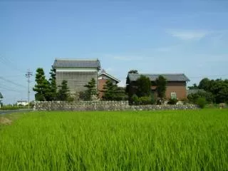
授業内容の概要 Outline of a Teaching plan(1) • the vulnerable area against flood:theflood plain ⇒desolate land • levee a river to protect the area from floods ・with low-level technology・・・low productivity ・with high-level technology・・・high productivity ⇒sustainable land use on the flood plain ex. rice fields, Waju, logistic parks, etc. Notes:Waju is a community surrounded by a levee to protect it from floods.
授業内容の概要Outline of a Teaching plan(2) A case study • the topographic map (1:25000) of “the western part of Gifu” • to have a concrete image of Waju communities 1. color the artificial levees ⇒ realize that the area is surrounded by levees 2. color the natural levees ⇒ assume the former river course and flood course ➡have a historical viewpoint of the alluvial plain cf. river improvement by Johannis de Rijke
予想の選択-検証の手順The procedure for making and examining assumptions 1.Making assumptions ・giving questions about map reading ・making assumptions and choosing between alternatives 2.Examining assumptions ・topographic map reading, etc.
問題の提示と作業による検証Giving questions and examining assumptions through activities (1) • Question 1 ・Do you think our campus area has been flooded before? A. YesB. No • Activity 1 ・Circle in colored pencil the numerical value of the height above sea level around the campus area. ・Assume the height of the riverbed.
問題の提示と作業による検証Giving questions and examining assumptions through activities (2) • Question 2 ・Do you think the levee of the Nagara River continues along the river ? A. Yes B. No • Activity 2 ・Color the levee of the Nagara River. ・Draw the cross-sectional views of the 5 kinds of the symbols indicating levees.
問題の提示と作業による検証Giving questions and examining assumptions through activities (3) • Question 3 ・How many Waju communities do you think there were in this area in the early Meiji Era (around 1870s)? A. About 10 B. About 30 C. About 80 • Activity 3 ・Color the levee of the Sakai River. Notes: Question 4~6 are omitted.
問題の提示と作業による検証Giving questions and examining assumptions through activities (4) • Question 7 ・Do you think the land of the JR Shinkansen “Gifu Hashima Station” is higher than the surroundings? A. Yes B. No • Activity 7 ・In the topographical map “Takehana,” compare the height of the JR Shinkansen “Gifu Hashima Station” with that of the surroundings.
検証のプロセスがもつ意味Aims of the teaching plan (1) • shifting the attention from an artificial levee to a natural levee (Waju) ・develop the ability of map reading through activities • understanding how Waju communities have developed ・sustainable land use on the flood plain
予想-検証モデルの有効性 Usefulness of the procedure for making and examining assumptions • The procedure ・develops awareness of the geographical features ・have a historical viewpoint of land use on alluvial plains (Waju) ・can be applied to other alluvial plains
受講生の感想からStudents’ comments (1) • I’m very much impressed with map reading. By coloring the levees of the rivers and settlements, I learned various geographical features from black and white maps. From the names of the places, I also learned when the settlements were formed. The activities gave me various viewpoints of map reading. (a junior at the faculty of education)
受講生の感想から Students’ comments (2) • Through the activities, I realized the importance of making use of materials. In this lecture, various materials such as maps and graphs were distributed every time, and we made the most of them. Looking closely at the maps and coloring them led me to deeper understanding of the areas. I think I have acquired new viewpoints of reading maps. (a junior at the faculty of education)