Download
1 / 11
110 likes | 327 Vues
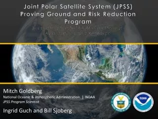
Joint Polar Satellite System (JPSS) Proving Ground and Risk Reduction Program Supporting the NOAA Mission through Applications and Research. Mitch Goldberg National Oceanic & Atmospheric Administration | NOAA JPSS Program Scientist Ingrid Guch and Bill Sjoberg. Challenge.

E N D
Joint Polar Satellite System (JPSS)Proving Ground and Risk Reduction ProgramSupporting the NOAA Mission through Applications and Research Mitch GoldbergNational Oceanic & Atmospheric Administration | NOAA JPSS Program Scientist Ingrid Guch and Bill Sjoberg
Challenge • Move from Products to End User Applications • Ensure users are ready for NPP/JPSS data and improve their key operational and research product and services • Severe weather forecasts and warnings • Aviation weather forecasts and warnings • Improve fire and air quality forecasts and warnings • Improve warnings and prediction of poor water quality in coastal regions • Improve drought, precipitation, snow and ice assessments and predictions • Periodic feedback from keys users on the impact of NPP/JPSS data and to identify improvements needed for products and applications • To meet this challenge, the NOAA JPSS Office has established a JPSS Proving Ground and Risk Reduction Program
Proving Ground and Risk Reduction Application Areas • Weather Forecasting (Improving Global, Regional forecasts) Tropical Cyclones Severe Weather (Nowcasting) • Ocean/Coastal (Coral Bleaching, Harmful Algal Bloom alerts) • Land (Droughts, Agriculture) • Hazards (Smoke, Fire, Volcanic Ash, Air Quality) • Hydrological (Precipitation, Floods, Soil Moisture, Snow/Ice, River Ice) • Climate (integrated products, real-time anomaly products) • Education and Training • Infrastructure (Direct Readout and Software (CSPP), Airborne campaigns) CSPP is a critical component of the JPSS Proving Ground!
Mapping NOAT Priorities to JPSS PGRR PGRR Projects Soundings/Radiances for Hurricane Intensity and Track Sounding applications over Alaska including nearcasting Soundings in AWIPSII
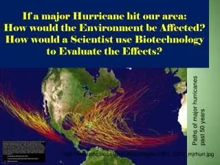
NWS in Alaska, through the JPSS Proving Ground, has become a primary and proactive user of VIIRS products and imagery. The examples demonstrates exploitation of critical data for arctic access and navigation, and safe transportation. VIIRS being used for sea ice analysis VIIRS animation showing strong Easterly Flow (Polynyas* and Leads) in Ice. Barrow * An area of open water surrounded by sea ice. It is now used as a geographical term for an area of unfrozen sea within the ice pack.
Mapping NOAT Priorities to JPSS PGRR Fund JCSDA for data assimilation and data denial studies Blended TPW project Enterprise algorithms – ABI algorithms being used on VIIRS for clouds, volcanic ash, aerosols, etc in NDE
Track Progress via Quarterly Reports and Monthly JPSS Science Seminars
Summary • An understanding of how JPSS data used throughout NOAA is pivotal to evolving and maintaining a robust satellite mission that serves the needs of all Line Offices. • This is why guidance from the NOAT is important to prioritize how best to use JPSS data in combination with other data to improve critical product and services • Alaska proving ground is an excellent example of rapid use and deployment of Suomi NPP data. JPSS continues to engage the NOAA user community, ensuring that both the best product and new, enhanced products (via the Proving Ground) are made available in the most timely manner possible.