Technical Presentation
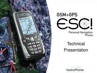
Personal Navigation Phone. Technical Presentation. Product data. 900/1800 MHz Dual Band GSM mobile phone 12-channel high performance GPS receiver Hybrid positioning GPS power management for better operating times Professional ergonomics Tough and splash proof

Technical Presentation
E N D
Presentation Transcript
Personal Navigation Phone Technical Presentation
Product data • 900/1800 MHz Dual Band GSM mobile phone • 12-channel high performance GPS receiver • Hybrid positioning • GPS power management for better operating times • Professional ergonomics • Tough and splash proof • Light-weighted: 198 g • Battery: 900 mAh • Emergency function • + ordinary phone features
Power consumption • Advanced power saving modes • Full power • Continuous position fix • Operating time up to 15 h • Economy • Optimising power consumption and position refresh rate • Variable time between position fixes • Operating time up to 40 h • At intervals • Allows the user to select an interval at which the GPS receiver attempts to acquire a position fix
Power consumption • Advanced power saving modes • Available intervals in At intervals -mode: • 5 min Operating time up to 95 h * • 10 min 125 h • 20 min 130 h • 30 min 135 h • 1 h 160 h • 2 h 160 h • 6 h 165 h • 12 h 170 h • 24 h 170 h • * in normal GSM network conditions with 1200 mAh battery
VetroPhone Esc! Telematics features • Navigation & guidance • Waypoints and routes • Heading, speed, distance, trip odometer, NMEA0183 interface • Maps • Map screens • Map handling • Locating friends • Friend find • Safety • Emergency function • Positioning technology
Navigation & guidance Waypoints and routes • The device has memory for up to 300 waypoints of your choice; places of interest, meeting points, business associates, good fishing sites etc. • You can create routes with certain waypoints • You can also navigate towards a waypoint • It is possible to send waypoints to your friends
Navigation & guidance Heading, speed, distance, odometer • The device shows your heading on a compass • You can also see your speed, distance travelled, distance to the target (next waypoint and final destination) and estimated time of arrival • NMEA interface for telematics data
Maps Map screen • Circular position marker shows your position on map • Direction of movement is shown with a black box on marker’s edge • Radial line shows the direction to the destination • Analogy between Guide and Map • Track log • Waypoints • Routes • Automatic scrolling
Maps Map handling Map can be panned and zoomed Pointing mode can be used for: • setting a destination • measuring a distance • creating a waypoint • editing a waypoint • sending co-ordinates • sending a waypoint
Locating friends Friend Find • Track and find other VetroPhone Esc! users • Locates other users on a map and guides you to them • Sends and receives position by SMS • Update: • last known position • time stamp • speed and direction • battery status • Tracking
Safety Emergency function • One-touch emergency button • Sends up to five SOS message with the user’s location and a voice connection is opened to a predefined number
Positioning technology GPS positioning • GPS ; satellite positioning is based on a system maintained by the US Military • There are 24 active satellites in the sky and the GPS-receiver in the VetroPhone Esc! is able to receive signals from the satellites • The position determination works outdoors and takes place once the device receives signals from at least three suitably positioned satellites • Accuracy of the position depends on the satellite coverage, which is affected by solid objects and weather; e.g. cloudiness, snow, surrounding tall buildings and heavy tree cover • Accuracy of the GPS positioning is about 10 meters • The position is represented as co-ordinates, e.g. N 21°45‘27” E 21°45‘27” • The system shows position as a point on a map
Positioning technology Network Positioning Support • The VetroPhone Esc! is positioned primarily by the GPS system • Service centre can request the GSM network parameters • For calculation of the position you need a separate server, available from VetroPhone Partners • Accuracy of the position depends on the distance between a base station and the device and between the different base stations • Accuracy of the network positioning is at its best about 100-400 meters and the positioning also works indoors
Positioning technology Assisted GPS- fast initial position • Capability to receive assistance to the GPS receiver in order to quicken the initial position calculation • Requires a third party station server • Used if the phone is in bad satellite coverage • Assistance over the MPTP binary coded protocol • Message will contain ephemeris and UTC time • Rough position e.g. GSM network. (Cell-ID, CI-TA)
Software Development Kit (SDK) • The tool to make your maps wireless • Provide basis for personal navigation • The VetroPhone SDK 1.0 gives you tools for downloading and managing maps, and it also consists specifications needed for building up a complete LBS and map service with POI and waypoint support for VetroPhone Esc! • The VetroPhone SDK 1.0 is available for standard C/C++ Windows software development platforms
Software Development Kit (SDK) • The SDK includes: • software librarys • demos • sample programs • protocol documentation of • Mobile Maps Service Protocol (MMSP) • Mobile Phone Telematics Protocol (MPTP) • VetroPhone AT commands • ETSI AT commands • white paper • presentation about SDK
Software Development Kit (SDK) • Mobile.lib • Mobile library offers basic functions for creating and closing connection to the mobile phone and checking the state of the connection • Mmsp.lib • Mmsp library offers functions for deleting maps, retrieving map information from the mobile phone and for sending maps to the VetroPhone Esc! • EscApi.lib • Escapi library offers functions for making tiles of bitmap files and sending bitmaps to the mobile phone • zlib.lib • zlib is a compression library which is used for compressing the map before downloading it to the mobile phone
Personal Navigation Phone For more informationwww.vecprom-technical-services.com