By:John Paul Agiorgousis
200 likes | 959 Vues
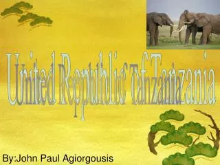
United Republic of Tanzania. By:John Paul Agiorgousis. Map of Tanzania. LOCATION. Absolute Location: 6'00" S, 35'00" Tanzania is South of Kenya and Uganda. Tanzania is East of Rwanda, The Dem. Rep. of the Congo, Burundi. Tanzania is North of Zambia, Mozambique, and Malawi.

By:John Paul Agiorgousis
E N D
Presentation Transcript
United Republic of Tanzania By:John Paul Agiorgousis
LOCATION • Absolute Location: 6'00" S, 35'00" • Tanzania is South of Kenya and Uganda. • Tanzania is East of Rwanda, The Dem. Rep. of the Congo, Burundi. • Tanzania is North of Zambia, Mozambique, and Malawi. • Tanzania is west of the east coast of Africa. • Tanzania is bordering the Indian Ocean
Geographical Features • Tanzania has mountains in the northeast, where Mount Kilimanjaro (Africa's highest peak) is located. • In the northwest there are the Great Lakes of Lake Victoria (Africa's largest lake) and Lake Tanganyika (Africa's deepest lake). • Central Tanzania has a large plateau, with plains and arable land. • The eastern shore is hot and humid, with the island of Zanzibar lying just off the shore. • Terrain: plains along coast; central plateau; highlands in north, south
Tanzanian Flag(Meaning of Colors) • Green: The Land • Black: The People • Yellow: Gold • Blue: The Ocean
Tanzanian Flag(History of Flag) • The flag of Tanzaniawas officially adopted on June 30, 1964. • The top stripe of the Tanzanian Flag is green, which symbolizes agriculture and the land. • In the bottom of the Tanzania flagthere is a blue stripe, symbolizing the Indian Ocean which is Tanzania's eastern coastline. • The middle stripe of the Tanzania flagis black in color, with a thin yellow stripe above and below it. • The black colored stripe represents the land and people of Tanzania. • The yellow stripe represents gold.
Capital • Since1996, the official capital of Tanzania has bee Dodoma, where parliament and some government offices are located. • Between independence and 1996 the major coastal city of Dar es Saleem had been the country's political capital.
Facts about Tanzania • Population:41,048,532 • Climate: Tanzania has three main climate zones; their hot humid coastal strip; the dry central plateau; and the semi-temperate mountains. • Area in square miles: 378,000 • Major languages:Kiswahili or Swahili (official) Kiunguja, English, and Arabic • Ethnic groups: Mainland- African(of which 95% are Bantu consisting of more than 130 tribes); Zanzibar-Arab.
History • Formal name(s) of Tanzania:Tanganyika and Zanzibar • Tanzania dates formally only from 1964. • Before that, its two component parts, the much larger mainland territory of Tanganyika and the coastal archipelago of Zanzibar • Tanzania obtained her independence from British in 1961 without any blood shed.
Health • Life expectancy: Overall:52.01 Male:50.50 Female:53.51 • Infant mortality rate: (deaths/1000 live births) *Overall:69.28 Male:76.24 Female:62.1
Economy • Annual Income per capita: $400 per person • Main exports: Gold, Coffee, Cashew nuts, cotton. • Major imports: Consumer goods, machinery and transportation equipment, industrial raw materials, and crude oil. • Main trade partners: South Africa, China, Kenya, India, Netherlands, Japan, United Arab Emirates, Germany, and Zambia • Unemployment rate: NA% (80% employed in agriculture 20% employed in industry) • GDP: $43.49 billion • Currency:Tanzanian shilling *1 Tanzanian shilling = 0.000752 U.S. dollars
Economy (Cont.) Inflation Rate
Government • Republic • President:Jakaya Mrisho Kikwete • Prime Minister: Mizengo Pinda Jakaya Mrisho Kikwete Mizengo Pinda
Tourism • Things to do: Mountain climbing, Diving and Snorkeling, Fishing, and Boating • Things to see: National Parks and Reserves, Lakes, Moutains and Volcanoes, Islands, Towns and Cities.
Citations • "Tanzania." Map of Tanzania. 14 Apr. 2009. U.S. Department of State.14 Apr. 2009 <http://www.state.gov/p/af/ci/tz/>. • "Tanzania Flag." Tanzania Flag. 16 Apr. 2009. Maps of World.16 Apr. 2009 <http://www.mapsofworld.com/flags/tanzania-flag.html>. • "Kampala Water Supply and Sanitation Expansion Programme, Uganda." Birds eye picture of Lake Victoria. 16 Apr. 2009. water-technology.net.16 Apr. 2009 <http://www.water-technology.net/projects/kampala/kampala5.html>. • "Lake Tanganyika." Lake Tanganyika. 8 Apr. 2009. Lake Tanganyika.16 Apr. 2009 <http://schools-wikipedia.org/wp/l/Lake_Tanganyika.htm>. • "Mt. Kilimanjaro.." Mt. Kilimanjaro. 12 Apr. 2009. Mount Kilimanjaro National Park Picture.16 Apr. 2009 <http://www.planetware.com/picture/mount-kilimanjaro-national-park-tza-tza312.htm>. • "Mt. Kilimanjaro ." Mt. Kilimanjaro. 16 Mar. 2007. KILIMANJARO MARANGU ROUTE.16 Apr. 2009 <http://www.besthike.com/africa/Tanzania/kilimanjaro_marangu.html>. • Elephants. 16 Feb. 2005. Dreams Of Africa Safaris.16 Apr. 2009 <http://www.dreamsofafricasafaris.co.ke/>. • "Tanzania Takes the Breath Away." Tree. 14 July 2008. Tanzania Takes the Breath Away.16 Apr. 2009 <http://africansafariadventures.wordpress.com/category/tanzania/>. • "Tanzanian money." Tanzanian money. 10 Oct. 2008. Tanzanian Facts and Figures .16 Apr. 2009 <http://africansafariadventures.wordpress.com/category/tanzania/>. • "Serenegti, Tanzania. Sunset.." Tanzania. Sunset. 10 Oct. 2008. Serenegti, Tanzania. Sunset..16 Apr. 2009 http://lh4.ggpht.com/_DP4wFWYcWTw/RiJcVM49TNI/AAAAAAAAALs/7DRux7yQ5jo/IMG_1947.JPG • Map of Africa with Tanzania highlighted in green. 2 Apr. 2005. C O F F E E O R I G I N S.16 Apr. 2009 <"Serenegti, Tanzania. Sunset.." Tanzania. Sunset. 10 Oct. 2008. Serenegti, Tanzania. Sunset..16 Apr. 2009 >. • "Inflation rate (consumer prices)." Bar graph of Tanzania's Inflation Rate. Tanzania Inflation rate (consumer prices).17 Apr. 2009 <http://www.indexmundi.com/tanzania/inflation_rate_(consumer_prices).html>. • "Inflation rate (consumer prices)." Spread Sheet of Tanzania's Inflation Rate. Tanzania Inflation rate (consumer prices).17 Apr. 2009 <http://www.indexmundi.com/tanzania/inflation_rate_(consumer_prices).html>.
Citations (Cont.) • "Kikwete.JPG." Jakaya Mrisho Kikwete. 19 Apr. 2008. File:Kikwete.JPG.26 Apr. 2009 <http://en.wikipedia.org/wiki/File:Kikwete.JPG>. • "Mhe. Pinda atoa pole." Mizengo Pinda. NEWS.26 Apr. 2009 <http://www.zenjydar.co.uk/20080402_pinda_ajali.htm>.