2. Motivation and objective
A21C-0637 Effects of Environmental Moisture on Rainbands and Inner-Core Dynamics in Hurricanes Derek Ortt 1 and Shuyi S. Chen, RSMAS/University of Miami. Katrina. Rita. 1. Introduction. 5. Environmental water vapor distributions. 6. Rainband structure.

2. Motivation and objective
E N D
Presentation Transcript
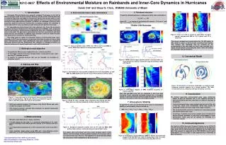
A21C-0637 Effects of Environmental Moisture on Rainbands and Inner-Core Dynamics in Hurricanes Derek Ortt1 and Shuyi S. Chen, RSMAS/University of Miami Katrina Rita 1. Introduction 5. Environmental water vapor distributions 6. Rainband structure Hurricanes Rita and Katrina were powerful category 5 hurricanes in the Gulf of Mexico during the 2005 hurricane season. However, the two storms evolved differently in a distinct large-scale atmospheric environment. Katrina was located within a moist environment and had a weak radial moisture gradient. Rita was in a dry environment and had a strong radial moisture gradient. In addition, the rainbands in Rita were more concentric about the storm and formed into a secondary eyewall. The rainbands in Katrina did not form into a secondary eyewall during the time period of this study. An unprecedented observational data was collected from these two hurricanes during the Hurricane Rainband and Intensity Experiment (RAINEX), with coordinated multi-aircraft missions, simultaneously sampling the inner-core, rainbands, and storm outer environment. The goal was to understand how the three areas interact and affect storm structure and intensity. In addition, high resolution numerical model forecasts were conducted in real time for mission planning. This study seeks to explain the interaction between environmental water vapor, rainbands, and TC internal dynamics. In particular, this study focuses on how the large scale environmental water vapor distributions may have affected the rainband in Hurricanes Katrina and Rita. Additionally, how variations in rainband structure can favor the occurrence of eyewall replacement cycles will be addressed. To quantify rainband patterns, a rainband circularity index is defined as: CI = GP >12.5 / GP where GP >12.5 is number of grid points with rainrate > 12.5 mm h-1 and GP is total number of grid points Environmental Composite Profiles Figure 9: Same as in Fig. 8, except for azimuthally averaged rainrate overlaid with MSI of 2.5 K (white) and 10 K (magenta). The primary rainbands are located within the 10K MSI radius. In Rita, which is closer to the hurricane circulation than Katrina. This indicate that rainbands may be confined by the environmental of dry and stable air, which may favorable for a highly circular pattern surrounding the storm center and leading the secondary eyewall formation. Figure 2: Total precipitable water (TPW) from TMI (a and b) and MM5 (c and d). Black dots indicate G-IV dropsonde locations. 2. Motivation and objective • To quantify the differences in rainband structure in Katrina and Rita • To investigate physical processes through which environmental water vapor can affect TC rainband structure • To identify TC rainband structure that may be favorable for formation of secondary eyewall (a) (b) (a) 8. Conceptual Model Figure 6: TRMM rainrate (upper panels) and the circularity index (CI, lower panels) for Katrina at 2135 UTC Aug 28 and Rita at 0812 UTC Sep 22. 3. Katrina and Rita Katrina Rita (a) (b) Figure 3: Environmental vertical profile composite from G-IV dropsondes (a) and MM5 (b). MM5 profiles are from the mean TPW outside of 300-km radius. Katrina Rita (b) (a) (c) (d) Figure 10: Schematics of hurricane rainbands in a relatively weak horizontal moisture gradient vis a strong gradient. The latter environment favors rainbands with high circularity as in Rita. Figure 7: Time-radius diagram of MM5 rainband circularity of Katrina and Rita. 9. Conclusions Both TMI and MM5 show that the rainbands in Rita have high circularity. These rainbands eventually formed into a secondary eyewall. In contrast, Katrina’s primary rainbands had low circularity and never were able to form into a secondary eyewall. • The distinct large-scale environmental water vaper distribution seems to play an important role in the rainband structure in Hurricanes Katrina and Rita, that lead to a different evolution of the storms: • A strong horizontal water vapor gradient was present in Rita, with a very dry, stable outer environment, which may confine the rainbands to within the moist region with a high circularity. • The rainbands in Rita lead to the formation of a secondary eyewall and eyewall replacement cycle. • In contrast, a relatively more moist, unstable outer environment in Katrina allowed rainbands to freely form and propagate in outer environment, which may not be optimal for formation of a secondary eyewall. Figure 1: Track and intensity of Hurricanes Katrina (a) and Rita (b) (from Unisys Weather). TMI 85 gHz of Katrina at 0324 UTC Aug 28, 2005 (c) and Rita at 0810 UTC Sep 22 (d) from NRL. Figure 4: NOAA P3 lower fuselage radar reflectivity from Katrina and Rita. Black dots are selected dropsonde locationsalong the flight tracks. 7. Atmospheric Stability Figure 4: P3 flight tracks in Hurricanes Katrina (a) and Rita (b). Black dots represent sample P3 dropsonde locations along the flight tracks. • Both were powerful category 5 hurricanes in the Gulf of Mexico and made landfall as category 3 hurricanes • Rita formed concentric eyewalls and underwent an eyewall replacement cycle while Katrina did not To quantify the effect of environmental water vapor on atmospheric stability, a moist stability index is defined as: • MSI = (T700 – 3T500 – T400 ) + (Td700 + Td500 +Td400) Katrina Rita 4. Model and data • TMI water vapor data with a ¼ degree resolution • P-3 GPS dropsonde data with a ½ s resolution (interpolated on to a 25m vertical resolution) from NOAA and NRL aircraft (47 in Katrina and 40 in Rita) • G-IV dropsondes interpolated on a 100m resolution (56 in Katrina and 56 in Rita) • High resolution model output using MM5 with vortex-following nested domains at 15, 5, and 1.67km horizontal resolution, respectively 10. Acknowledgements We thank the NOAA Hurricane Research Division for the NOAA P3 and G-IV dropsonde data, Remote Sensing Systems for the TMI water vapor data, and the Naval Research Laboratory for the TMI 85 gHz data. This research is supported by the NSF RAINEX research grant ATM-0432717. The first author is also supported by a University of Miami fellowship. Figure 5: Rainband composite profiles from (a) P-3 and (b) MM5. MM5 profiles taken between rainbands along simulated flight tracks. The relative drier environment and more moist rainband region in Rita indicate that the stronger moisture gradient between the hurricane and its environment than that in Katrina. The question is how will this affect the structure of the rainbands in both storms? Figure 8: Azimuthally averaged MSI from MM5 for Katrina from 0000 UTC August 27-30 and Rita from 1200 UTC September 21-23. The white contour represents the Jordan Mean Sounding MSI of 2.5 K. 1Corresponding author address and email: 4600 Rickenbacker Causeway, Miami FL 33149 dortt@rsmas.miami.edu


