Download
1 / 21
210 likes | 348 Vues
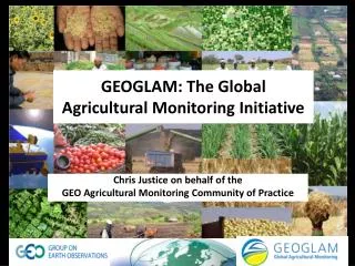
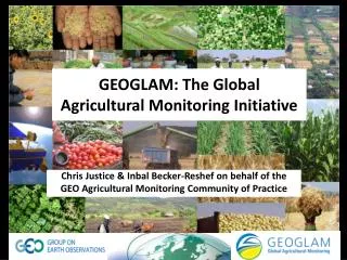
T The Global Agricultural Monitoring System of Systems Community of Practice. Chris Justice and Inbal Becker-Reshef on behalf of the GEO Agricultural Monitoring ( Ag0703 ) Community of Practice. The GEO Agricultural Monitoring Community of Practice.

E N D
TThe Global Agricultural Monitoring System of SystemsCommunity of Practice Chris Justice and Inbal Becker-Reshef on behalf of the GEO Agricultural Monitoring ( Ag0703 ) Community of Practice
The GEO Agricultural Monitoring Community of Practice Global Agricultural Monitoring (Task: AG-07-03) Task Co-Chairs Chris Justice, University of Maryland, USA Olivier Leo, Joint Research Centre, European Commission, Ispra, Italy Wu Bingfang, Institute of Remote Sensing Applications, CAS, Beijing, China Task Executive Director: Jai Singh Parihar, Space Applications Centre (ISRO), India
GEOSS Agricultural Monitoring Task (Ag 0703) • Support the development and improvement of Operational Agricultural Monitoring Systems, enhancing the current capabilities by using Earth Observations in the areas of: • Agricultural Monitoring - sub task A ( w. IGOL and GOFC/GOLD) • Agricultural Production Monitoring • Famine Early Warning • Agricultural Land Use Change • Agricultural Risk - Forecasting Weather and Predicting Climate - sub task B ( Bob Stefanski WMO – Chair ) • Capacity Building for Agricultural Monitoring - sub task C ( Johnson Owaro _ Chair )
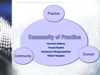
Communities of practice are… Groups of people who share a concern, a set of problems, or a passion about a topic by interacting on an ongoing basis - Cultivating Communities of Practice, Harvard Business School Press, 2002 • GEO AG07 03 Global Agricultural Monitoring Community of Practice • An open community of interested parties – Agricultural Monitoring practitioners, space agencies, data providers: in-situ and satellite observation • all are welcome to join
What is the Agricultural Monitoring Community of Practice • All those involved in Ag Monitoring that • share the common vision of the task • have participated in our task workshops • have shown an interest in participating in our tasks • are interested in seeing the current agricultural observing systems improved • are willing to contribute to the development of an agricultural monitoring system of systems
Workshop 1: March 2006, UN FAO, Rome30 participants ‘Agricultural Monitoring Meeting Convened for the Integrated Global Observations for Land (IGOL) Theme’ Workshop 2: July 2007, UN FAO, Rome 47 Participants ‘Developing a Strategy for Global Agricultural Monitoring in the Framework of the Group on Earth Observations ‘ Workshop 3: June 2008, EC JRC, Ispra, Italy 41 Participants ‘GEOSS Best Practices for Crop Area Estimation/Forecasting and Future Needs Workshop ‘ Workshop 4: February 2009, CAS, Beijing 100+ Participants ‘Developing an Agricultural Monitoring System of Systems‘ Workshop 5: November 2009, Canada-GEO, Canada 100+ Participants ‘International GEO Workshop on Synthetic Aperture Radar (SAR) to Support Agricultural Monitoring‘
GEO Agricultural Monitoring System of Systems: CoP Approach • Develop a common vision and goals for the system amongst the Community of Practice (CoP) • Work to establish the conditions under which such a system can develop (GEO partners) • Identify near term practical steps (task activities and initiatives) that will contribute to achieving the vision (CoP) • Raise awareness to the importance of EO for agricultural monitoring and the level of national commitments for the Task Activities (CoP)
GEO Agricultural Monitoring System of Systems : Task Goals • Global monitoring of agricultural production, facilitating reduction of risk and increased productivity at a range of scales • Timely and accurate national (sub-national) agricultural statistical reporting • Accurate forecasting of shortfalls in crop production and food supply • Effective early warning of famine, enabling a timely mobilization of an international response in food aid • Global mapping, monitoring and modeling of changes in agricultural land use, type and distribution, in their social and ecological context (land use change / climate change)
Workshop Report: www.earthobservations.org/cop_ag_gams.shtml • Provide the rationale of the task • Outline current capabilities • Articulate the common goal • Identify gaps • Identify enabling conditions • Make recommendations
Enabling Conditions: CoP Recommendations • Identify observation requirements for the system of systems • Establish non-prohibitive data pricing policies, allowing for free and open sharing of data and enabling affordable regional agricultural monitoring • Define and Coordinate a systematic data acquisition strategy • Coordinate Sub-Task Near Term Data initiatives • a moderate (10m-60m) resolution data initiative providing a global data set for the 2009-2011 period, from the available international assets (Partner with GEO D 0702, DA 0703 Land Surface Imaging Constellation) • JECAM Test Site data acquisition (w. CEOS) • Ensure continuity of the EO data that these systems rely on • Identify a standard set of products and methods to be used for agriculture monitoring • Increase coverage of meteorological stations for the WMO database especially for Africa • Assist the integration of the satellite data into operational monitoring systems in developing countries
GEO Agricultural Monitoring Near Term Task Initiatives (5 years) • Initiative 1: AMulti-source Production, Acreage and Yield (PAY) database • Common centralized online database to enable objective assessment of food security and risk management planning • Facilitate inter - comparison and convergence of estimation methods • Initiative 2:Joint Experiments on Crop Assessment and Monitoring (JECAM) • undertaking data, modeling and monitoring method inter-comparisons, accuracy assessments and integration, based on multi-source satellite and in-situ data • prototyping a system of systems
GEO Agricultural Monitoring Task Initiatives Initiative 3:Coordinated Data Initiatives for Global Agricultural Monitoring (CDIGAM). To ensure the on-going, frequent and timely acquisition, accessibility of satellite data during crop growing season and the continuity of those observations necessary for agricultural monitoring, Compile the best available information on agricultural areas, crop calendars and cropping systems – define a global acquisition strategy To fill the gaps in the current in-situ observations. Initiative 4:GLAMSS Thematic Workshop Series (GTWS). Community workshops thematic methodological issues and topics to improve communication amongst the CoP, develop best practices and standards, encourage cooperation, coordination and data sharing. Initiative 5:Agriculture and Climate Change. Initiative in development – integration of models and observations
Ag 0703a GTWS Activities Recent Activities • Thematic Workshop and Document on Best Practices for Crop Acreage Estimates (2008) • Thematic Workshop Satellite Rainfall Estimation (2008) • Ag 0703 Session at IRSE, Stresa (Italy May 2009) • Ag 0703 Session at SBRSE, Natal (Brazil April 2009) • Ag 0703 Session at NEESPI/LCLUC Workshop Almaty, (Khazakstan, Sept, 2009) • Thematic Workshop SAR/OpticalAgricultural Monitoring, Kananaski, (Canada, Nov , 2009) • JECAM Coordination Meeting Planned Activities • IGOS-P GEO Symposium, Washington, (US, Nov 2009 • Thematic workshop on impact of Climate Change on Agriculture, Ahmedabad, India (December 2009) • 2nd WorkshopSatellite Rainfall Estimation,) Ispra ( Spring 2010) • JECAM DATA Coordination Workshop, Belgium (Summer 2010) • JECAM China Coordination Workshop, TBD (Fall 2010)
GEO Agriculture Monitoring Community of Practice Website: http://www.earthobservations.org/cop_ag_gams.shtml
The Ag 0703 CoP Process • GEO Sec invited a chair for launching the task • Preliminary Identification of Previous and Current Major Programs, Projects, Activities on the SBA Topic/Task Area • Initial scoping workshop with leaders in the field and individuals from the above (20-30) • Refine the Task • Assess current observation capabilities and identify gaps in the system of systems • Develop a common vision and broad goals • Identify Sub Tasks • Follow up implementation planning workshop (30-40) • Develop Implementation Strategy • Flesh out Sub Tasks • Develop near term (2 year) activities associated with the necessary components • With GEO Sec identify co-chairs to help with implementation • Identify related GEO Tasks – open communication • Identify critical GEO Partners needed for implementation • Series of Larger Community Workshops on Task Components (100+ ) • To increase the CoP participation and outreach • Engage new support for implementing the sub tasks • Smaller Community Workshops on Sub Tasks areas needing community attention (15-20) e.g. • Compare methods and models - Develop Best Practices Documents • Create Data Sets • Capacity Building / Training
Stewardship Maturing ?Legacy Coalescing Potential Growth Stages of COP- Where Are We ?? We Are Here It forms an identity, takes charge of its practice and grows The community is established and acts as the steward of its domain Members come together and launch a community The CoP has outlived its usefulness and people move on Loose network of people with similar issues and needs The of Ag Mon System of Systems is established and is operational Set standards, Implement system components The Ag Mon System of Systems is running routinely Identify and prioritize Task activities Engage partner organizations Agree on a common Vision and Goals
Suggested Approach for Implementation • Develop the CoP building on existing programs / community structures where available (e.g. IGOS) • Embrace ongoing CoP “Contributory Projects” i.e. those projects which contribute to the Task goals (usually not created by the task - probably would have happened without GEO – usually at the national level) • Identify those critical CoP projects which provide a ‘framework’ for implementation and connect them into a system • Outreach on Sub-Task activities which need support - identify additional contributory projects within the community (through Sub-Task workshops) • Solicit and implement new projects and activities needed by the Task (created by the Task – voluntary - usually international projects – leverage GEO to obtain support)
Lessons Learned • Much enthusiasm in the agricultural monitoring community for an effective system of systems • Task Leadership is critical • Co-chairs, Secretariat, Sub Tasks Leads must have access to resources to catalyze task implementation – with home agency support • Need to keep focus • All are welcome to join the CoP but need to contribute directly to the Tasks at hand • An active and supportive SBA POC is needed at the Secretariat • in step with and directly helping with the CoP tasks • Leveraging influence with GEO partners • guiding interactions with GEO Program as a whole • Poor response from those organizations you would imagine would be most interested in a GEOSS • FAO, WFP, WMO (Probably entering at the wrong level – therefore no funding • GEO Sec may need to help entry at a higher level and seek commitments ) • Crosscut WGs need to work to help implement the Tasks with GEO Partners and build strategic and concrete support
Current Ag0703 needs from the UIC • Need assistance with interfacing with users from the Developing World • Support for regional workshops focused on regional agricultural monitoring issues utilizing regional JECAM Sites • Involving training of trainers • Provision of free data from the various satellite systems for the training • Need help to interface with other GEO Tasks that can help us complete our sub-tasks and meet our goals and vice-versa
TThe Global Agricultural Monitoring System of SystemsCommunity of Practice Thank You Any Questions ?