Download

1 / 41
440 likes | 1.05k Vues
James C. Gibeaut Bureau of Economic Geology Jackson School of Geosciences The University of Texas at Austin City of Galveston March 8, 2007. GALVESTON ISLAND GEOHAZARDS MAP. Texas Coast. Barrier Island Cross Section. Protective Ridge. Bay. Gulf. Wetland. Upland. Island Core.

E N D
James C. Gibeaut Bureau of Economic Geology Jackson School of Geosciences The University of Texas at Austin City of Galveston March 8, 2007 GALVESTON ISLAND GEOHAZARDS MAP
Barrier Island Cross Section Protective Ridge Bay Gulf Wetland Upland Island Core Upland Wetland Upland Beach/ Dune Future Wetland Today Future Beach/Dune After 60 Years of Sea-Level Rise and Erosion Protective Ridge Wetland Island Core Beach/ Dune Upland Wetland Upland
Average Annual Shoreline Change Rate1930 - 2000 and 1974 - 2000 End of Seawall San Luis Pass
Galveston Island State Park, Pre-Frances, August 8, 1998 (profile BEG-02)
Galveston Island State Park, Post-Frances, September 16, 1998 (profile BEG-02)
Galveston Island State Park, April 27, 2006 (profile BEG-02)
Foredune Mapping landward dune line shoreline
Barrier Island Cross Section Protective Ridge Bay Gulf Wetland Upland Island Core Upland Wetland Upland Beach/ Dune Future Wetland Today Future Beach/Dune After 60 Years of Sea-Level Rise and Erosion Protective Ridge Wetland Island Core Beach/ Dune Upland Wetland Upland
Total Estuarine Marsh Area From White et al., 2004
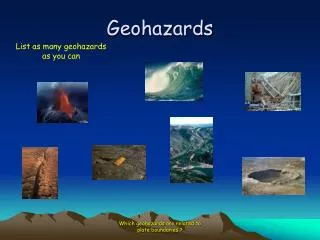
Causes of Wetland Loss • Development/Land Use • Global Sea-Level Rise • Land Subsidence • Topographic/Morphology Effects • Sediment Deficit • Marsh Edge Erosion by Waves and Currents
Development 1956
Development 1979
Pier 21 - Galveston 180.0 160.0 140.0 120.0 100.0 Average water level (cm) y = 0.652x - 1145.6 Global ocean-level rise 80.0 2 R = 0.9436 60.0 4.36 + 2.16 = 6.52 mm/yr 40.0 20.0 Local land subsidence 0.0 1900 1910 1920 1930 1940 1950 1960 1970 1980 1990 2000 2010 Year Relative Sea-Level Change
Shoreline Change From Gibeaut et al., 2003
Model Flow Future date reached? DEM (original) Classify habitat types according to elevation Habitat grid Yes No Adjusted DEM Apply vertical accretion adjustment Output habitat grid 1-year loop Apply global sea level adjustment Shoreline change grid Retreat shoreline Compute statistics of habitat status Apply local subsidence adjustment Maps Statistics Graphs
Geohazards Map Units West Bay Gulf of Mexico
Area of enhanced potential for washover Natural protective ridge Storm washover paths