Download
1 / 24
250 likes | 475 Vues
CALIFORNIA FOREST BIOMASS SUSTAINABILITY MODEL. Overview of Proposed Methods November, 2012. Mark Rosenberg Fire and Resource Assessment Program California Department of Forestry and Fire Protection November, 2012. FRAP Biomass Sustainability Model.

E N D
CALIFORNIA FOREST BIOMASS SUSTAINABILITY MODEL Overview of Proposed Methods November, 2012 Mark Rosenberg Fire and Resource Assessment Program California Department of Forestry and Fire Protection November, 2012
FRAP Biomass Sustainability Model • Address State and Federal policy goals (AB 32, AB 1504, State RPS, Federal RFS etc.) • Update biomass maps and estimates of potential for California (MW, MBF, BDT) • Model current and future forests, and wood/energy products • Model Scale and Intensity of harvest at different price points paid for Biomass material • Evaluate CA Forest Practice Rules and USFS management plans ability address carbon and ecosystem sustainability issues
Approach • Develop baseline biomass estimates (total standing live tree) in GIS • Estimate annual biomass potential • by land owner type • including growth projections • Model biomass availability under • Forest practice rules (FPA) • USFS land management plans • Sustainability goals • Tree size available to biomass market based on price • Evaluate impacts on sustainability of forest resources and ecosystem services • Create an interactive model on the web to evaluate facility locations, resource supply and ecosystem impacts
Methods Overview • Integrate baseline data into a common framework (GIS) for modeling : • Forest inventory • Vegetation maps • FPA rules and USFS land management plans • Transportation infrastructure • Harvest processing costs • Energy system infrastructure • Establish baseline biomass and timber volume maps in GIS • Estimate annual biomass and timber volume availability • ‘Business as usual’ harvest levels on public and private lands • Moderate and High biomass price scenarios • Run growth and yield projections to evaluate current forests, wood/energy products, and future forest sustainability
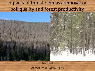
Forest Biomass Resources Sources of Biomass • Logging slash (branches, tops, and other materials removed from trees during harvest) • Forest thinning (for wildfire threat reduction, ecological purposes, or stand improvement) • Lumber mill waste from merchantable saw logs (sawdust, planer shavings, and trim ends) http://frap.fire.ca.gov/publications/BIOMASS_POTENTIALS_FROM_CA_FOREST_AND_SHRUBLANDS_OCT_2005.pdf
Biomass Data and Prescriptions 1 2 3 4 5 6 Gross potential represents the entire standing forest biomass over 5” DBH within California. Harvest constraints identify areas not available for timber or biomass extraction. Technical potential represents biomass available for removal considering topography (slope constraints), and legal/regulatory limitations on access and sustainability goals. Growth and Yield modeling are used to model how areas re-grow after harvest. Maximum harvest constrains volumes to FPA and USFS Management Plans. Harvest Prescriptions are modeled by land owner type and includes post harvest condition and outputs based upon (proposed)10-year growth estimates for each modeled prescription and landowner group. These will be pre-staged in the ‘annualized’ database.
GIS Database Components Annualized technically available biomass estimates from FIA and harvest prescriptions set (current) conditions at the beginning of the model run.
Forest Inventory & Vegetation Forest Inventories from FIA Vegetation maps from USFS/CAL FIRE grouped by similarity to create “Strata” STRATA maps overlain on FIA points and plots assigned to strata groups FIA based biomass estimates transferred to maps via STRATA labels Growth and Yield modeling on strata for each harvest prescription and landowner type in 10 year increments http://www.fs.fed.us/r5/rsl/projects/frdb/layers/stra.html
Post Stratify Forest Inventory • Group vegetation maps into “Strata” populations • Veg type, tree size, and/or canopy closure by owner • Overlay Forest inventory plots -> get Strata assigned to each plot • ~6 or more cluster plots or 30 or more subplots per map population (stratum) to form a statistical sample for each vegetation condition • Calculate sample means and standard error for each biomass component by Strata http://www.fs.fed.us/r5/rsl/projects/frdb/layers/stra.html
Post Stratify Forest Inventory • Assigning plots to map strata populations results in detailed population estimates of vegetation types • The process reduces variance of overall estimates of basal area, volume, and biomass and can be used to project growth and mortality. • This is also useful in habitat modeling, estimating old growth forests, etc. http://www.fs.fed.us/r5/rsl/projects/frdb/layers/stra.html
Sample Strata Logic (LNF) http://www.fs.fed.us/r5/rsl/projects/frdb/layers/stra.html
User Inputs & Stored Criteria • Stored Criteria Price paid for Lumber (by species group) • User identifies: • Price paid for biomass in BDT or MW or MWH • Harvest Scale/Intensity setting (proposed) • High = 100% of available material up to what the price point will bare – constrained by FPA; • Medium, = 50% of available material harvested up to a diameter size class limit set by expert knowledge - constrained by FPA; • Low = Business as usual based on most recent 5-year average • Haul distance (Optional) • User specified energy Plant location and MW demand
Potential Priority Areas • Fire Threat • Forest Health • Insect and Disease Risk Treatment Priorities Example treatment priorities map Fire Threat Treatment Areas Estimates for treatment priorities are reported within hauling distance
Energy and Transportation Systems • Transportation costs will be modeled spatially and will include ‘costs’ for areas with and without roads (Opportunities to Collaborate?) • Harvest Processing costs will be estimated (FRCS?) • Energy Infrastructure will use existing plants and MW demands. • Users can input additional facility locations. • Conversion efficiency settings model different technologies
User Outputs Feed back to model and project future conditions Biomass (BDT), Energy (MWh), Capacity (MW) Board foot volume (MBF) output based on users specified model run Tree size break point between biomass market and lumber market (i.e. for the Bole). GIS data on conditions resulting from model simulation (biomass, habitat), including modeled facility location (and others) GIS data on new treatment priorities based on user specified model run
Cooperative Project Timeline Development of dynamic link library (DLL) for computing biomass using regional equations specific to species and by major AGB components (Zhou and Hemstrom, 2009) – Completed Develop forest inventory strata logic on private lands – Nov./Dec. 2012 Generate statewide GIS-based strata layer from vegetation GIS data – Nov. 2012 Develop forest inventory strata estimates – Dec. 2012 Merge inventory strata estimates for forestland volume, carbon and biomass – Jan. 2013 Develop custom prescriptions for treatment effect modeling – Feb./Mar. 2013 Growth and yield modeling – Apr. 2013 Web application development – Dec. 2013
Thank You Mark Rosenberg Fire and Resource Assessment Program CAL FIRE (916)445-5366 Mark.Rosenberg@fire.ca.gov
Outreach Questions Harvest Constraints Harvest constraints identify areas excluded from harvesting due to sustainability concerns or management status. What important sustainability and management constraints should be considered? Please suggest data layers and set points for potential incorporation into the Model.
Outreach Questions Land Owner Prescriptions In this model, Biomass estimates are annualized by assuming an amount of harvest conducted by a land owner. Each land owner type is assigned one or more representative harvest prescriptions governed by either the Forest Practice Rules or a USFS Land Management Plan. What are appropriate (or inappropriate) harvest prescriptions for each of the following land owner groups? • Federal • Private non-industrial (Intensive, non-intensive, Light touch, no harvest) • Private Industrial (even age, un-even age) Are important land owners not well represented by these groups (e.g. does Federal = USFS lands)?
Outreach Questions Estimate Reporting Biomass potentials are estimated, by major ownership for: • The entire standing, live resource • Areas that are estimated to be technically available for harvest; • An average annual harvest (averaged from the most recent 5-years available) • Areas with high fire threat and insect or disease risk Are there additional priority landscapes which should be considered to estimate and report out biomass potentials during model simulation?
Outreach Questions Intensity and Scale Set points This model allows users to enter one or more set points based on a) Price paid for biomass ($/BDT) or energy ($/MWh)and; b) Harvest scale/intensity or; c) Hauling distance, which is optionally set instead of the intensity. What approach should be used to identify set points for the “User input” related to “Harvest Intensity/Scale” setting (high, medium, low)?
Outreach Questions Model Outputs Anticipated model outputs include: a) BDT, MBF and MW potential in the vicinity of one or more power generation facilities; b) outputs from (a) above, constrained to a priority treatment area; c) the DBH size threshold between merchantable and non-merchantable bole, and; d) landscape outputs in GIS format, immediately following treatment, and for 10-year increments (up to 100 years) based upon harvest scenario, facility location and modeled re-growth. What other outputs from this model should be considered (such as habitat suitability, special habitat elements, etc.)?