Download
1 / 36
360 likes | 484 Vues
Georeferencing Introduction: Collaboration to Automation. Dave Bloom Museum of Vertebrate Zoology University of California, Berkeley. Georeferencing. Collaborations. Automation. Georeferencing. Collaborations. Automation. What is a georeference?. What is a georeference?.

E N D
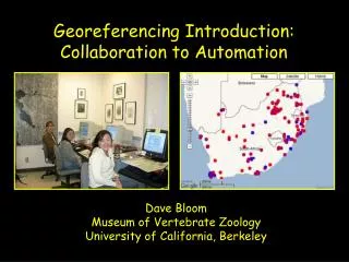
Georeferencing Introduction: Collaboration to Automation Dave Bloom Museum of Vertebrate Zoology University of California, Berkeley
Georeferencing Collaborations Automation
Georeferencing Collaborations Automation
What is a georeference? A numerical description of a place that can be mapped.
What is a georeference? A numerical description of a place that can be mapped. In other words…
What we have:Localities we can read ID Species Locality 1 Lynx rufus Dawson Rd. N Whitehorse 2 Pudu puda cerca de Valdivia 3 Canis lupus 20 mi NW Duluth 4 Felis concolor Pichi Trafúl 5 Lama alpaca near Cuzco 6 Panthera leo San Diego Zoo 7 Sorex lyelli Lyell Canyon, Yosemite 8 Orcinus orca 1 mi W San Juan Island 9 Ursus arctos Bear Flat, Haines Junction
Darwin Core Location Terms • higherGeography • waterbody, island, islandGroup • continent, country, countryCode, stateProvince, county, municipality • locality • minimumElevationInMeters, maximumElevationInMeters, minimumDepthInMeters, maximumDepthInMeters
Darwin Core Georeference Terms • decimalLatitude, decimalLongitude • geodeticDatum • coordinateUncertaintyInMeters • georeferencedBy, georeferenceProtocol • georeferenceSources • georeferenceVerificationStatus • georeferenceRemarks • coordinatePrecision • pointRadiusSpatialFit • footprintWKT, footprintSRS, footprintSpatialFit
What is a georeference? A numerical description of a place that can be mapped.
“Davis, Yolo County, California” Coordinates: 38.5463 -121.7425 Horizontal Geodetic Datum: NAD27 “point method”
Data Quality • data have the potential to be used in ways unforeseen when collected. • the value of the data is directly related to the fitness for a variety of uses. • “as data become more accessible many more uses become apparent.” – Chapman 2005 • the GBIF Best Practices (Chapman and Wieczorek 2006) promote data quality and fitness for use.
What is an acceptable georeference? A numerical description of a place that can be mappedand that describes the spatial extent of a locality and its associated uncertainties.
“Davis, Yolo County, California” Coordinates: 38.5486 -121.7542 38.545 -121.7394 Horizontal Geodetic Datum: NAD27 “bounding-box method”
“Davis, Yolo County, California” Coordinates: 38.5468 -121.7469 Horizontal Geodetic Datum: NAD27 Maximum Uncertainty: 8325 m “point-radius method”
What is an ideal georeference? A numerical description of a place that can be mappedand that describes the spatial extent of a locality and its associated uncertaintiesas well as possible.
“Davis, Yolo County, California” “shape method”
“20 mi E Hayfork, California” “probability method”
Method Comparison point easy to produce no data quality bounding-box simple spatial queries difficult quality assessment point-radius easy quality assessment difficult spatial queries shape accurate representation complex, uniform probability accurate representation complex, non-uniform
MaNIS/HerpNET/ORNIS (MHO) Guidelines http://manisnet.org/GeorefGuide.html • uses point-radius representation of georeferences • circle encompasses all sources of uncertainty about the location • methodology formalizes assumptions, algorithms, and documentation standards that promote reproducible results • methods are universally applicable
Darwin Core Georeference Terms • decimalLatitude, decimalLongitude • geodeticDatum • coordinateUncertaintyInMeters • georeferencedBy, georeferenceProtocol • georeferenceSources • georeferenceVerificationStatus • georeferenceRemarks • coordinatePrecision • pointRadiusSpatialFit • footprintWKT, footprintSRS, footprintSpatialFit
Georeferencing Collaborations Automation
Collaborative Distributed Databases for Vertebrates
MaNIS Localities Georeferenced n = 326k localities (1.4M specimens) r = 14 localities/hr (point-radius method) t = 3 yrs (~40 georeferencers)
ORNIS Localities Georeferenced n = 267k localities (1.4M specimens) r = 30 localities/hr (point-radius method) t = 2 yrs (~30 georeferencers)
Scope of the Problem for Natural History Collections ~2.5x10⁹ records
Scope of the Problem for Natural History Collections ~2.5x10⁹ records ~6 records per locality* ~14 localities per hour* * based on the MaNIS Project
Scope of the Problem for Natural History Collections ~2.5x10⁹ records ~6 records per locality* ~14 localities per hour* ~15,500 years * based on the MaNIS Project
Scope of the Problem for Natural History Collections ~2.5x10⁹ records ~6 records per locality* ~14 (30) localities per hour* ~15,500 (7233) years * based on the MaNIS (ORNIS) Project
Georeferencing Collaborations Automation
Automation Combining the Best in Georeferencing GADM GeoLocate MaNIS Georeferencing Calculator
GADM Global Administrative Boundaries: